This item has been sold, but you can get on the Waitlist to be notified if another example becomes available, or purchase a digital scan.
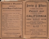
1892 Amerine and Willson Map of California
California-amerinewillson-1892$625.00


Title
Amerine and Willson's Indexed Township and County Map of California.
1892 (dated) 34.75 x 26.5 in (88.265 x 67.31 cm) 1 : 1000000
1892 (dated) 34.75 x 26.5 in (88.265 x 67.31 cm) 1 : 1000000
Description
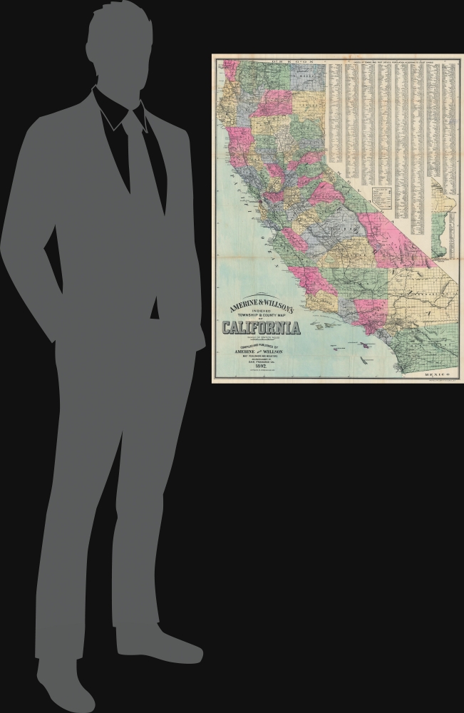
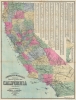
This is the 1892 Amerine and Willson map of California. It illustrates the state during a heady period of expansion, largely driven by rapid railroad development in the second half of the 19th century that opened the way for agricultural development of the interior as well as real estate booms in Los Angeles and San Diego.
A Closer Look
Coverage embraces the state of California, with counties, railroads, roads, and some topography noted. The eastern portion of San Bernardino and San Diego counties appears along the right border since these reaches did not otherwise fit on the sheet. A city and town index occupies the upper right. Four counties in modern-day California are not yet illustrated: Madera County, Kings County, Riverside County, and Imperial County. Madera, Kings, and Riverside were founded in 1893, the year after this map's publication. Imperial County was not founded until 1907. In the lower left, the title cartouche is typographically striking.Publication History and Census
This map was compiled and published by Amerine and Willson and printed by Britton and Rey in 1892. It is rare. We note just four examples cataloged in OCLC: Yale University, Southern Methodist University, the University of California Berkeley, and the California Historical Society. An example is part of the David Rumsey Map Collection. We note only two instances when this piece has entered the private market in recent years.CartographerS
Charles Hamilton Amerine (1856 - March 26, 1903) was an American civil engineer and map publisher. Born in Kentucky, Amerine was living in San Francisco by 1891. In 1892, as part of the partnership Amerine and Wilson, he published a township and county map of California. They may have published one other map of the Pacific Coast. More by this mapmaker...
Britton and Rey (1852 - 1906) was a lithographic firm based in San Francisco founded by Joseph Britton (1825 - 1901) and Jacques Joseph Rey (1820 - 1892). The leading firm in the area during the second half of the 19th century, Britton and Rey eventually earned the reputation of being the western Currier and Ives. They published both large-format and postcard views of California, as well as with stock certificates, stationery, and maps. Within the partnership, Rey was the artist and Britton the principal lithographer. Britton was also principally concerned with the business aspects of the firm. The firm also printed lithographs by other artists, including Thomas Almond Ayres (1816 - 1858), George Holbrook Baker (1824 - 1906), Charles Christian Nahl (1818 - 1878), and Frederick August Wenderoth (1819 - 1884). After Rey's death in 1892 and Britton's subsequent retirement, the firm passed to Rey's son, Valentine J. A. Rey, who ran the firm until at least the 1906 San Francisco earthquake and fire. A. Carlisle and Company, another San Francisco printer, acquired the remains of the Britton and Rey firm in 1916. For more information about Joseph Britton and Jacques Joseph Rey, please reference their individual biographies included in our cartographer database. Learn More...
Condition
Average. Wear and toning along original fold lines. Manuscript infill to upper left quadrant. Verso repairs to fold separations. Verso repairs and reinforcements at fold intersections. Slight loss at fold intersections.
References
Rumsey 14267.002. OCLC 78598758.