
Britton and Rey

Britton and Rey (1852 - 1916) was a lithographic firm based in San Francisco founded by Joseph Britton (1825 - 1901) and Jacques Joseph Rey (1820 - 1892). The leading firm in the area during the second half of the 19th century, Britton and Rey eventually earned the reputation of being the western Currier and Ives. They published both large-format and postcard views of California, as well as with stock certificates, stationery, and maps. Within the partnership, Rey was the artist and Britton the principal lithographer. Britton was also principally concerned with the business aspects of the firm. The firm also printed lithographs by other artists, including Thomas Almond Ayres (1816 - 1858), George Holbrook Baker (1824 - 1906), Charles Christian Nahl (1818 - 1878), and Frederick August Wenderoth (1819 - 1884). After Rey's death in 1892 and Britton's subsequent retirement, the firm passed to Rey's son, Valentine J. A. Rey, who ran the firm until at least the 1906 San Francisco earthquake and fire. A. Carlisle and Company, another San Francisco printer, acquired the remains of the Britton and Rey firm in 1916. For more information about Joseph Britton and Jacques Joseph Rey, please reference their individual biographies included in our cartographer database.
California gold-rush boomtowns.
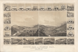
Scotts Bar and French Bar, on Scotts River, Siskiyou County, California.
$8,000.00
Acquire
- Digital Map Information
- Suitable for large format printing
- File Size: 737.07 MB
- File Type: ZIP / TIFF
- ICC color profile embedded
- Delivered instantly via download link
A remarkable 1856 two-color chromolithograph bird's-eye view of California gold mining boomtowns Scotts Bar and French Bar, Siskiyou County, California. The view reveals these boomtowns on Scotts River - a 60-mile-long tributary of the Klamath River - at the height of the Northern California Gold Rush. Today, they are both ghost towns. (more details)
A real estate agent's advertisement promoting farm land for sale in the San Joaquin Vally in California.
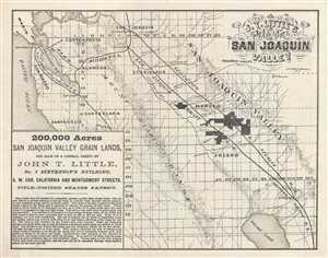
John T. Little's Map of San Joaquin Valley.
$750.00
Acquire
- Digital Map Information
- Suitable for large format printing
- File Size: 2.67 MB
- File Type: ZIP / TIFF
- ICC color profile embedded
- Delivered instantly via download link
This is an 1871 John T. Little promotional real estate map of the San Joaquin Valley, in California east of San Francisco Bay. The map depicts the region from the Pacific Ocean to the Yosemite Valley and from Marin County and San Joaquin, California to Tulare Lake. ... (more details)
Greatest view of San Francisco.
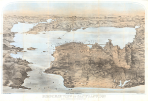
Birdseye View of San Francisco and Surrounding Country.
$22,000.00
Acquire
- Digital Map Information
- Suitable for large format printing
- Full resolution TIFF file
- ICC color profile embedded
- Delivered instantly via download link
This is George Henry Goddard's stunning chromolithograph bird's-eye view of San Francisco Bay, city, and environs, here in its 1880 edition. A product of Goddard's artistic virtuosity, this is not only the best early view of the San Francisco Bay area but also one of the finest American views ever made, offering a unique and outstanding artistic take on the genre. (more details)
The Best Laid Plans...
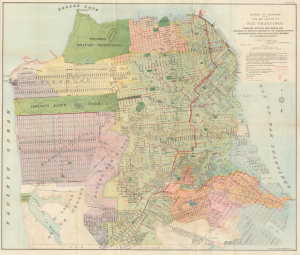
System Of Sewerage for the City and County of San Francisco.
$900.00
Acquire
- Digital Map Information
- Suitable for large format printing
- File Size: 53.09 MB
- File Type: ZIP / TIFF
- ICC color profile embedded
- Delivered instantly via download link
This is a scarce 1899 map of a planned but never-realized sewer system for the city (and county) of San Francisco, printed by Britton and Rey. Aside from its representation of the planned sewer system, the map is also significant for representing similar planned but only partly realized street layouts in newly-developing areas in the western and southern parts of the city. (more details)
'A city undaunted by tragedy, audaciously innovative, rising to meet the challenges of the day.'
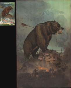
'Undaunted'.
$2,250.00
Acquire
- Digital Map Information
- Suitable for large format printing
- File Size: 62.39 MB
- File Type: ZIP / TIFF
- ICC color profile embedded
- Delivered instantly via download link
This is a rare 1911 Britton and Rey chromolithograph view of San Francisco, issued to promote the city's resurgent spirit following the 1906 San Francisco Fire. A titanic grizzly bear represents the spirit of San Francisco, 'a city undaunted by tragedy, audaciously innovative, rising to meet the challenges of the day.' (more details)