Digital Image: 1911 McCorquodale Railroad Map of England and Wales
EnglandRailroads-mccorquodalegeorge-1911_d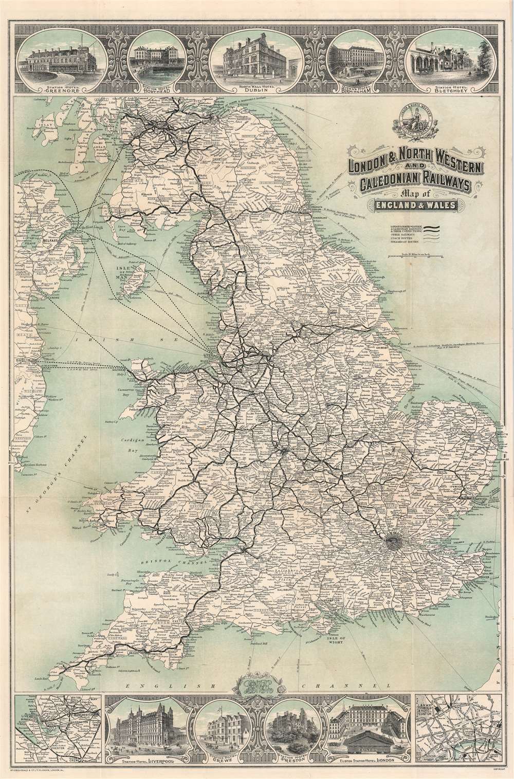

Title
London and North Western and Caledonian Railways Map of England and Wales.
1911 (undated) 30 x 20 in (76.2 x 50.8 cm) 1 : 1203840
1911 (undated) 30 x 20 in (76.2 x 50.8 cm) 1 : 1203840
Description
FOR THE ORIGINAL ANTIQUE MAP, WITH HISTORICAL ANALYSIS, CLICK HERE.
Digital Map Information
Geographicus maintains an archive of high-resolution rare map scans. We scan our maps at 300 DPI or higher, with newer images being 600 DPI, (either TIFF or JPEG, depending on when the scan was done) which is most cases in suitable for enlargement and printing.
Delivery
Once you purchase our digital scan service, you will receive a download link via email - usually within seconds. Digital orders are delivered as ZIP files, an industry standard file compression protocol that any computer should be able to unpack. Some of our files are very large, and can take some time to download. Most files are saved into your computer's 'Downloads' folder. All delivery is electronic. No physical product is shipped.
Credit and Scope of Use
You can use your digial image any way you want! Our digital images are unrestricted by copyright and can be used, modified, and published freely. The textual description that accompanies the original antique map is not included in the sale of digital images and remains protected by copyright. That said, we put significant care and effort into scanning and editing these maps, and we’d appreciate a credit when possible. Should you wish to credit us, please use the following credit line:
Courtesy of Geographicus Rare Antique Maps (https://www.geographicus.com).
How Large Can I Print?
In general, at 300 DPI, you should at least be able to double the size of the actual image, more so with our 600 DPI images. So, if the original was 10 x 12 inches, you can print at 20 x 24 inches, without quality loss. If your display requirements can accommodate some loss in image quality, you can make it even larger. That being said, no quality of scan will allow you to blow up at 10 x 12 inch map to wall size without significant quality loss. For more information, it is best consult a printer or reprographics specialist.
Refunds
If the high resolution image you ordered is unavailable, we will fully refund your purchase. Otherwise, digital images scans are a service, not a tangible product, and cannot be returned or refunded once the download link is used.
Cartographer
George McCorquodale (May 10, 1817 - 1895) was an English printer active in the late 19th century. McCorquodale was the son of Hugh McCorquodale and Lucia Hall. He was born in Liverpool, where in 1841 he established a stationer's shop, Liverpool Printing and Stationery Company. Attaining considerable success, George founded McCorquodale and Company in Newton-le-Willows in 1846. McCorquodale capitalized on printing maps, timetables, and pamphlets for the growing English railroad industry. By the 1870s, the firm established printing factories in London, Glasgow, and Leeds. In 1878, Sir Richard Moon, chairman of the London and North Western Railway, convinced McCorquodale to establish a printing office in Wolerton, then a major railroad town. This eventually led to commercial printing of books, stationary, and registered envelope. By this time, McCorquodale was one of the largest printers in the British Isles. In addition to his businesses, McCorquodale held the office of High Sheriff of Lancashire in 1882, and High Sheriff of Anglesey in 1888. He retired to Anglesey, dying in 1895. The McCorquodale company remains active and is based in Derby. More by this mapmaker...
References
OCLC 920140925.