1836 Maire Large Format Map of Europe
Europe-maire-1836$650.00
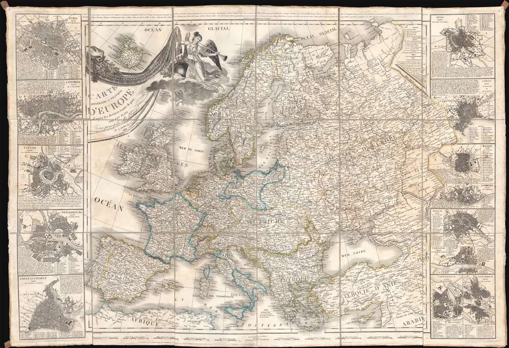


Title
Carte Itinéraire et Politique D'Europe d'après les derniers traités de paix, avec les Plans des principales villes d'Europe.
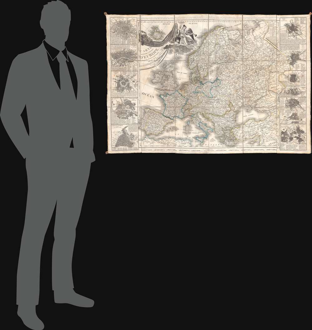
1836 (dated) 31 x 45.75 in (78.74 x 116.205 cm) 1 : 6350000
1836 (dated) 31 x 45.75 in (78.74 x 116.205 cm) 1 : 6350000
Description
A large-scale 1836 map of Europe by Nicolas Maire, issued in the heady years of the early 19th century, when Europe, still reeling from the Napoleonic Wars (1803 - 1815), politically redefined itself.
A Closer Look
The map covers all of Europe, from Spain and the British Isles to the Ural Mountains and from the Arctic to the Mediterranean. Inset city plans include Paris, London, Vienna, St. Petersburg, Constantinople, Rome, Naples, Madrid, Lisbon, Berlin, Warsaw, Copenhagen, and Stockholm.Publication History and Census
This map was compiled in the early years of the Bourbon Restoration (1814 - 1830) by aspiring Ingenieur et Geographe du Roi, Nicolas Maire. It was engraved by Jean Baptiste Tardieu (1768 - 1837) and Jean-Baptiste-Marie Chamouin (1768 - 18xx), with the lettering engraved by Alphonse Pelicier (17xx - 18xx). The map was first issued in 1816, but we note subsequent issues by various French publishers throughout the first half of the 19th century, suggesting it was a successful and popular publication.CartographerS
Nicolas Maire (fl. 1803 - 1840) was a French engraver active in Paris in the late 18th and early 19th centuries. Little is known of his early years during the chaotic days of the French Revolution, but some argue that he was a military engineer under Louis Brion de la Tour (1743 - 1803). During the First Empire, under Napoleon Bonaparte, he established himself as a commercial cartographer, leverage the expanding empire's growing access to cartographic data. He successfully negotiated the political upheavals after the Battle of Waterloo, acquiring the prestigious post of Ingenieur et Geographe du Roi during the Bourbon Restoration of Louis XVIII (1755 - 1824). Maire was an early pioneer of data visualization through maps - and most of his maps are correspondingly data rich and large. In 1821, he published an Atlas Administratif de Pairs which employed a unique template and coding system to visualize urbanization data. He also issued an impressive and rare mineralogical map of Italy, as well as other significant thematic pieces. More by this mapmaker...
Pierre Jean (1754 - 1829) was a French engraver, publisher, print seller, and map maker active in Paris in the late 18th and early 19th centuries. Jean entered the engraving and printing business on June 7 of 1784 when he married the daughter of Louis-Joseph Mondhare, a prominent French engraver, print seller and map publisher. Mondhare changed the name of his firm to Mondhare & Jean. Under Mondhare, for about 12 years, Jean mastered the in-and-outs of the engraving and map publishing business. Mondhare retired in 1796, leaving Jean his business and printing plates. Jean subsequently continued to publish on his own account, as Chez Jean, from the old Mondhare & Jean offices at 32 Rue Saint-Jean de Beauvais. Learn More...
Jean Baptiste Tardieu (1768 - December 24, 1837) was a French cartographic engraver of the large Paris-based Tardieu family. The Tardieu family was extremely prolific, with numerous members, for over 200 years, being skilled and active engravers. Most of the Tardieu engravers simply identified themselves as 'Tardieu' or at best with their initials, so it is often extremely difficult to distinguish their individual work. Along with fellow engraver Louis Tardieu (1765 - 1793), Jean Baptiste was the son of the engraver Pierre Joseph Tardieu (1724 – 1793) and Henriette Larchange (1735 – 17??), Pierre Joseph's second wife. From Pierre Joseph's first wife, Anne Catherine Labdouche (1725 – 1758), he also had a half-sister, Rosalie Tardieu (c. 1750 – 1756), and four half-brothers, all also engravers: Jean Baptiste Pierre Tardieu (1746 – 1816), Jean Claude Tardieu (1746 – 1828), Pierre Alexandre Tardieu (1756 – 1844), and Antoine-François Tardieu (1757 – 1822). Learn More...
Jean-Baptiste-Marie Chamouin (1768 - 18xx) was a French engraver active in the late 18th and early 19th centuries. Chamouin was born in Paris. He mastered engraving working at the Dépôt de Guerre, and went on to private commercial work in geographical publication. He engraved with Jean Baptiste Tardieu (1768 - 1837), Pierre M. Lapie (fl. 1779 - 1850), and Conrad Malte-Brun (1755 - 1826), among others. His offices, at least in 1845, were at 29 Rue de la Harpe, Paris. Learn More...
Alphonse Pelicier (17xx - 18xx) was a French letter engraver active in Paris during the early 19th century. He engraved lettering for a number of maps, important documents, and historical portraits issued in the first 20 years of the 19th century. Pelicier was most active during the Bourbon Restoration (1814 - 1830). Learn More...
Condition
Good. Some spotty toning. Original linen backing stable.
References
OCLC 1036395510.