Digital Image: 1929 Bodine Tourist Map of Indiana
Indiana-bodine-1929_d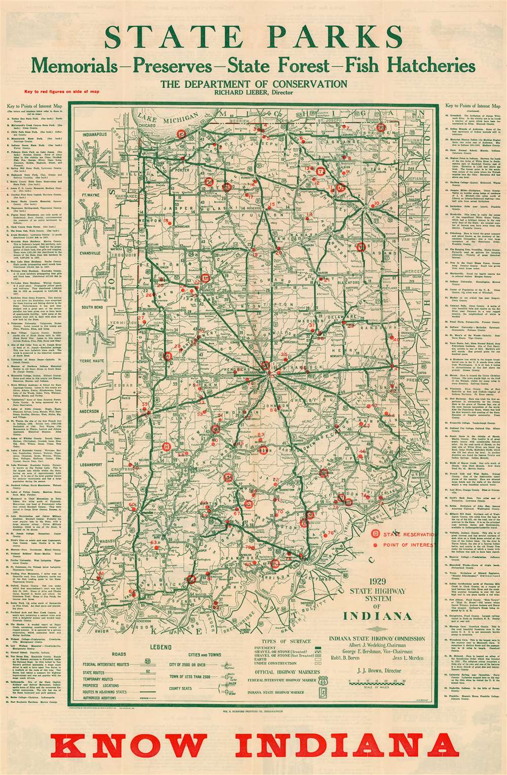


Title
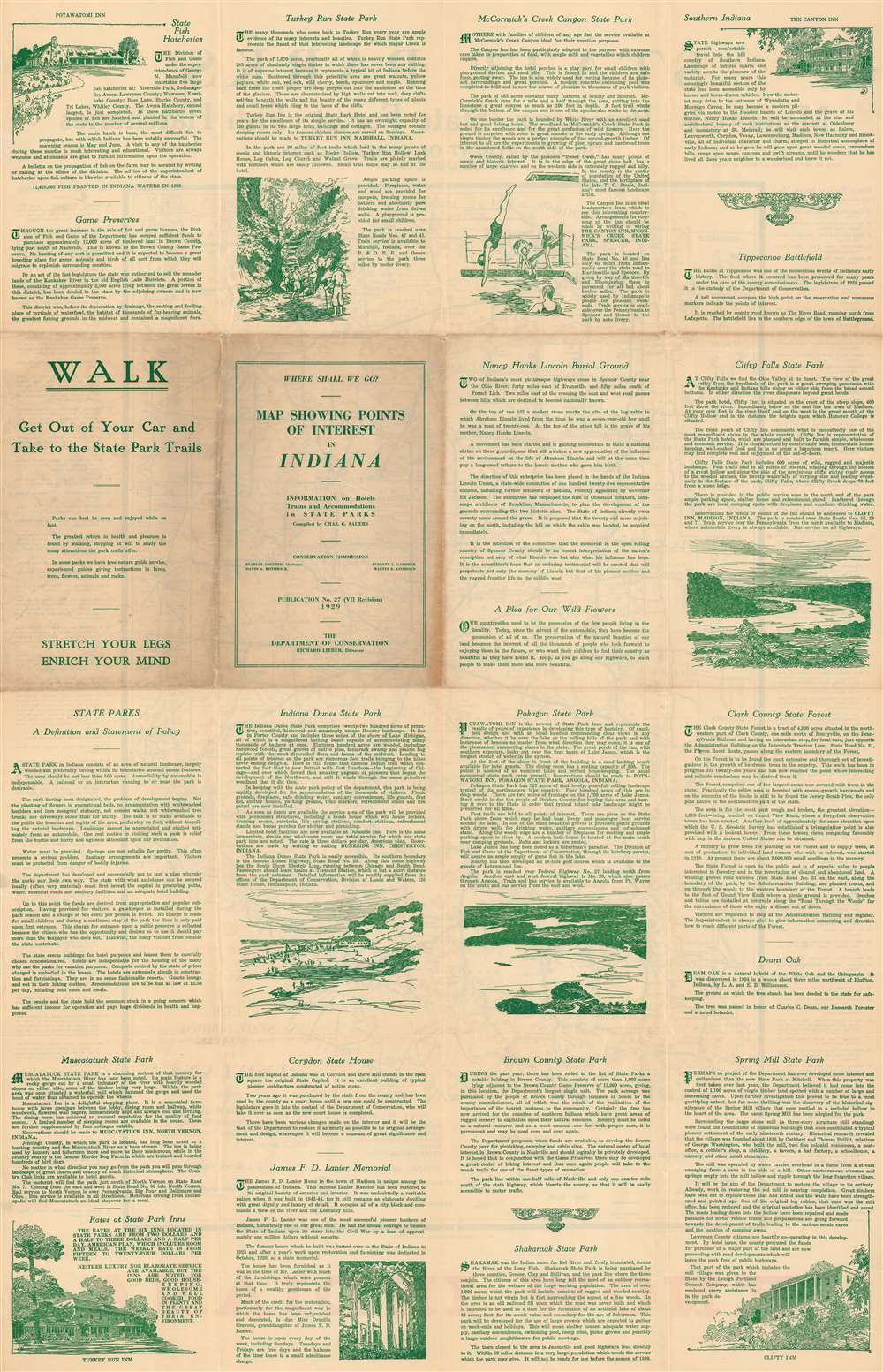
Map Showing Points of Interest in Indiana.
1929 (dated) 31.5 x 21.5 in (80.01 x 54.61 cm) 1 : 810000
1929 (dated) 31.5 x 21.5 in (80.01 x 54.61 cm) 1 : 810000
Description
FOR THE ORIGINAL ANTIQUE MAP, WITH HISTORICAL ANALYSIS, CLICK HERE.
Digital Map Information
Geographicus maintains an archive of high-resolution rare map scans. We scan our maps at 300 DPI or higher, with newer images being 600 DPI, (either TIFF or JPEG, depending on when the scan was done) which is most cases in suitable for enlargement and printing.
Delivery
Once you purchase our digital scan service, you will receive a download link via email - usually within seconds. Digital orders are delivered as ZIP files, an industry standard file compression protocol that any computer should be able to unpack. Some of our files are very large, and can take some time to download. Most files are saved into your computer's 'Downloads' folder. All delivery is electronic. No physical product is shipped.
Credit and Scope of Use
You can use your digial image any way you want! Our digital images are unrestricted by copyright and can be used, modified, and published freely. The textual description that accompanies the original antique map is not included in the sale of digital images and remains protected by copyright. That said, we put significant care and effort into scanning and editing these maps, and we’d appreciate a credit when possible. Should you wish to credit us, please use the following credit line:
Courtesy of Geographicus Rare Antique Maps (https://www.geographicus.com).
How Large Can I Print?
In general, at 300 DPI, you should at least be able to double the size of the actual image, more so with our 600 DPI images. So, if the original was 10 x 12 inches, you can print at 20 x 24 inches, without quality loss. If your display requirements can accommodate some loss in image quality, you can make it even larger. That being said, no quality of scan will allow you to blow up at 10 x 12 inch map to wall size without significant quality loss. For more information, it is best consult a printer or reprographics specialist.
Refunds
If the high resolution image you ordered is unavailable, we will fully refund your purchase. Otherwise, digital images scans are a service, not a tangible product, and cannot be returned or refunded once the download link is used.
Cartographer
Harry D. Bodine (October 3, 1894 - February 3, 1942) was an American engineer and Army veteran. Born in Cincinnati, Ohio, Bodine arrived in Indianapolis in 1913 and not long after enlisted in the U.S. Army for a three-year enlistment. He re-enlisted in the army engineer corps in 1916. At the outbreak of World War I, Bodine held the rank of master engineer sergeant, senior grade. Bodine was among the first enlisted men deployed to Europe under the command of General John J. Pershing. He roomed with Captain Eddie Rickenbacker (who would become the most successful fighter ace of the war with twenty-six aerial victories and a recipient of the Medal of Honor) while crossing the Atlantic and ultimately served under General Pershing in Europe for twenty-eight months. Bodine returned to Indianapolis after World War I and became the cartographer for the Indiana State Highway Commission soon after his return. He held this position until his death from a heart attack, which he suffered while giving a lecture at the Oriental Masonic lodge at the age of forty-eight. He was survived by his wife Agnes and their two sons. More by this mapmaker...
References
OCLC 63256554.