Digital Image: 1934 Burpitt Plat Map of Part of Johnson Estates, Atlanta, Georgia
JohnsonEstatesAtlanta-burpitt-1934_d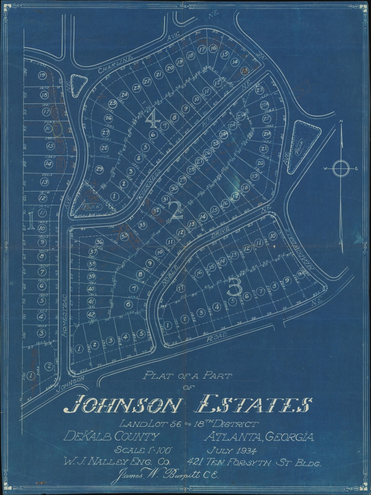

Title
Plat of a Part of Johnson Estates Land Lot 56 18th District DeKalb County Atlanta, Georgia.
1934 (dated) 21.5 x 16.25 in (54.61 x 41.275 cm) 1 : 1200
1934 (dated) 21.5 x 16.25 in (54.61 x 41.275 cm) 1 : 1200
Description
FOR THE ORIGINAL ANTIQUE MAP, WITH HISTORICAL ANALYSIS, CLICK HERE.
Digital Map Information
Geographicus maintains an archive of high-resolution rare map scans. We scan our maps at 300 DPI or higher, with newer images being 600 DPI, (either TIFF or JPEG, depending on when the scan was done) which is most cases in suitable for enlargement and printing.
Delivery
Once you purchase our digital scan service, you will receive a download link via email - usually within seconds. Digital orders are delivered as ZIP files, an industry standard file compression protocol that any computer should be able to unpack. Some of our files are very large, and can take some time to download. Most files are saved into your computer's 'Downloads' folder. All delivery is electronic. No physical product is shipped.
Credit and Scope of Use
You can use your digial image any way you want! Our digital images are unrestricted by copyright and can be used, modified, and published freely. The textual description that accompanies the original antique map is not included in the sale of digital images and remains protected by copyright. That said, we put significant care and effort into scanning and editing these maps, and we’d appreciate a credit when possible. Should you wish to credit us, please use the following credit line:
Courtesy of Geographicus Rare Antique Maps (https://www.geographicus.com).
How Large Can I Print?
In general, at 300 DPI, you should at least be able to double the size of the actual image, more so with our 600 DPI images. So, if the original was 10 x 12 inches, you can print at 20 x 24 inches, without quality loss. If your display requirements can accommodate some loss in image quality, you can make it even larger. That being said, no quality of scan will allow you to blow up at 10 x 12 inch map to wall size without significant quality loss. For more information, it is best consult a printer or reprographics specialist.
Refunds
If the high resolution image you ordered is unavailable, we will fully refund your purchase. Otherwise, digital images scans are a service, not a tangible product, and cannot be returned or refunded once the download link is used.
Cartographer
James William Burpitt (June 12, 1900 - October 24, 1982) was an American civil engineer and Army officer. Born in Atlanta, Georgia, Burpitt attended high school in Atlanta before attending the Georgia School of Technology (Georgia Tech) and graduated in 1922. While at Georgia Tech, Burpitt was part of the R.O.T.C. program and was commissioned as an officer even before graduation. In February 1942, when Burpitt filled out his Selective Service Registration Card, he was working for himself as a civil engineer. By 1944, he served in the Army Corps of Engineers and had reached the rank of captain. After the war, Burpitt stayed in the Army and helped build military cemeteries in Paris, France. At one point, he was assigned to (worked for?) the American Battle Monuments Commission. Burpitt retired from the Army as a lieutenant colonel. After retirement, he split his time between Atlanta and Nokomis, Florida. He married Pauline Landon Burpitt on June 20, 1925, with whom he had two daughters. More by this mapmaker...