This item has been sold, but you can get on the Waitlist to be notified if another example becomes available, or purchase a digital scan.
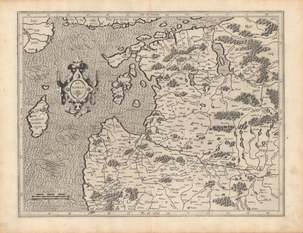
1595 Mercator Map of Livonia (Latvia and Estonia)
Livonia-mercator-1595$275.00

Title
Livonia.
1595 (undated) 14.5 x 18.5 in (36.83 x 46.99 cm) 1 : 1700000
1595 (undated) 14.5 x 18.5 in (36.83 x 46.99 cm) 1 : 1700000
Description
A beautifully engraved 1595 map of Livonia (modern-day Latvia and Estonia) that appeared in Gerardus Mercator's Atlas. It was published in the wake of a long conflict, known as the Livonian War (1558 - 1583), which drew in the nearby powers of Poland-Lithuania, Sweden, and Denmark-Norway, to prevent a Russian takeover of the region.
Aside from Livonia and the Duchy of Courland and Semigallia, surrounding lands of Sweden (including Stockholm at top-left), Poland-Lithuania, and Tsarist Russia (Moscovie) are indicated. The mix of Germanic and Slavic placenames reflects the complex interaction between cultures in this area. Latin text on the verso provides a basic introduction to the region and gives latitude and longitude coordinates for larger cities. The title cartouche and elaborately engraved text for 'Mare Balthicum,' and for the scale and Mercator's signature below, add beautiful flourishes.
The Russians found early success, capturing most of Livonia and establishing a friendly monarch as their agent, but the combined intervention of Sweden, Poland-Lithuania, and Denmark-Norway, and the effective leadership of Polish-Lithuanian King Stephen Báthory, led to an effective counter-attack beginning in 1578. By 1582, the Russians were expelled from Livonia and even lost some of their pre-war territory, most notably Pskov (Pleskow here, towards top-right).
As a result, Livonia, Courland, and Semigallia were incorporated into Poland-Lithuania, while 'Swedish Estonia' was established in the northern portion of Livonia. For the next 150 years, Sweden, Russia, and Poland-Lithuania would contend with each other continuously for these lands, with some resolution only coming with the Treaty of Nystad at the end of the Great Northern War (1700 - 1721), which confirmed Russian supremacy in the eastern Baltic.
A Closer Look
Livonia (also as Liefland or Livland) is a historic region in the eastern Baltic, including most of modern-day Latvia and Estonia. Recognizable cities are present here, though not always with the names used today: Riga is at center towards bottom; the city of Reuel near top is now Tallinn; Narva, near top, today the easternmost point in the European Union, was on the frontlines of the Livonian War. Towns and cities, rivers, lakes, forests, and islands are indicated throughout.Aside from Livonia and the Duchy of Courland and Semigallia, surrounding lands of Sweden (including Stockholm at top-left), Poland-Lithuania, and Tsarist Russia (Moscovie) are indicated. The mix of Germanic and Slavic placenames reflects the complex interaction between cultures in this area. Latin text on the verso provides a basic introduction to the region and gives latitude and longitude coordinates for larger cities. The title cartouche and elaborately engraved text for 'Mare Balthicum,' and for the scale and Mercator's signature below, add beautiful flourishes.
The Livonian War (1558 - 1583)
Not long before this map's publication, Livonia was the site of a drawn-out, fluctuating war between the Tsardom of Russia and several rival neighboring states. The conflict was only one in a series of wars in the 16-18th centuries over control of the eastern Baltic. Muscovy (later Tsarist Russia), Sweden, Poland-Lithuania, and others all aspired to control the region, and especially its profitable maritime trade that had traditionally been controlled by the Hanseatic League. At the start of the Livonian War, a confederation led primarily by descendants of the Teutonic Order ruled the area. When this confederation reached out to Poland-Lithuania for protection from an increasingly powerful Russia to its east, Tsar Ivan IV invaded in 1558.The Russians found early success, capturing most of Livonia and establishing a friendly monarch as their agent, but the combined intervention of Sweden, Poland-Lithuania, and Denmark-Norway, and the effective leadership of Polish-Lithuanian King Stephen Báthory, led to an effective counter-attack beginning in 1578. By 1582, the Russians were expelled from Livonia and even lost some of their pre-war territory, most notably Pskov (Pleskow here, towards top-right).
As a result, Livonia, Courland, and Semigallia were incorporated into Poland-Lithuania, while 'Swedish Estonia' was established in the northern portion of Livonia. For the next 150 years, Sweden, Russia, and Poland-Lithuania would contend with each other continuously for these lands, with some resolution only coming with the Treaty of Nystad at the end of the Great Northern War (1700 - 1721), which confirmed Russian supremacy in the eastern Baltic.
Publication History and Census
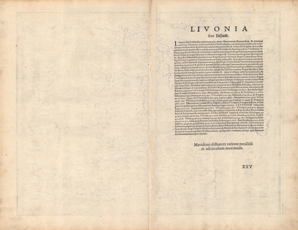
This map was first issued in Gerardus Mercator's Atlas Sive Cosmographicae Meditationes de Fabrica Mundi et Fabricati Figura, published in 1595 shortly after his death. It was then reissued in later editions of the Atlas, including those published by Jodocus Hondius. The short Latin text on the verso suggests that this map is from an early edition of the Atlas, possibly the first, as even early editions of the Mercator-Hondius Atlas had already elaborated the verso text considerably. Examples of the map dated to 1595 are held by Villanova University, Princeton University, Harvard University, the Bibliotheek Universiteit van Amsterdam, Danish Union Catalogue and Danish National Bibliography, the Royal Danish Library, the Bibliothèque nationale de France, and the Universitätsbibliothek Eichstätt-Ingolstadt.Cartographer
Gerard Mercator (March 5, 1512 - December 2, 1594) is a seminal figure in the history of cartography. Mercator was born near Antwerp as Gerard de Cremere in Rupelmonde. He studied Latin, mathematics, and religion in Rupelmonde before his Uncle, Gisbert, a priest, arranged for him to be sent to Hertogenbosch to study under the Brothers of the Common Life. There he was taught by the celebrated Dutch humanist Georgius Macropedius (Joris van Lanckvelt; April 1487 - July 1558). It was there that he changed him name, adapting the Latin term for 'Merchant', that is 'Mercator'. He went on to study at the University of Louvain. After some time, he left Louvain to travel extensively, but returned in 1534 to study mathematics under Gemma Frisius (1508 - 1555). He produced his first world map in 1538 - notable as being the first to represent North America stretching from the Arctic to the southern polar regions. This impressive work earned him the patronage of the Emperor Charles V, for whom along with Van der Heyden and Gemma Frisius, he constructed a terrestrial globe. He then produced an important 1541 globe - the first to offer rhumb lines. Despite growing fame and imperial patronage, Mercator was accused of heresy and in 1552. His accusations were partially due to his Protestant faith, and partly due to his travels, which aroused suspicion. After being released from prison with the support of the University of Louvain, he resumed his cartographic work. It was during this period that he became a close fried to English polymath John Dee (1527 - 1609), who arrived in Louvain in 1548, and with whom Mercator maintained a lifelong correspondence. In 1552, Mercator set himself up as a cartographer in Duisburg and began work on his revised edition of Ptolemy's Geographia. He also taught mathematics in Duisburg from 1559 to 1562. In 1564, he became the Court Cosmographer to Duke Wilhelm of Cleve. During this period, he began to perfect the novel projection for which he is best remembered. The 'Mercator Projection' was first used in 1569 for a massive world map on 18 sheets. On May 5, 1590 Mercator had a stroke which left him paralyzed on his left side. He slowly recovered but suffered frustration at his inability to continue making maps. By 1592, he recovered enough that he was able to work again but by that time he was losing his vision. He had a second stroke near the end of 1593, after which he briefly lost speech. He recovered some power of speech before a third stroke marked his end. Following Mercator's death his descendants, particularly his youngest son Rumold (1541 - December 31, 1599) completed many of his maps and in 1595, published his Atlas. Nonetheless, lacking their father's drive and genius, the firm but languished under heavy competition from Abraham Ortelius. It was not until Mercator's plates were purchased and republished (Mercator / Hondius) by Henricus Hondius II (1597 - 1651) and Jan Jansson (1588 - 1664) that his position as the preeminent cartographer of the age was re-established. More by this mapmaker...
Source
Mercator, G., Mercator's Atlas sive cosmographicae meditationes de fabrica mundi et fabricati figura, (Amsterdam) 1595.
Condition
Very good. A few spots of discoloration towards top.
References
OCLC 980370149, 633689585.