This copy is copyright protected.
Copyright © 2024 Geographicus Rare Antique Maps
1916 Caspar City Plan or Map of Milwaukee, Wisconsin
Milwaukee-caspar-1916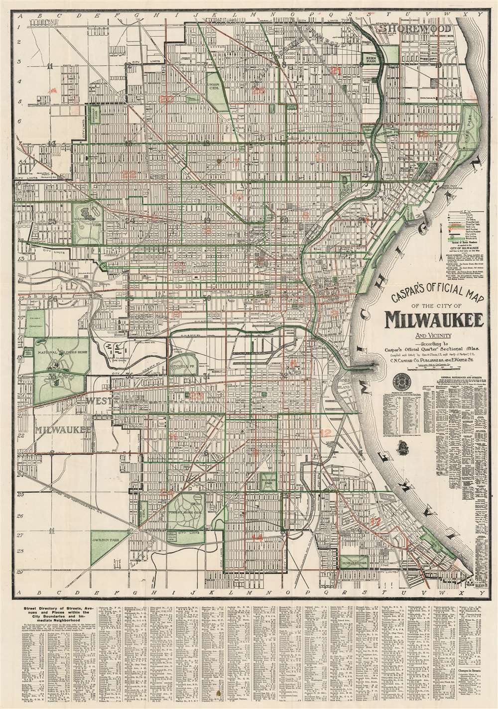
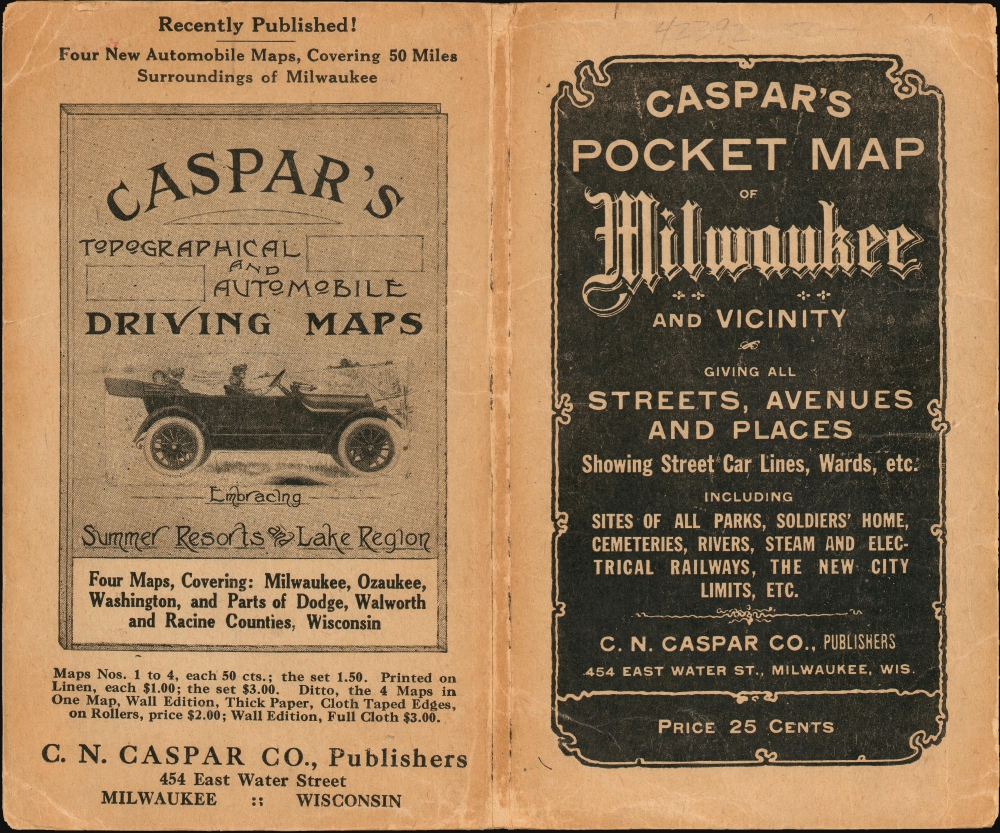

Charles Nicholas Caspar (October, 1854 - 1928), also known as Carl, was a German-American bookseller, antiquarian bookseller, and publisher based in Milwaukee, Wisconsin. Caspar was born in Germany and emigrated to the United States in 1868, becoming a citizen in 1878. Under the imprint of 'C. N. Caspar Company', he published maps, atlases, postcards, and touristic brochures. Most of his cartographic work is local in nature and focuses on Milwaukee and the immediate vicinity. The firm also did considerable business in German language material. The retail outlet was called C. N. Caspar Company Book Emporium and located at 454 East Water St., Milwaukee. More by this mapmaker...
George W. Cloos (May 8, 1887 - October 1, 1927) was a German-American civil engineer and real estate insurance appraiser active in Milwaukee, Wisconsin, in the early 20th century. Cloos was born in Milwaukee to German immigrant parents. Cloos compiled several regional atlases and maps in partnership with fellow German-American Carl / Charles N. Caspar. Learn More...
Copyright © 2024 Geographicus Rare Antique Maps | Geographicus Rare Antique Maps
This copy is copyright protected.
Copyright © 2024 Geographicus Rare Antique Maps