Digital Image: 1930 Kropp Panoramic View of Palm Beach Florida
PalmBeachFlorida-kropp-1930_d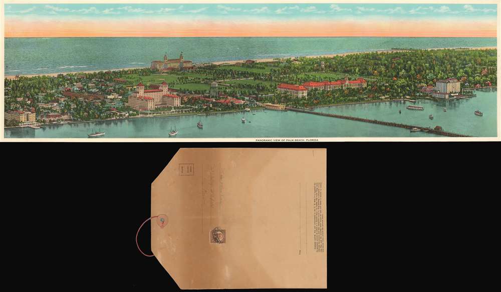

Title
Panoramic View of Palm Beach Florida.
1930 (undated) 8.25 x 29.25 in (20.955 x 74.295 cm)
1930 (undated) 8.25 x 29.25 in (20.955 x 74.295 cm)
Description
FOR THE ORIGINAL ANTIQUE MAP, WITH HISTORICAL ANALYSIS, CLICK HERE.
Digital Map Information
Geographicus maintains an archive of high-resolution rare map scans. We scan our maps at 300 DPI or higher, with newer images being 600 DPI, (either TIFF or JPEG, depending on when the scan was done) which is most cases in suitable for enlargement and printing.
Delivery
Once you purchase our digital scan service, you will receive a download link via email - usually within seconds. Digital orders are delivered as ZIP files, an industry standard file compression protocol that any computer should be able to unpack. Some of our files are very large, and can take some time to download. Most files are saved into your computer's 'Downloads' folder. All delivery is electronic. No physical product is shipped.
Credit and Scope of Use
You can use your digial image any way you want! Our digital images are unrestricted by copyright and can be used, modified, and published freely. The textual description that accompanies the original antique map is not included in the sale of digital images and remains protected by copyright. That said, we put significant care and effort into scanning and editing these maps, and we’d appreciate a credit when possible. Should you wish to credit us, please use the following credit line:
Courtesy of Geographicus Rare Antique Maps (https://www.geographicus.com).
How Large Can I Print?
In general, at 300 DPI, you should at least be able to double the size of the actual image, more so with our 600 DPI images. So, if the original was 10 x 12 inches, you can print at 20 x 24 inches, without quality loss. If your display requirements can accommodate some loss in image quality, you can make it even larger. That being said, no quality of scan will allow you to blow up at 10 x 12 inch map to wall size without significant quality loss. For more information, it is best consult a printer or reprographics specialist.
Refunds
If the high resolution image you ordered is unavailable, we will fully refund your purchase. Otherwise, digital images scans are a service, not a tangible product, and cannot be returned or refunded once the download link is used.
Cartographer
Emil C. Kropp (April 1, 1860 - December 24, 1907) was a Milwaukee based postcard and view publisher active in the late 19th and early 20th centuries. Kropp was born in Hamburg, Germany, and emigrated to the United States in 1871. Around 1897 or 1898 he visted the fatherland where he was inspired by the bourgeoning postcard business. On his return to Wisconsin, he began publishing postcards under the Kropp imprint, with his first postcards appearing in 1898. When Kropp died in 1907, the firm was taken over by his children, Adolph Kropp (1900 - 1918), Walter Kropp (1902 - 1913), and Herbert Louis Kropp (1903 - 1973), who incorporated as E. C. Kropp and Company. The firm produced millions of postcards and by 1956, was liquidated to L. L. Cook. The firm still operates as a subset of the GAF Corporation. More by this mapmaker...