Digital Image: 1941 World War II Taiwan Times Japanese Wall Map of the Philippines
Philippines-taiwantimes-1941-2_d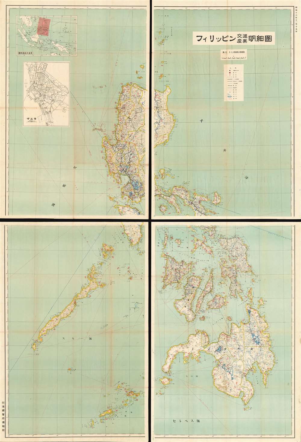

Title
Philippines Detailed Traffic and Industry Map. / フィリッピン交通產業明細圖
1941 (dated) 79 x 54 in (200.66 x 137.16 cm) 1 : 1000000
1941 (dated) 79 x 54 in (200.66 x 137.16 cm) 1 : 1000000
Description
FOR THE ORIGINAL ANTIQUE MAP, WITH HISTORICAL ANALYSIS, CLICK HERE.
Digital Map Information
Geographicus maintains an archive of high-resolution rare map scans. We scan our maps at 300 DPI or higher, with newer images being 600 DPI, (either TIFF or JPEG, depending on when the scan was done) which is most cases in suitable for enlargement and printing.
Delivery
Once you purchase our digital scan service, you will receive a download link via email - usually within seconds. Digital orders are delivered as ZIP files, an industry standard file compression protocol that any computer should be able to unpack. Some of our files are very large, and can take some time to download. Most files are saved into your computer's 'Downloads' folder. All delivery is electronic. No physical product is shipped.
Credit and Scope of Use
You can use your digial image any way you want! Our digital images are unrestricted by copyright and can be used, modified, and published freely. The textual description that accompanies the original antique map is not included in the sale of digital images and remains protected by copyright. That said, we put significant care and effort into scanning and editing these maps, and we’d appreciate a credit when possible. Should you wish to credit us, please use the following credit line:
Courtesy of Geographicus Rare Antique Maps (https://www.geographicus.com).
How Large Can I Print?
In general, at 300 DPI, you should at least be able to double the size of the actual image, more so with our 600 DPI images. So, if the original was 10 x 12 inches, you can print at 20 x 24 inches, without quality loss. If your display requirements can accommodate some loss in image quality, you can make it even larger. That being said, no quality of scan will allow you to blow up at 10 x 12 inch map to wall size without significant quality loss. For more information, it is best consult a printer or reprographics specialist.
Refunds
If the high resolution image you ordered is unavailable, we will fully refund your purchase. Otherwise, digital images scans are a service, not a tangible product, and cannot be returned or refunded once the download link is used.
Cartographer
Taiwan Times (January 8, 1919 – March, 1945) was a government issued Japanese newspaper published in Taiwan from 1919 – 1945. There were three publications that bore the name Taiwan Times, each was very different, and they are considered separate publications, but in fact, each succeeds its predecessor. First was the Taiwan Association Newspaper, which was published from 1898 to 1907. In Meiji 40 (1907) the defunct publication was taken over by the Taiwan branch of the Toya Association, which published as the Taiwan Times until 1919. In that year, it was taken over by the Taiwan Governor's Office (台湾總督府情報部), for which it was a propaganda tool for the Japanese Imperial Government. The newspaper focused on government and military affairs, the war progress, and general issued associated with the South China Sea region. It is considered the longest-lived and most far-reaching periodical issued during the Japanese occupation. More by this mapmaker...
References
OCLC 64055638.