Digital Image: 1906 Hoempler Map of the Amazon River from Iquitos, Peru, to Manaus, Brazil
RioAmazonas-hoempler-1906_d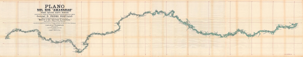


Title
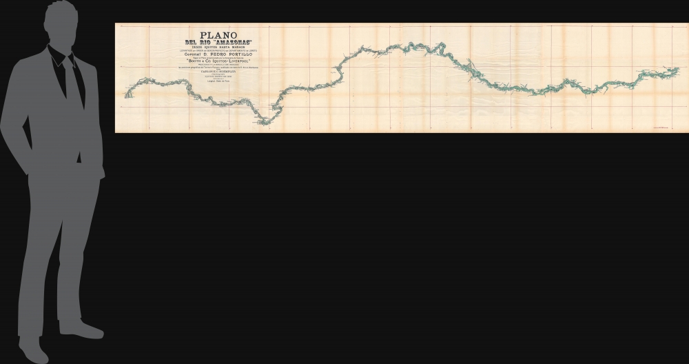
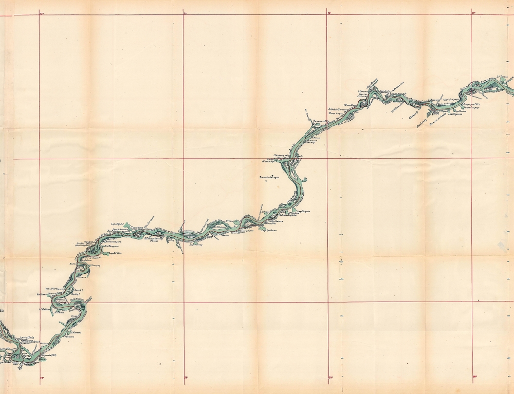
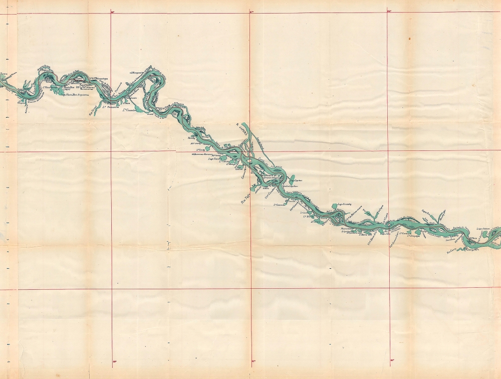
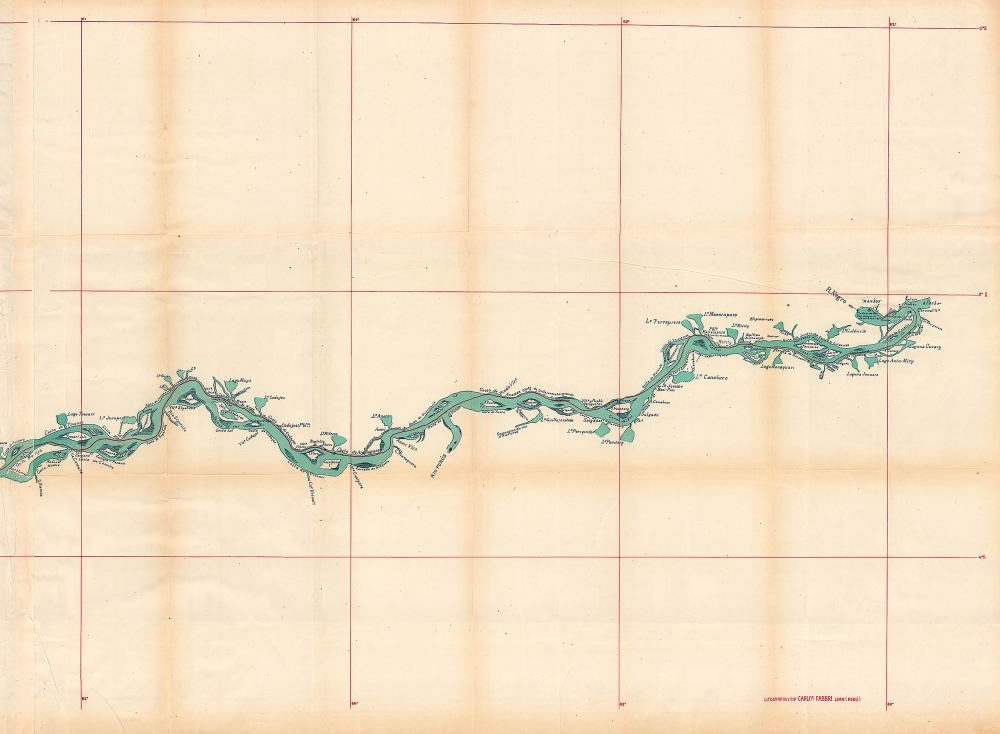
Plano del Rio 'Amazonas' desde Iquitos hasta Manaos: levantado por orden del Señor Prefecto del Departamento de Loreto Coronel D. Pedro Portillo Segun el Plano proporcionado por la Compañía de Vapores 'Booth and Co. Iquitos - Liverpool'
1906 (dated) 24 x 124.5 in (60.96 x 316.23 cm) 1 : 500000
1906 (dated) 24 x 124.5 in (60.96 x 316.23 cm) 1 : 500000
Description
FOR THE ORIGINAL ANTIQUE MAP, WITH HISTORICAL ANALYSIS, CLICK HERE.
Digital Map Information
Geographicus maintains an archive of high-resolution rare map scans. We scan our maps at 300 DPI or higher, with newer images being 600 DPI, (either TIFF or JPEG, depending on when the scan was done) which is most cases in suitable for enlargement and printing.
Delivery
Once you purchase our digital scan service, you will receive a download link via email - usually within seconds. Digital orders are delivered as ZIP files, an industry standard file compression protocol that any computer should be able to unpack. Some of our files are very large, and can take some time to download. Most files are saved into your computer's 'Downloads' folder. All delivery is electronic. No physical product is shipped.
Credit and Scope of Use
You can use your digial image any way you want! Our digital images are unrestricted by copyright and can be used, modified, and published freely. The textual description that accompanies the original antique map is not included in the sale of digital images and remains protected by copyright. That said, we put significant care and effort into scanning and editing these maps, and we’d appreciate a credit when possible. Should you wish to credit us, please use the following credit line:
Courtesy of Geographicus Rare Antique Maps (https://www.geographicus.com).
How Large Can I Print?
In general, at 300 DPI, you should at least be able to double the size of the actual image, more so with our 600 DPI images. So, if the original was 10 x 12 inches, you can print at 20 x 24 inches, without quality loss. If your display requirements can accommodate some loss in image quality, you can make it even larger. That being said, no quality of scan will allow you to blow up at 10 x 12 inch map to wall size without significant quality loss. For more information, it is best consult a printer or reprographics specialist.
Refunds
If the high resolution image you ordered is unavailable, we will fully refund your purchase. Otherwise, digital images scans are a service, not a tangible product, and cannot be returned or refunded once the download link is used.
Cartographer
Karl Emil Cuno Hoempler Urban (January 29, 1864 - December 15, 1936) was a Peruvian-German cartographer and surveyor. Heompler was born in Königsberg, Germany. It is not clear when he emigrated to Peru, but by the 1876 he was working with the Peruvian Servicio Geográfico del Ejército hoy Instituto Geográfico Militar. He appears to have been based alternatively in Lima and Iquitos, a jungle port on the Amazon. He made maps of eastern Peru and western Brazil, usually of the Amazon region, including a 10-foot-long map of the Amazon River from Iquitos to Manaus. More by this mapmaker...
References
OCLC 66906578, 34048386, 1091710644.