1834 Dépôt de la Marine Nautical Map of St. Pierre Island
StPierre-depotmarine-1834$450.00

Title
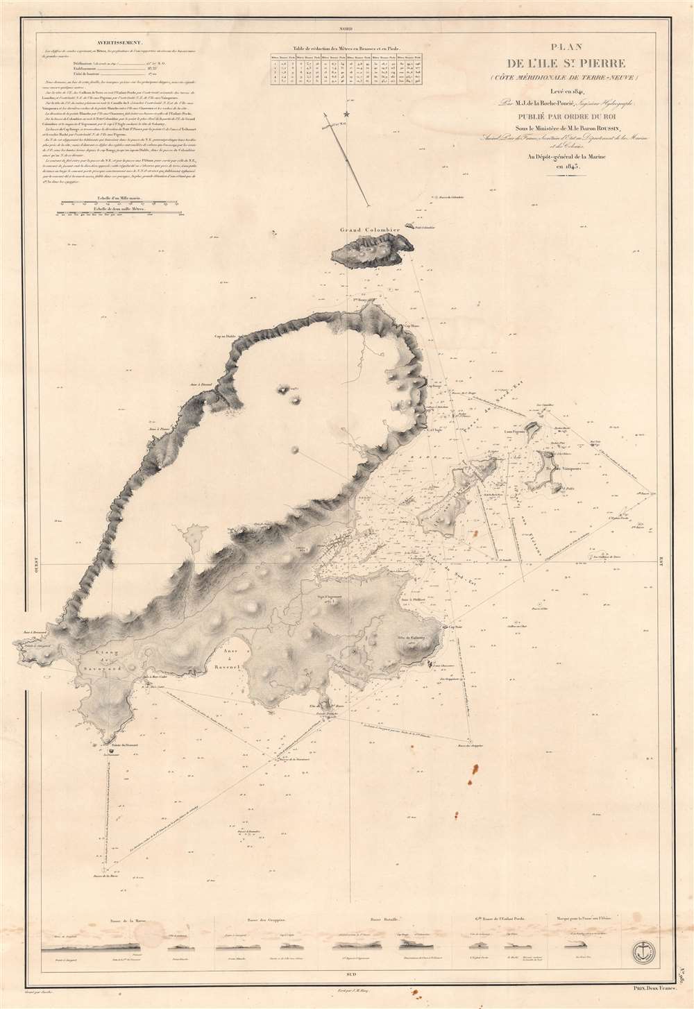
Plan de l'Ile St. Pierre (Côte Méridionale de Terre Neuve).
1834 (dated) 35 x 24.25 in (88.9 x 61.595 cm) 1 : 18000
1834 (dated) 35 x 24.25 in (88.9 x 61.595 cm) 1 : 18000
Description
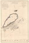
This is an 1834 Jules de la Roche-Poncié and Dépot de la Marine nautical chart or maritime map of St. Pierre Island, part of the French overseas collective, ('collectivité d'outre-mer'), St. Pierre and Miquelon. St. Pierre dominates the sheet, and its coastlines appear in impressive detail. Coves, points, bays, and other coastal locations are labeled. The Ile aux Chiens, Ile aux Vainqueurs, the Ile aux Pigeons, and Grand Colombier are illustrated and labeled, along with numerous smaller coastal islands. Depth soundings, navigation directions, and other notations provide mariners with navigational assistance. Nine coastal views appear along the bottom border to further aid navigation.
Publication History and Census
This map was created by Jules de la Roche-Poncié, drawn by Jacques-Marie Hacq, engraved by Stanislas Jacobs, and published by the Dépôt de la Marine in 1834. We note a single cataloged example, which is part of the collection at Memorial University Newfoundland.CartographerS
Dépôt des Cartes et Plans de la Marine (fl. 1720 - present), often called the Dépôt de Marine, was a French hydrographic mapping organization founded in 1720 under Charles-Hercule of Albert de Luynes (1674 - 1734). Much like the U.S. Coast Survey, the British Admiralty, and the Spanish Deposito Hydrografico, the Dépôt was initiated as a storehouse and distribution center of existing nautical and marine charts. Eventually the Dépôt initiated its own mapping activities in an attempt to improve and expand upon existing material. Some of the more prominent cartographers and hydrographers associated with the of Dépôt des Cartes were, Philippe Buache, Jacques-Nicholas Bellin, Giovanni Rizzi-Zannoni, Rigobert Bonne, and Jean Nicolas Buache. More by this mapmaker...
Ferdinand Antoine Jules de la Roche-Poncié (August 19, 1810 – March 30, 1881) was a French hydrographic engineer and cartographer active throughout the 19th century. Poncié was born in Vauxrenard, France. After graduating from the École Polytechnique in 1829 he joined the French navy, becoming a naval hydrographic engineer in 1832. Numerous important French surveys bear his name, including the first detailed hydrographic survey of the St. Pierre and Miquelon Islands, and numerous maps of East Asian waters. He received the Legion of Honor in 1841, ultimately attaining the grade of Commander. In 1860 he settled in Paris where he became a member of the Hydrographic Committee under Rear-Admiral Pierre Mathieu. He died in Paris in 1881. Learn More...
Jacques-Marie Hacq (September 22, 1785 – 18??) was a French letter and line engraver, and historian, active in Paris during the middle part of the 19th century. Hacq was born in Paris and trained under J. P. Besançon, who he succeeded at the Dépôt de la Guerre in 1830. He engraved for the Dépôt de la Guerre as early as 1830 and for the Dépôt des Cartes et Plans de la Marine from, at least, 1840 to 1852. In addition to his work for the French Government, he also completed maps and engravings for Lesage, Lapie, Dufour, Duperrez, Gouvion St. Cyr, and Dumont d'Urville. His historical works include a history of the Napoleonic Wars and a history of Paris under the reign of Louis XIII. During most of his career in Paris he lived at 58 Rue de la Harpe. Learn More...
Stanislas Joseph Jacobs (18?? – July 5, 1867) was a French line engraver active in Paris during the middle part of the 19th century. Jacobs did work for the both the Dépôt de la Guerre ad Dépôt de la Guerre and the Dépôt des Cartes et Plans de la Marine. He often worked with Jacques-Marie Hacq. His most important publication is most likely the Eugène Duflot de Mofras map of the American west, published in 1844. Stanislas was a member of the French Société de Géographie from 1842. In 1862 Stanislas' son, Alfred Joseph Jacobs (December 15, 1827 - July 16, 1889), also an engraver, descended into mental illness and was consigned the Charenton hospice. His son's illness apparently catapulted Stanislas into a deep unremitting despair. Stanislas retired in 1862. He was married to Thérèse Alexandrine Outrequin (January 28, 1804 – February 20, 1873). He lived in Paris at Rue De Condé, 1. Learn More...
Condition
Good. Light soiling.
References
OCLC 456729582.