Digital Image: 1703 Pierre Mortier Nautical Chart or Map of the World (Insular California)
World-mortier-1703_d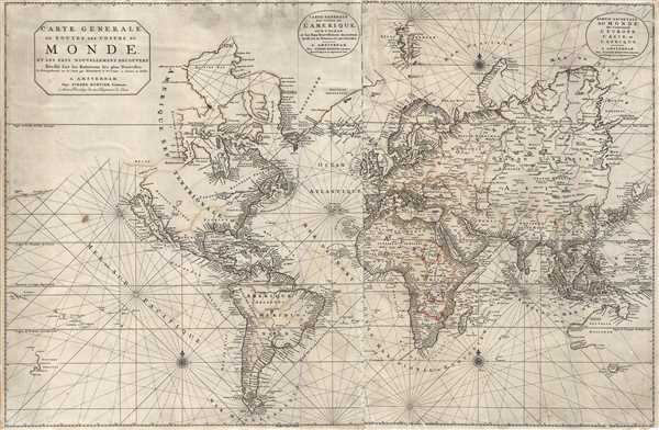

Description
FOR THE ORIGINAL ANTIQUE MAP, WITH HISTORICAL ANALYSIS, CLICK HERE.
Digital Map Information
Geographicus maintains an archive of high-resolution rare map scans. We scan our maps at 300 DPI or higher, with newer images being 600 DPI, (either TIFF or JPEG, depending on when the scan was done) which is most cases in suitable for enlargement and printing.
Delivery
Once you purchase our digital scan service, you will receive a download link via email - usually within seconds. Digital orders are delivered as ZIP files, an industry standard file compression protocol that any computer should be able to unpack. Some of our files are very large, and can take some time to download. Most files are saved into your computer's 'Downloads' folder. All delivery is electronic. No physical product is shipped.
Credit and Scope of Use
You can use your digial image any way you want! Our digital images are unrestricted by copyright and can be used, modified, and published freely. The textual description that accompanies the original antique map is not included in the sale of digital images and remains protected by copyright. That said, we put significant care and effort into scanning and editing these maps, and we’d appreciate a credit when possible. Should you wish to credit us, please use the following credit line:
Courtesy of Geographicus Rare Antique Maps (https://www.geographicus.com).
How Large Can I Print?
In general, at 300 DPI, you should at least be able to double the size of the actual image, more so with our 600 DPI images. So, if the original was 10 x 12 inches, you can print at 20 x 24 inches, without quality loss. If your display requirements can accommodate some loss in image quality, you can make it even larger. That being said, no quality of scan will allow you to blow up at 10 x 12 inch map to wall size without significant quality loss. For more information, it is best consult a printer or reprographics specialist.
Refunds
If the high resolution image you ordered is unavailable, we will fully refund your purchase. Otherwise, digital images scans are a service, not a tangible product, and cannot be returned or refunded once the download link is used.
Cartographer S
Pierre Mortier (January 26, 1661 - February 18, 1711) or Pieter Mortier was a cartographer, engraver, and print seller active in Amsterdam during the later 17th and early 18th centuries. Mortier, then known as Pieter, was born in Leiden. He relocated to Paris from 1681 to 1685, adopting the French name Pierre, which he retained throughout his career. While in France, he developed deep French connections by bringing sophisticated Dutch printing technology and experience to nascent French map publishers such as Guillaume De L'Isle (1675 - 1726), Alexis-Hubert Jaillot (c. 1632 - 1712), and Nicholas de Fer (1646 - 1720). Consequently, much of Mortier's business was built upon issuing embellished high quality editions of contemporary French maps - generally with the permissions of their original authors. In the greater context of global cartography, this was a significant advantage as most Dutch map publishes had, at this point, fallen into the miasma of reprinting their own outdated works. By contrast, the cartographers of France were producing the most accurate and up to date charts anywhere. Mortier's cartographic work culminated in the magnificent nautical atlas, Le Neptune Francois. He was awarded the Privilege, an early form of copyright, in 1690. Upon Pierre's death in 1711 this business was inherited by his widow. In 1721, his son Cornelius Mortier took over the day to day operation of the firm. Cornelius partnered with his brother-in-law Jean Covens to form one of history's great cartographic partnerships - Covens and Mortier - which continued to publish maps and atlases until about 1866. More by this mapmaker...
Baltasar Ruyter (fl. c. 1680 - 1710) was a Dutch engraver active in the late 17th and early 18th centuries. His work is most commonly associated with Pierre Mortier, and the firm of his son Jean Covens and Cornielle Mortier (Coven's and Mortier). Little is known of his life. Learn More...
Nicolaes Witsen (May 8, 1641 - August 10, 1717) was a Dutch cartographer, diplomat, writer, businessman, and politician. Witsen was born in Amsterdam to the politically powerful Cornelius Jan Witsen, burgomaster, head bailiff and administrator of the Dutch West India Company. Witsen studied Law at the University of Leiden where he developed an interest in language and maps. He was highly educated and traveled in elite circle, befriending Oliver Cromwell, Andrew Vinius, Cosimo III de'Medici, Melchisédech Thévenot, and others. In 1662 he presented a paper at the Amsterdam Athenaeum Illustre arguing for the effect of comets on earthly life. Witsen joined the VOC (Dutch East India Company) became an expert on shipbuilding, composing several treatises on the subject. His passion, however, remained cartography, particularly the cartography of Asia. Having traveled in embassy to Russia, Witsen contrived to get special access to Russian records on the exploration of Siberia, including the heretofore unknown explorations of Semyon Dezhnev. He also acquired the diary of Maarten Gerritsz Vries, who had explored the coast of Sakhalin in 1643. The Vries diary was thereafter lost. This information he compiled into several influential maps and books on Asia which were extensively copied. One result of this work is the Witsen Peninsula - a narrow outcropping of land extending from Siberia that appears on many maps of the early 17th century. Later, Witsen became Mayor of Amsterdam, a position he held some 13 times, and under whose tenure arts flourished. Witsen died in Amsterdam and was buried near his country home in Egmond aan den Hoef. Learn More...
Source
Mortier, Pierre, Neptune François, (Amsterdam, Pierre Mortier), 1703.
References
Shirley, Rodney W., The Mapping of the World: Early Printed World Maps 1472-1700, 559. OCLC 159835222, 309464365.