
Mortier, Pierre
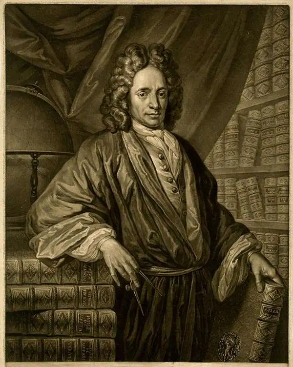
Pierre Mortier (January 26, 1661 - February 18, 1711) or Pieter Mortier was a cartographer, engraver, and print seller active in Amsterdam during the later 17th and early 18th centuries. Mortier, then known as Pieter, was born in Leiden. He relocated to Paris from 1681 to 1685, adopting the French name Pierre, which he retained throughout his career. While in France, he developed deep French connections by bringing sophisticated Dutch printing technology and experience to nascent French map publishers such as Guillaume De L'Isle (1675 - 1726), Alexis-Hubert Jaillot (c. 1632 - 1712), and Nicholas de Fer (1646 - 1720). Consequently, much of Mortier's business was built upon issuing embellished high quality editions of contemporary French maps - generally with the permissions of their original authors. In the greater context of global cartography, this was a significant advantage as most Dutch map publishes had, at this point, fallen into the miasma of reprinting their own outdated works. By contrast, the cartographers of France were producing the most accurate and up to date charts anywhere. Mortier's cartographic work culminated in the magnificent nautical atlas, Le Neptune Francois. He was awarded the Privilege, an early form of copyright, in 1690. Upon Pierre's death in 1711 this business was inherited by his widow. In 1721, his son Cornelius Mortier took over the day to day operation of the firm. Cornelius partnered with his brother-in-law Jean Covens to form one of history's great cartographic partnerships - Covens and Mortier - which continued to publish maps and atlases until about 1866.
Correcting the Zambezi. First Amsterdam edition.
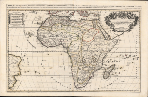
L'Afrique distinguée en ses principales parties, sçavoir La Barbarie, Le Biledulgerid, L'Egypte, Le Saara ou le Desert, Le Pays des Negres, La Guinee, La Nubie, L Abissinie, Le Zanguebar, Le Congo, Le Monomotapa, Les Cafres, Les Iles de Canarie, du Cap-Verd, de St.Thomas, L'Isle Dauphine, autrement Madagascar, ou sont remarqués les Empires, Monarchies, Royaumes, Estats, et peuples qui partagent presentement L'Afrique.Tiré sur les Relations les plus nouvelles. Par le Sr. Sanson, Geographe ordre. du Roy.
$1,800.00
Acquire
- Digital Map Information
- Suitable for large format printing
- DPI: 600
- File Size: 1120.48 MB
- File Type: ZIP / TIFF
- ICC color profile embedded
- Delivered instantly via download link
This is a spectacular 1692 first Pierre Mortier edition of Alexis-Hubert Jaillot and Guillaume Sanson's large-format map of Africa - one of the largest and most beautiful atlas maps of the continent to appear in the 17th century, here in a striking old color example. This map is most significant for it correction of the location of the Zambezi River, correctly placing it north of Sofala. (more details)
Magnificent Seventeenth-Century Asia.
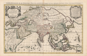
L'Asie diviseé en ses Principales Regions, et ou se peut voir l'estendue Des Empires, Monarchies, Royaumes et Estats qui partagent présentement L'Asie.
$1,500.00
Acquire
- Digital Map Information
- Suitable for large format printing
- DPI: 600
- File Size: 112.68 MB
- File Type: ZIP / TIFF
- ICC color profile embedded
- Delivered instantly via download link
This is a beautiful example of Hubert Jaillot's two-sheet map of Asia in its 1696 Mortier issue. While fundamentally based on Nicolas Sanson's mapping of the continent, the map has been updated to reflect advances in European knowledge of the Far East. Moreover, Jaillot's background as a sculptor has resulted in the artfully engraved cartouches which grace this work. (more details)
The earliest acquirable European mapping of Korea based on firsthand report.
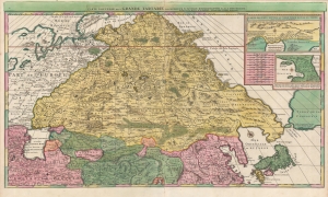
Carte Nouvelle de la Grande Tartarie.
$3,500.00
Acquire
- Digital Map Information
- Suitable for large format printing
- DPI: 600
- File Size: 123.4 MB
- File Type: ZIP / TIFF
- ICC color profile embedded
- Delivered instantly via download link
This is a stunning, original-color example of Pierre Mortier's 1696 two-sheet map of northern Asia, Siberia, and Tartary. It is drawn primarily from two sources: Hubert Jaillot's 1695 six-sheet wall map of Asia and Nicolaes Witsen's 1687 map of Tartary. As a result, this map represents the most up-to-date cartography of central and northeastern Asia of the seventeenth century, which would not be significantly improved upon until the maps of Strahlenberg thirty years later. (more details)
French Cartography and Dutch Decorative Engraving.
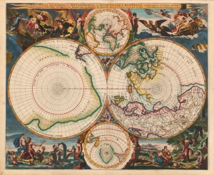
Les Deux Poles Arctique ou Septentrional, et Antarctique ou Meridional, ou Description des Terres Arctiques et Antarctiques ; et des Pays circomvoisins jusques aux 45. Degres de Latitude.
$4,000.00
Acquire
- Digital Map Information
- Suitable for large format printing
- Full resolution TIFF file
- ICC color profile embedded
- Delivered instantly via download link
This is a beautiful example of Peter Mortier's 1696 double-hemisphere map of the northern and southern hemispheres. The primary hemispheres focus on the northern and southern thirds of the world. The secondary hemispheres show the entire world, centered respectively on Paris and its antipodes. (more details)
Among the Earliest Obtainable Maps of the Chesapeake.
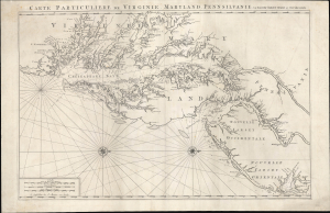
Carte Particuliere de Virginie, Maryland, Pennsilvanie, La Nouvelle Jarsey. Orient et Occidentale.
$4,500.00
Acquire
- Digital Map Information
- Suitable for large format printing
- Full resolution TIFF file
- ICC color profile embedded
- Delivered instantly via download link
This is Pierre Mortier and Alexis-Hubert Jaillot's c. 1700 large-format nautical chart of the Mid-Atlantic coast, including Chesapeake Bay and the Delaware River Estuary. One of the most important early modern maps of this region, it is significant for its early inclusion of Philadelphia and prodigious hydrographic information. (more details)
The Route to the East Indies.
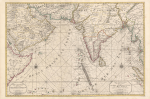
Carte Particuliere d'une Partie d'Asie ou sont Les Isles D'Andemaon, Ceylan, Les Maldives.../ Partie Occidentale d'une D'Asie ou sont les Isles De Zocotora De l'Amirante...
$2,800.00
Acquire
- Digital Map Information
- Suitable for large format printing
- DPI: 600
- File Size: 116.25 MB
- File Type: ZIP / TIFF
- ICC color profile embedded
- Delivered instantly via download link
This is a superb, original-color example of Pierre Mortier's 1700 chart and map of the Indian Ocean. This grand, two-sheet engraving also maps the surrounding lands of eastern Africa, Arabia, Persia, India, and the Malay Peninsula. Countless islands are mapped, including the Maldives, Sri Lanka, and Sumatra. As indicated by the presence of two separate cartouches, the two sheets could also be had as separate works; however, in Mortier's mammoth Neptune François they were frequently bound joined, as here. (more details)
Superb Original Color.
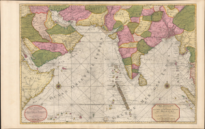
Carte Particuliere d'une Partie d'Asie ou sont Les Isles D'Andemaon, Ceylan, Les Maldives.../ Partie Occidentale d'une D'Asie ou sont les Isles De Zocotora De l'Amirante...
$4,000.00
Acquire
- Digital Map Information
- Suitable for large format printing
- Full resolution TIFF file
- ICC color profile embedded
- Delivered instantly via download link
This is a premium full-original-color example of Pierre Mortier's 1700 nautical chart and map of the Indian Ocean and the adjacent parts of eastern Africa, Arabia, Persia, India, and the Malay Peninsula. Countless islands are mapped, including the Maldives, Sri Lanka, and Sumatra. (more details)
Seaside Resort and Final Resting Place of Roman Elites.
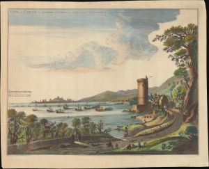
Veue de Caiete du Royaume de Naples. vers le Golfe de Venise.
$500.00
Acquire
- Digital Map Information
- Suitable for large format printing
- File Size: 21.94 MB
- File Type: ZIP / TIFF
- ICC color profile embedded
- Delivered instantly via download link
A lovely c. 1704 view of Gaeta, Italy, originally prepared by Johannes Blaeu in 1663 for the Theatrum Civitatum et Admirandorum Italiæ and reissued with minor changes by Pierre Mortier for his Nouveau Theatre d'Italie. (more details)