This item has been sold, but you can get on the Waitlist to be notified if another example becomes available, or purchase a digital scan.
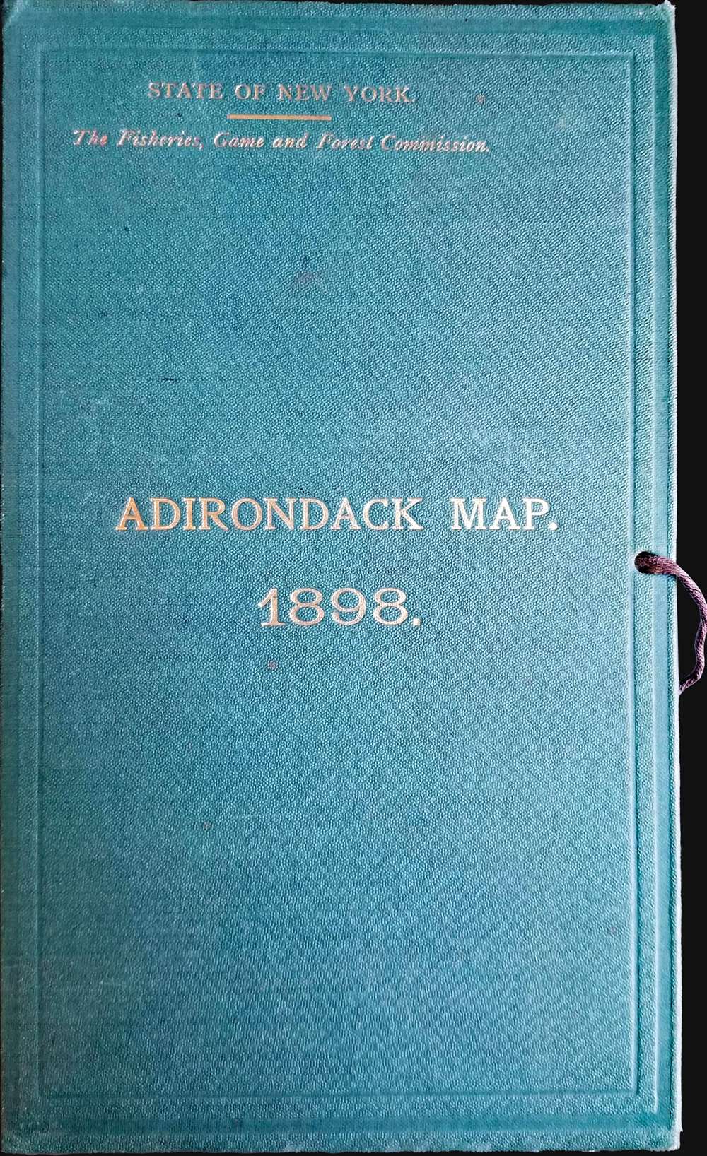
1898 Fox Wall-Sized Map of the Adirondacks, New York
Adirondack-fox-1898$475.00


Title
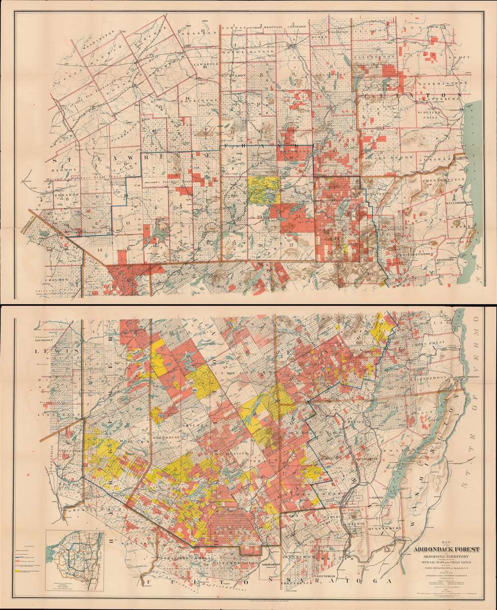
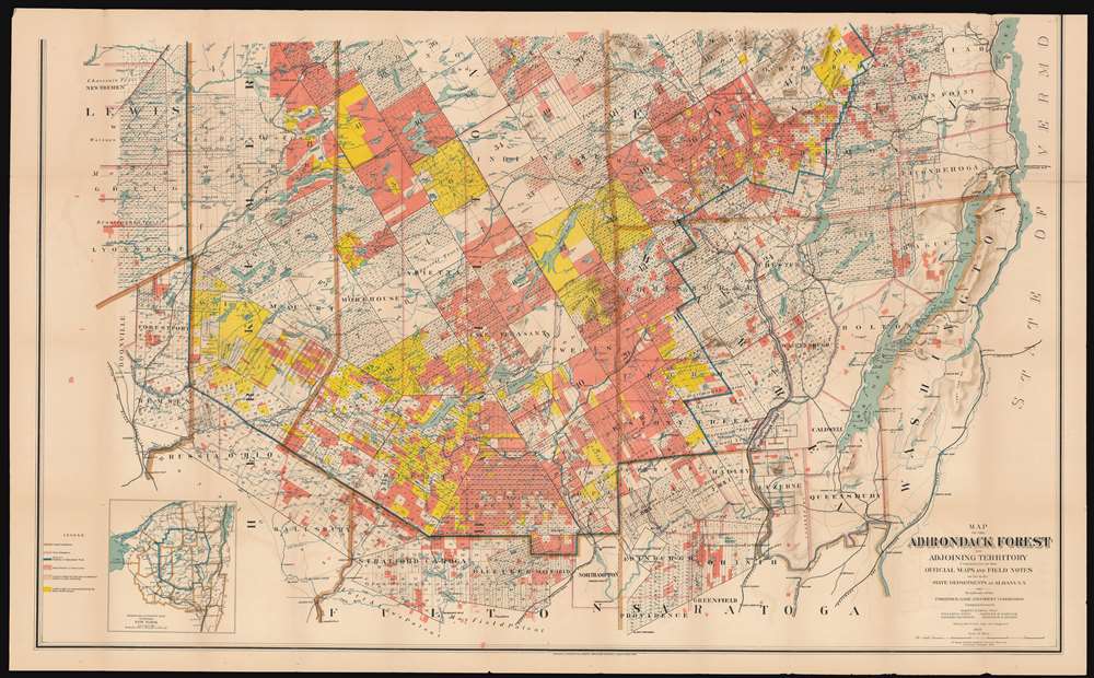
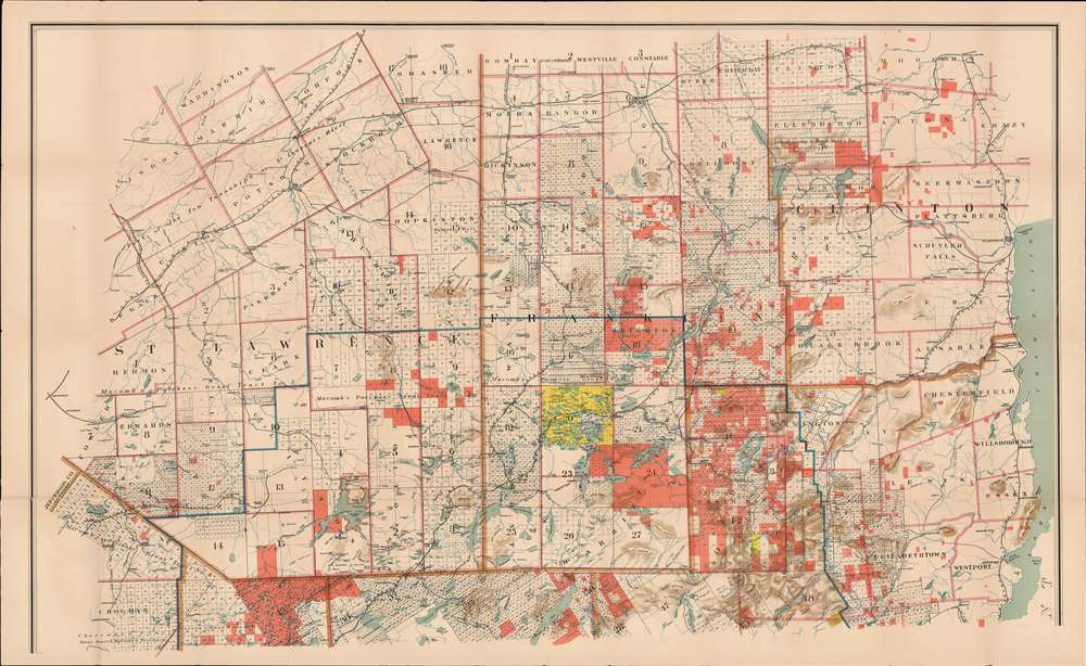
Map of the Adirondack Forest and Adjoining Territory Compiled from Official Maps and Field Notes on file in the State Departments at Albany, N.Y.
1898 (dated) 72 x 60 in (182.88 x 152.4 cm) 1 : 127000
1898 (dated) 72 x 60 in (182.88 x 152.4 cm) 1 : 127000
Description
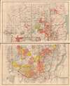
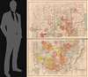
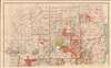
An uncommon large scale 1898 William Fox map of the Adirondack mountains of New York. The map covers the entire Adirondack Mountain region, extending from Saratoga to Plattsburg, and from Lewis County to Lake George and Lake Champlain. The map was made on behalf of the State Fisheries, game Commission for administrative purposes. The boundaries of the Adirondack State Park are defined by a bold blue line. Additional color coding designates the state of various lands. Pink shading identifies state forest preserve lands, yellow illustrates those lands bought or contract by the Forest Preserve Board, and lighter pink lands in which the state has joint ownership.
Unlike most state parks, the Adirondack Park is not a cohesive unit fully owned by the state. Some 52% of the park is privately owned. The park includes more than 100 towns and villages, as well as farms, private homes, and active timbering zones. The complex ownership structure led to unique administrative challenges and the need for comprehensive large scale maps like this one.
The Adirondack Park
The Adirondack State Park, part of the New York Forest Preserve, was established in 1892 'for the free use of all … for their health and pleasure.' In 1884, a state legislative commission chaired by botanist Charles Sprague Sargent recommended the establishment of an Adirondack Mountain forest preserve. The New York State Legislature formally adopted the suggestion one year later designated state-owned lands within certain counties in the Adirondacks and Catskills to be 'forever kept wild.' In 1894, the Adirondack State Park was formally enshrined as an amendment to the New York State Constitution.Unlike most state parks, the Adirondack Park is not a cohesive unit fully owned by the state. Some 52% of the park is privately owned. The park includes more than 100 towns and villages, as well as farms, private homes, and active timbering zones. The complex ownership structure led to unique administrative challenges and the need for comprehensive large scale maps like this one.
Publication History and Census
The earliest variant on this map we have identified was issued in 1893. Subsequent updates appeared in 1895, as here in 1898, in 1902, and in 1908. Others may exist. Each was a completely new and revised map, published by different printing houses. The present map was drawn by William Fox and printed by the Wynkoop, Hallenbeck, Crawford Company. Fox also made a related map of the Catskill Preserve. Examples are well represented institutionally, but few have made their way into the private market.CartographerS
William F. Fox (January 11, 1840 - June 16, 1909) was an American engineer, historian, and administrator. He became the Superintendent of Forests at the Adirondack Park in New York State. Fox was born in Ballston Spa, New York to a family in the lumber trade, and graduated Union College in 1860, having studied to become an engineer. Soon enough, any career plans were put on hold with the onset of the American Civil War: He joined the 107th New York Volunteers and fought in the War, receiving a commission and advancing in rank as Captain, Major, and Lieutenant Colonel. He would commit his experiences to paper, contributing to postwar efforts to enumerate the horrors of the conflict: His 'Chances of Being Hit in Battle' was published by Century Magazine in 1888, and the following year he published 'Regimental Losses in the American Civil War.' He wrote a three volume history of the action of New York soldiers at the battle of Gettysburg as well as histories of several Union generals. In addition to his writing, Fox would continue in his family's lumber business; he travelled abroad to study modern methods in the trade, and he worked as a forester on behalf of the Blossburg Coal, Mining and Railroad Company in Pennsylvania. In 1885 he became assistant secretary to the New York State Forest Commission, served as Assistant Forest Warden from 1888 to 1891, and became the first Superintendent of Forests upon the creation of the Adirondack Park in 1892. His work as Superintendent provided the basis for the founding of the New York State College of Forestry at Cornell. More by this mapmaker...
Wynkoop Hallenbeck Crawford Co. (fl. c. 1895 - 1925) was a large-scale printer and publisher based in New York in the late 19th and early 20th centuries. The firm originated with Matthew Bennet Wynkoop (February 15, 1830 - March 30, 1895) was born in Zanesville, Ohio and died in New York City. He mastered the printing trade in Pittsburg and moved to New York in 1850. He joined forces with John Johnson Hallenbeck (1817 - April 30, 1891) and an unknown 'Thomas' to form 'Wynkoop, Hallenbeck and Thomas'. When Thomas retired, the name was changed to 'Wynkoop and Hallenbeck', with Wynkoop being the senior partner. Wyncoop died in 1895 and shortly thereafter, Crawford joined the firm, which was consequently renamed, Wynkoop Hallenbeck Crawford. When John J. Hallenbeck died, in 1891, and his shares passed to Mr. Harry C. Hallenbeck, then a junior partner, who relocated it to Pearl street and meeting success, opened offices in Albany, New York and Lansing, Wisconsin. By 1902 they were one of the largest printing concerns in the United States. They began bidding on state contracts in 1901, acquiring contracts in Michigan. They also did extensive printing for the railroad and shipping industry. The firm seems not to have published after 1925. Learn More...
Condition
Good. Exhibits wear along original fold lines. Verso reinforcements to separations at nearly every fold intersection. Exhibits minor areas of infill. Accompanied by original binder.
References
OCLC 38962909.