This item has been sold, but you can get on the Waitlist to be notified if another example becomes available, or purchase a digital scan.
1719 Mallet Map of Africa in Antiquity
AfriqueAncienne-mallet-1719$75.00

Title
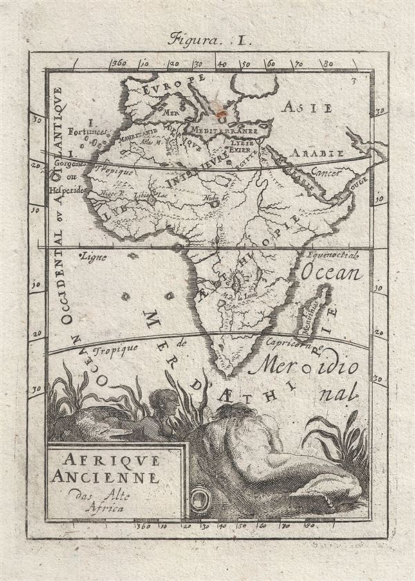
Afrique Ancienne das Alte Africa.
1719 (undated) 6 x 4.5 in (15.24 x 11.43 cm) 1 : 81187200
1719 (undated) 6 x 4.5 in (15.24 x 11.43 cm) 1 : 81187200
Description
An attractive 1719 miniature map of Africa by Alain Manesson Mallet. Map covers the entire continent of Africa as well as adjacent parts of Europe, Asia, and Arabia. Attempts to illustrate Africa in Antiquity. Shows the Nile according to the Ptolemaic model terminating in two large lakes at the base of the Mountains of the Moon. The jigger river flows inland to its source at Lake Nuba. Roman provinces are identified along the Mediterranean coast. An allegorical cartouche depicting a sphinx, a crocodile, and a heavily muscled man decorates the base of the map. Issued for the 1719 Frankfurt edition of Mallet's Description de L'Univers.
Cartographer
Alain Manesson Mallet (1630-1706) was a French cartographer, grammarian, engineer and mathematician, active in the mid to late 17th century. Despite being born in France, as a young man Mallet joined the Portuguese - yes Portuguese - army where he served as a Sergeant-Major. Later he was able to levy his war experience into a career as Inspector of Fortifications for Louis XIV of France. It was in this position, where his work entailed examining and sketching various fortresses, that Mallet developed his cartographic interests. His most important work is his monumental five volume opus Description de L'Univers, published in 1683. This impressive work described the cultures, governments, lands, and customs of all the known peoples of the earth and included numerous maps and engravings. At the time, the Description was the largest and most comprehensive work of its kind ever published. A year later, in 1684, he published his 3 volume Les Travaux de Mars ou l'Art de la Guerre. Mallet is also known for his invention of the "dumpy bubble", a telescopic sight incorporating a level bubble used for surveying and astronomical observations. More by this mapmaker...
Source
Mallet. A. M, Description de L'Univers, (Frankfurt) 1719.
Condition
Very good. Originall pressmark. Blank on verso.
References
OCLC 164841388.