
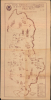
1966 Lulo / Kuka Pictorial Map of Albania, Fourth Five-Year Plan


This item has been sold.
Skema e përdorimit të lëndë ve djegese në qytetet e R.P. Sh. [Republika Popullore e Shqipërisë] per vjeçarin E-IVte 1966-1970 / [Scheme of Fuel Use in the Cities of the People's Socialist Republic of Albania for the Fourth Five Year Plan 1966-1970].
Albania's Autarky Agenda.
Choose a Collection:
This Item
Enquire
Albania's Autarky Agenda.
This is an important and rare c. 1966 ferro-gallic print pictorial map of Albania prepared to illustrate the country's Fourth Five Year Plan (1866 - 1970) for economic development. When this map was issued, Albania was the poorest country in Europe, estranged from long-time Communist allies in Soviet Russia and actively cultivating new allies in far-off Maoist China. The map pictorially illustrates fuel resources throughout the country, ranging from nitrogen to charcoal briquettes. As a ferro-gallic print, production numbers of this map must have been limited to the 10s rather than 100s or 1000s, and survival rates would have been low. This is likely the sole surviving example of this important map capturing Albania's struggles to find its place in the Communist world.A Closer Look
Albania is presented with nearby countries and major topographic features labeled. Administrative divisions, roads, forests, and cities are indicated throughout with small tables next to cities providing the percentages of their fuel to be provided by various sources, such as wood (dru), 'sawdust briquettes' (briket tallashi), charcoal (qymyr druri), kerosene (vajguri), and hot water (uji nxehtë). A legend at bottom-right explains symbols used, including for more 'modern' fuel sources such as coal mines, nitrogen plants, and natural gas resources, in addition to factories producing sawdust and charcoal briquettes. A table above the legend gives the overall national breakdown of fuel sources; the reliance on wood and its derivatives for the majority of the country's fuel is evidence of its relative poverty at the time.Historical Context
This map was prepared when Albania was among the most isolated countries in the world, with only distant China as a friend amidst a sea of perceived enemies. This situation arose from the complicated and contentious international relations within the Communist sphere during the Cold War. Like many smaller Communist countries, especially those with a strong domestic Communist movement that had gained legitimacy through resistance during the Second World War (such as North Korea, Yugoslavia, and Vietnam), Albania bristled at attempts by larger Communist countries to control its domestic politics. In particular, the Soviet Union and neighboring Yugoslavia played an outsized role in the early years of the People's Republic of Albania.During his rise to power in the 1940s, Enver Hoxha fell into deep disagreements with the Yugoslav Communists over issues of ethnicity and territorial boundaries (presaging the conflicts of the 1990s that followed the collapse of Communism). As a result, Hoxha turned to the Soviet Union for support against perceived Yugoslav interference, especially as Yugoslav-Soviet relations worsened in the late 1940s. However, this arrangement proved short-lived; Hoxha, having followed the Stalinist model, felt threatened by Khruschev's Destalinization efforts beginning in 1956, and launched a domestic purge as a result (accusing Yugoslavia of plotting a coup). Stuck between a powerful neighbor and an even more powerful but untrustworthy benefactor (aid from which constituted roughly half of Albania's economy), Hoxha undertook the gambit of reaching out to the People's Republic of China, which also saw worsening relations with the Soviet Union from 1956 onwards. Chinese aid to Albania increased accordingly, and friendly propaganda in both countries was issued, with images of the two dictators happily shaking hands being a frequent feature (both had boosted their cult of personality in response to Destalinization).
As Maoism moved in a more militant direction in the late 1960s during the Cultural Revolution, which was aimed at 'Soviet Revisionism' among other ills, Albania followed suit. One of Hoxha's most tangible legacies was a network of nearly 175,000 bunkers and pillboxes (for a population of 3 million people) strewn across the landscape, a stark reminder of the paranoid mindset that demanded the Albanian people be prepared for a foreign invasion at any moment. This program of 'bunkerization' (bunkerizimi) began in tandem with the Fourth Five Year Plan referred to here.
The Fourth Five Year Plan
The Fourth Five-Year Plan of the People's Republic of Albania, covering from 1966 to 1970, was a significant period of intense economic development and radical internal social change, heavily influenced by the country's strategic alignment with the People's Republic of China and a drive for autarkic self-sufficiency. Although setting very ambitious goals (especially a 50 percent increase in industrial production), the plan was largely successful (on paper, at least), thanks to an influx of Chinese aid, which more than supplanted the recently-withdrawn Soviet aid. Alongside the nominally successful electrification and heavy industry drive, Hoxha also pursued a 'Cultural and Ideological Revolution' closely modeled on China's Cultural Revolution, including compulsory physical labor for bureaucrats and intellectuals, an intense anti-religious campaign, and a drive against 'bureaucratism.'Publication History and Census
This map was prepared by engineers (inxhinierë) Saib Lulo and Thoma Kuka and drawn by technician (teknik) Aristidh Papadhopulli for the Ministry of Municipal Economics and the Industrial Ministry. It most likely appeared near the start of the five-year plan, as fuel allocations for the upcoming years were being publicized. We have been unable to locate any other examples of this map, and this is likely a singular survivor.Condition
Good. Light wear along original fold lines. Slight loss at a fold intersections. Closed edge tears professionally repaired on verso. Slight loss in margin in bottom left corner. Uneven toning in bottom-right quadrant.