
1952 Soviet Military Secret Plan for Fighting 'Imperialist' Arctic Invasion

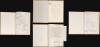
Организация и ведение противодесантной операции на морском побережье во взаимодействии с военно-морским флотом / [Organization and Conduct of an Anti-Amphibious Operation on the Seacoast in Coordination with the Navy].
Cold War Era Soviet Plan to Repel an American Arctic Invasion.
$7,500.00
Choose a Collection:
This Item
Enquire
Cold War Era Soviet Plan to Repel an American Arctic Invasion.
This is a one-of-a-kind 1952 Cold War Era top-secret report with maps, prepared for the Operations Directorate of the Northern Military District of the Armed Forces of the Soviet Union. The booklet discusses detailed plans to repel a much-feared 'Anglo-American imperialist' invasion of the Soviet Union from the Arctic. It offers unique insight into the Soviet perspective and defensive planning at the height of the Cold War (1947 - 1991).A Closer Look
The report is divided into five sections, which are listed in a table of contents at the front:- Operational-Strategic Position of the Northern Military District (Oперативно-стратегическое положение северного военного округа)
- American-British Imperialists - The Bitterest Enemies of the Soviet People (Aмерикано-Aнглийские империалисты - злейшие враги Cоветского народа)
- The Probable Character of Enemy Actions, Possible Composition of the Landing Force, and Objectives the Enemy May Set When Conducting an Operation in the North (Bероятный характер действий противника, возможный состав десанта и цели, которые может поставить противник при проведении операции на севере)
- Fundamental Principles of the Organization and Conduct of Anti-Landing Defense of the Sea Coast (Принципиальные основы организации и ведения противодесантной обороны морского побережья)
- Conclusion (Заключение)
The document continues in this vein, mostly discussing hard strategic realities and military planning, but with ideological statements and choice quotations interspersed. The anonymous author or authors point to the potential vulnerability of the far north, which, unlike the western borders of the Soviet Union, lying adjacent to friendly (i.e., Soviet-occupied) countries, was exposed to attack from the Americans and British from their outposts in Iceland, Svalbard, and Norway. The role of the Soviet Northern Fleet is emphasized, and its protection is prioritized in the event of any invasion, along with securing railway routes. More abstractly, the mineral wealth and industrial potential of the Kola Peninsula is discussed. Overall, the author(s) are writing to justify the significance of their sector to superiors to secure more attention and resources vis-à-vis other military districts. A scan of the entire text of the document (minus the maps) can be accessed at this link (Russian Cold War Arctic Report).
The Maps
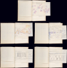
Aside from the text, a range of maps, schemes, and diagrams are included as foldouts. The maps and schemes imaged above include (in order of appearance):- Average monthly positions of the ice edge in the Arctic Basin (Средние месячные положения кромки льдов в бассейне Арктики.)
- Map of existing airfields and those under construction (Карта существующих усовершенствованных и строящихся аэродромов)
- Sailing formation of one of the British landing detachments (5th Infantry Division) in the Sicilian landing operation in 1943 (Походный ордер одного из десантных отрядов англичан (5пд) в сицилийской десантной операции)
- Conceptual scheme of an amphibious landing according to the doctrine of the US Army (Принципиальная Схема высадки морского десанта по взглядам американской армии.)
- Scheme [Map] of the defense of a coastal sector by a machine gun-artillery division (Схема обороны пулеметно-артиллерийской дивизией участка морского побережья)
- Conceptual Scheme of the installation locations for anti-landing obstacles in coastal defense (Принципиальная схема мест установки противодесантных заграждений в обороне морского побережья)
- Possible types of fortification obstacles and the locations of their installation in water (Bозможные виды фортификационных заграждений и места их установки в воде)
- Conceptual Scheme of the actions of aviation, naval, and ground forces by stages of an anti-landing operation (Принципиальная схема действий сил авиации, военно-морского флота и сухопутных войск по этапам противодесантной операции.)
The Northern Military District
The Northern Military District (Северный военный округ) was a short-lived rearrangement that existed from 1951 to 1960. It was formed from the Belomorsky (Беломорский) or 'White Sea' Military District and was headquartered at Petrozavodsk (Петрозаводск) in Karelia. It oversaw the Karelo-Finnish Soviet Socialist Republic, Murmansk Oblast, and Pechengsky District. In 1960, the Northern Military District was dissolved and mostly absorbed into the Leningrad Military District.Historical Context
Based on the dates of the maps and information in the text, this booklet was likely prepared in early (February - March) 1952, a time when Cold War tensions were rapidly increasing. In February 1952, the formal accession of Greece and Turkey to NATO marked the alliance's first expansion, pushing into areas historically considered crucial for Russian/Soviet security (the Bosporus and Black Sea) and fundamentally reshaping the geopolitical landscape of the early Cold War. Outside of NATO, the U.S. also signed a range of bilateral security treaties in the early 1950s, especially in the Pacific, with South Korea, the Philippines, the Republic of China (Taiwan), Thailand, and Japan. These arrangements coincided with the stalemated Korean War and a rapidly accelerating arms race that saw the United States test its first thermonuclear device later in 1952.Within this context, the Arctic suddenly took on a much greater significance than in the past. Soviet strategic thinking was deeply preoccupied with homeland defense and the acute vulnerability of its massive, exposed northern border to American incursions. The Soviets had learned hard-won lessons on fighting in the Arctic and near-Arctic from the Winter War (1939 - 1940) and World War II (1939 - 1945), namely the siege of Leningrad and the 1941 battle for Murmansk. After the Soviets successfully fought off German and Finnish forces, Murmansk became an important conduit for supplies from the Western Allies via Arctic convoys that reached Murmansk and Arkhangelsk (similar to but larger than convoys operated during the First World War). Escorted by the Royal Navy, Royal Canadian Navy, and U.S. Navy, these convoys carried Lend-Lease Aid to the tune of some 1,400 merchant vessels over the course of the war, 85 of which were sunk along with 16 Allied warships, while four Axis ships and 30 submarines were sunk.
Both Soviet and American planners realized that the shortest flight paths for a strategic nuclear strike on the enemy lay directly across the North Pole (leading to their becoming known as transpolar routes). For the Soviet military, this geostrategic shift triggered an offensive strategy heavily reliant on long-range aviation. The USSR began constructing a network of forward staging bases, airfields, and refueling hubs along its northern perimeter, stretching from the Kola Peninsula all the way to the Chukotka Peninsula opposite Alaska. These austere installations were designed to project power across the Arctic Ocean, extending the operational range of early Soviet strategic bombers, such as the Tu-4 and the turboprop Tu-95 'Bear,' ensuring they could reach targets deep within the United States. Perhaps most impressive was the Nagurskoye (Нагу́рское) Airfield, located some 1350 kilometers (840 miles) north of Murmansk, at a latitude north of Svalbard (Spitzbergen). Scientific stations, such as the drifting ice station North Pole-2 (Северный полюс-2), were also established in great secrecy to deliver data that could be useful for military purposes.
This period also marked the increasing prominence of the Soviet Northern Fleet based in the ports of Murmansk and Severomorsk and the submarine base at Zapadnaya Litsa on the Kola Peninsula. The Soviet submarine forces took on a greater role in the global projection of Soviet power as the 1950s progressed, including the launching of the K-3 Leninsky Komsomol, the first Soviet nuclear submarine, which became operational in 1958.
Publication History and Census
This report was prepared in 1952 within the Operations Directorate (Оперативное управление) of the Military District Headquarters (Штаба Военного Окр.) of the Northern Military District (Северный военный округ). It is stamped as being both 'secret' (Секретно) and a unique document ('sole copy' экз. единственный). The individual maps are also generally stamped 'secret' or 'top secret' (Сов. секретно) and sometimes contain notes reiterating that they are the sole copies prepared. Therefore, this is a unique opportunity to acquire a confidential report on Soviet military preparedness from the height of the Cold War.Condition
Excellent. 51 leaves, 14 leaves of maps, schemes and tables.