
1772 Tommaso Masi Atlas of America (Revolutionary War)

This item has been sold.
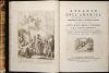
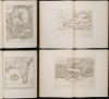
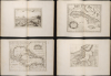
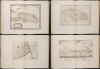
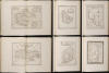
Atlante Dell'America Contenente le Migliori Carte Geografiche, e Topografiche delle Principale Citta, Laghi, Fiumi, e Fortezze del Nuovo Mondo.
Early days of American Revolutionary War.
Early days of American Revolutionary War.
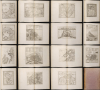
This is an important Tommaso Masi 1777 atlas of the Americas, issued in Livorno, Italy, to capitalize on the general interest in the Americas, particularly North America, sparked by the American Revolutionary War (1775-1783).A Closer Look
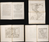
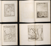
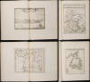
This is a spectacular Italian atlas of the Americas issued in the early days of the American Revolutionary War. It features 15 pages of text (including the title engraving) and 44 maps and views (including the extra map of Quebec City not included in most examples or in the index). The maps can be traced to the work of Popple and other, mostly British, sources.The finely engraved frontispiece opposite the title page is worthy of mention. It features an unclothed American Indian woman passing the scepter of dominion to a fully armored European nobleman. Above, in the clouds, the Virgin Mary and baby Jesus look down on the scene, suggesting divine approval. The text below the map is a quotation from Seneca the Elder, suggesting the destined European discovery of America, Venient annis saecula seris, quibus Oceanus vincula rerum laxet et ingens pateat tellus, Tethysque novos detegat Orbes. [There will come in later years an age when Ocean will loosen the bonds of things, and a vast land shall lie revealed, and Tethys shall disclose new worlds.]
Contents
Below is a complete index of contents:
- North and South America
- New England, New York, and Pennsylvania
- Boston and Environs (after Popple, inset)
- New York City and Environs (after Popple, inset)
- Great Lakes
- Niagara Falls (View)
- Quebec City (Map, not in index)
- Quebec City (View)
- Gulf of St. Lawrence
- Newfoundland
- Hudson Bay
- Guantanamo Bay, Cuba
- Florida
- Pensacola, Florida
- St. Augustine, Florida
- New Mexico (View)
- West Indies and Gulf of Mexico
- Cuba (after Popple)
- Havana
- St. Domingo and Hispaniola (after Popple)
- City Plan of St. Domingo
- Jamaica
- St. Eustatius [Sint Eustatius] (View)
- Guadalupe
- Martinique
- Barbados
- Granada
- Vera Cruz, Mexico
- Acapulco, Mexico
- Yucatan, Mexico (after Popple)
- Darien [Panama] (after Popple)
- Porto Bello [Portobelo, Panama]
- Chagres River [Panama]
- South America
- Cartagena, Santa Maria, and Venezuela
- Cartagena [Colombia]
- Quito [Ecuador]
- Amazon River
- Lima [Peru]
- Cusco [Peru]
- Potosi [Bolivia] (View)
- Santiago [Chile]
- Paraguay [and Uruguay]
- San Salvador [Brazil]
Publication History and Census
Most of the maps in the work can be traced to M. Coltenllini's 1763 Il Gazzettiere Americano, published to capitalize on interest in the French and Indian War (1754 - 1763). The text is mostly translated from the 1763 American Gazetteer, published in London. The pertinent maps were revised and updated by Giovanni Tommaso Masi for the 1777 edition, intended to illustrate the early days of the American Revolutionary War (1775 - 1783). They are the work of several Italian engravers, including Andrea Scacciati, G.M. Terreni, Giuseppe Pazzi, D.V. Rossi, Violante Vanni, and N. Mabraini. Scarce to the market.Cartographer
Giovanni Tommaso Masi (17?? - 1818) was an Italian bookseller and publisher based in Livorno, Italy. He sometimes published as 'Tommaso Masi et Comp' or 'Giov. Tommaso Masi'. Masi is best known for publishing the striking Atlante Dell'America at the outset of the American Revolutionary War (1775 - 1783). Further Details...
Condition
Very good. Folio. Contemporary marbled paper boards with brown leather binding, worn in places. 15 page of explanatory text. Engraved title vignette. Engraved allegorical frontispiece and 44 engraved maps and plans. Includes the scarce double-page map of Quebec found only in a few copies, and is present in the contents.
References
Howes, W., U.S.iana (1650-1950): A Selective Bibliography in which are Described 11,620 Uncommon and Significant Books Relating to the Continental Portion of the United States, A372. Phillips (Atlases) 1167. Sabin, J., A Dictionary of Books Relating to America: from its Discovery to the Present Time, 35955 (see Jefferys). Rumsey 14343.000.