
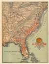
1916 Matthews-Northrup Map of the Eastern U.S. and Atlantic Coast Line Railroad

This item has been sold.
Atlantic Coast Line Railroad and Connections.
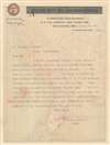
Letter from a ticket agent to a potential customer on verso.
- Digital Map Information
- Suitable for large format printing
- Full resolution TIFF file
- ICC color profile embedded
- Delivered instantly via download link
Letter from a ticket agent to a potential customer on verso.
An outstanding c. 1916 Matthews-Northrup railroad map of the eastern United States highlighting the route of the Atlantic Coast Line. The map is essentially letterhead and features a letter on the verso from a ticket agent to a client.The Atlantic Coast Line
The name Atlantic Coast Line first appears in 1871, when the Wilmington and Weldon Railroad and the Wilmington and Manchester Railroad began using the name to mutually promote their network. Baltimore-based investor, William T. Walters, acquired both railroads after the American Civil War (1861 - 1865), but operated them separately. Most of Walter's South Carolina railroads were consolidated in 1897-1898 as the Atlantic Coast Line Railroad Company of South Carolina. Similarly, his lines in Virginia consolidated in 1898 as the Atlantic Coast Line Railroad Company of Virginia. North Carolina followed in 1899. The full network consolidated in 1899 or 1900 to become the Atlantic Coast Line Railroad Company. In 1902, the Atlantic Coast Line was acquired by Henry Plant and incorporated into the Plant System.Verso Content and Dating the Map
While the map itself is undated, the typewritten letter on the Atlantic Coast Line letterhead on the verso bears the date January 22, 1916.Publication History and Census
This map was created and published by Matthews-Northrup c. 1916. This is the only known cataloged example.Cartographer
Matthews-Northrup Works (fl. c. 1895 - 1930) were a Buffalo, New York based, in their own words, "writing, designing, engraving, printing, [and] binding" firm. The firm was founded by James Newson Matthews (November 21, 1828 - December 20, 1888) as the J. N. Matthews Company. William Phelps Northrup (April 2, 1850 - February 2, 1929) later joined the company as an apprentice and then partner, at which point the firm was reincorporated as the Matthews-Northrup Works. The Matthews-Northrup Works rose to prominence as publishers and printers of railroad maps, with dozens to their credit. When James died, his shares were inhered by George Edward Matthews (1855 - 1910), who ran the business until his death in 1910. Also in 1910, they famously redesigned the cover of National Geographic Magazine. Despite some six previous cover changes in just 21 years, the Matthews-Northrup layout proved so popular that it was used for nearly 50 years. The firm can also take credit for the Winchell typeface, designed in 1903 under E. E. Winchell's tenure as art director. Curiously, the partners of Matthews-Northrup maintained an unusual affectation in which only the officers of the company could wear beards or mustaches. In this same spirit, the firm also had its own private social club, the Fellowcraft Club, where the all-male employees could relax, play pool, drink and dine. Matthews-Northrup maintained offices on Washington Street, Buffalo, where they were based, as well as Madison Square, New York City, Garden Tower, Boston, and the Citizens Building in Cleveland. Further Details...
Condition
Very good. Light wear along original fold lines. Typewritten letter on verso.