
Matthews-Northrup Works
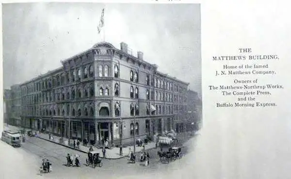
Matthews-Northrup Works (fl. c. 1895 - 1930) were a Buffalo, New York based, in their own words, "writing, designing, engraving, printing, [and] binding" firm. The firm was founded by James Newson Matthews (November 21, 1828 - December 20, 1888) as the J. N. Matthews Company. William Phelps Northrup (April 2, 1850 - February 2, 1929) later joined the company as an apprentice and then partner, at which point the firm was reincorporated as the Matthews-Northrup Works. The Matthews-Northrup Works rose to prominence as publishers and printers of railroad maps, with dozens to their credit. When James died, his shares were inhered by George Edward Matthews (1855 - 1910), who ran the business until his death in 1910. Also in 1910, they famously redesigned the cover of National Geographic Magazine. Despite some six previous cover changes in just 21 years, the Matthews-Northrup layout proved so popular that it was used for nearly 50 years. The firm can also take credit for the Winchell typeface, designed in 1903 under E. E. Winchell's tenure as art director. Curiously, the partners of Matthews-Northrup maintained an unusual affectation in which only the officers of the company could wear beards or mustaches. In this same spirit, the firm also had its own private social club, the Fellowcraft Club, where the all-male employees could relax, play pool, drink and dine. Matthews-Northrup maintained offices on Washington Street, Buffalo, where they were based, as well as Madison Square, New York City, Garden Tower, Boston, and the Citizens Building in Cleveland.
Adult education and cultural enrichment on the beautiful shores of Lake Chautauqua.
Map Showing the Location of Chautauqua Lake S. S. Assembly Grounds.
$250.00
Acquire
- Digital Map Information
- Suitable for large format printing
- File Size: 5.97 MB
- File Type: ZIP / TIFF
- ICC color profile embedded
- Delivered instantly via download link
This is an 1881 envelope with a miniature map issued for the 1881 season of the Chautauqua Meetings - adult education camps held annually on the shores of Lake Chautauqua, New York. (more details)
Railroad Wars: Competing with the transcontinental routes of the Northern Pacific.
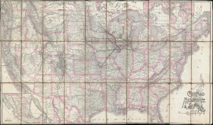
Map of the Chicago, Milwaukee and St. Paul Ry: and connections.
$950.00
Acquire
- Digital Map Information
- Suitable for large format printing
- File Size: 69.34 MB
- File Type: ZIP / TIFF
- ICC color profile embedded
- Delivered instantly via download link
This is a large-format 1893 railroad map of the United States illustrating the Chicago, Milwaukee and St. Paul Railway (CSMP), and its national connections. The map appeared at the height of the Railroad Wars, a period of fierce competition and expansion between rival railroad networks. It illustrates attempts by the CMSP to compete with the Northern Pacific's transcontinental service. (more details)
A Richly Detailed Map of Manhattan and the Bronx: One of the First to Show the Bronx Zoo
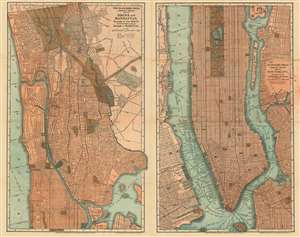
The Blanchard Press Correctly Indexed Map of Bronx and Manhattan/ The Blanchard Press Correctly Indexed Map of New York City Southern Part of Manhattan Borough.
$850.00
Acquire
- Digital Map Information
- Suitable for large format printing
- File Size: 43.36 MB
- File Type: ZIP / TIFF
- ICC color profile embedded
- Delivered instantly via download link
This is a rare 1895 Map of Manhattan and the Bronx printed by J. N. Matthews for the Blanchard Press. This is one of the first maps to focus on Northern Manhattan and the Bronx, reflective of the spread not only of the city's population but also the increase of public works there. The map shows Van Cortland Park (first set aside as parkland in 1888) and the Morris Park Race Track (site of the Belmont Stakes between 1890 and 1904 and the Preakness in 1890.) The newly-founded Bronx Zoo is shown as well, although it would not open until 1899. (more details)
Vistas of Yosemite.
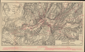
Yosemite Valley Showing Wagon-Roads and Trails.
$200.00
Acquire
- Digital Map Information
- Suitable for large format printing
- File Size: 15.54 MB
- File Type: ZIP / TIFF
- ICC color profile embedded
- Delivered instantly via download link
A highly detailed topographic map of Yosemite Valley published by Underwood and Underwood in 1902 as part of the booklet Yosemite Valley through the Stereoscope. (more details)
A large, highly detailed wall map of the Adirondacks.
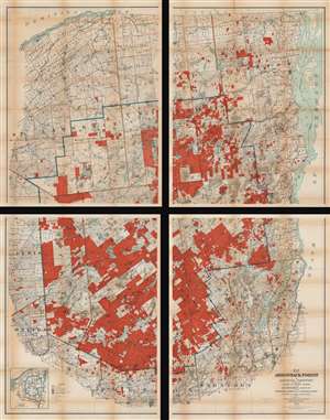
Map of the Adirondack Forest and Adjoining Territory.
$950.00
Acquire
- Digital Map Information
- Suitable for large format printing
- Full resolution TIFF file
- ICC color profile embedded
- Delivered instantly via download link
An uncommon large scale 1909 Millins O. Wood and Glenn S. Smith map of the Adirondack mountains of New York. The map depicts the entire Adirondack Mountain region, extending from the St. Lawrence River and Canada to Groversville and Broadalbin, and from Lewis and St. Lawrence counties to Lake George and Lake Champlain. Created by authority of the Forest, Fish and Game Commission, the boundaries of the Adirondack State Park are defined by a bold blue line. Additional color coding designates the state of various lands. Bright red shading identifies Forest Preserve or State Lands, while red and white striped areas mark lands in which the State has an undivided interest or joint ownership. Town boundaries are noted in pink. County boundaries are illustrated by brown lines. The whole is divided into various land patents, purchases, lots, and townships, many of which are labeled. Both conventional and electric railroads are depicted using two different annotations. An inset in the lower left corner is a county and railroad map of northern New York. (more details)
A climate map that highlights average temperatures throughout the state.
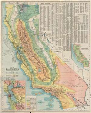
Map of California. Compiled from officiala nd authentic sources by the Southern Pacific.
$400.00
Acquire
- Digital Map Information
- Suitable for large format printing
- File Size: 39.46 MB
- File Type: ZIP / TIFF
- ICC color profile embedded
- Delivered instantly via download link
This is a 1910 Matthews Northrup and Southern Pacific climate map of California. The map depicts the region from the Pacific Ocean to Nevada and from Oregon to Arizona and Mexico. Six different colors are used to highlight different average temperature zones within the state, allowing the viewer to form some idea about the climate in any given part of the state. A chart providing the temperature range associated with each color is situated in the lower left corner, next to an inset map of the San Francisco Bay Area. Myriad cities and towns are labeled throughout, but the most detail is included along the thick black lines which represent the route of the Southern Pacific Railroad. The thinner black lines are connecting rail lines. The upper right quadrant is dominated by an index of place names which provides the grid location for innumerable cities and towns in California. A second index provides the names of the counties and the county seats. A second inset map situated along the right border compares other states in the U.S. with California, both in terms of square miles and population. (more details)
The Boston and Maine Railroad rail network.
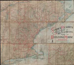
Summer Resorts of the Coast, Lake and Mountain Regions along the Boston and Maine Railroad and Connections.
$350.00
Acquire
- Digital Map Information
- Suitable for large format printing
- File Size: 57.1 MB
- File Type: ZIP / TIFF
- ICC color profile embedded
- Delivered instantly via download link
This is a decorative 1913 Matthews-Northrup map of New England. The map depicts from New York City northwards along the Atlantic coast as far as New Brunswick and the Gulf of Saint Lawrence and from the Hudson River Valley to the Atlantic Seaboard. Thick red lines highlight the Boston and Maine Railroad. This network includes not only the Boston and Maine Railroad, but also the Maine Central Railroad, the New York, New Haven, and Hartford Railroad, and the Boston and Albany Railroad, along with several others. Thinner red lines trace routes of connecting railroads, while other railroads, electric railways, stage lines, and canals, are illustrated by various notations. An inset map on the lower right highlights 'American Switzerland' the White Mountains of New Hampshire. (more details)
Weaving Rails through the Adirondack Wilderness.
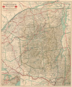
Map of the Adirondack Mountains showing How to Reach Them by the New York Central Lines / Map of the Adirondacks and List of Hotels, Boarding Houses...
$400.00
Acquire
- Digital Map Information
- Suitable for large format printing
- Full resolution TIFF file
- ICC color profile embedded
- Delivered instantly via download link
This is a large-format 1914 map of the Adirondack region, prepared by Matthews-Northrup for the New York Central Railroad. At this time, the New York Central had a near-monopoly on the Adirondacks, which had become a favorite destination for elite clientele from New York and other cities in the eastern U.S. and Canada. (more details)
Striking map of Washington, D.C.
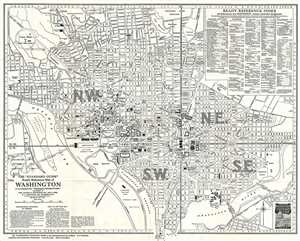
The 'Standard Guide' Ready Reference Map of Washington, to accompany the 'Washington Standard Guide'.
$500.00
Acquire
- Digital Map Information
- Suitable for large format printing
- File Size: 9.28 MB
- File Type: ZIP / TIFF
- ICC color profile embedded
- Delivered instantly via download link
This is a striking 1937 map or plan of Washington, D.C. by the Foster and Reynolds Company of New York. It covers Washington D.C. from the Arlington National Cemetery and Georgetown College eastward as far as 28th Street and the Congressional Cemetery and from the ... (more details)