This item has been sold, but you can get on the Waitlist to be notified if another example becomes available, or purchase a digital scan.
1909 Mehmet Eşref Map of North America w/ Telegraph Cables
AtlanticTelegraph-esref-1909$175.00

Title
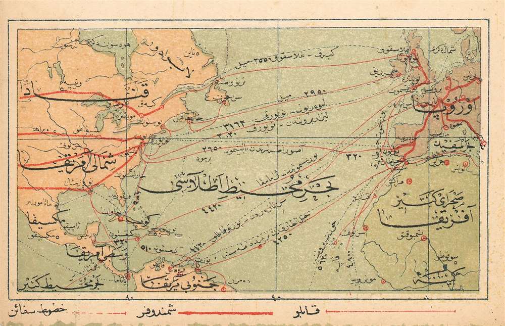
(Turkish Map of North America and Europe showing Transatlantic and Transcontinental Telegraph Cables
1909 (undated) 3.25 x 5.25 in (8.255 x 13.335 cm) 1 : 75960086
1909 (undated) 3.25 x 5.25 in (8.255 x 13.335 cm) 1 : 75960086
Description
This is a 1909 Turkish map of North America and Europe, marking the positions of major telegraph cables, both transatlantic and transcontinental. It was produced by the educator and publisher Mehmet Eşref, and may well be the only such printed map available to the collector. All titles and descriptive text is in Ottoman Turkish. National borders are not shown, but major features such as the Great Lakes and the Mississippi do appear. The telegraph routes are marked in red. Chromolithograph.
Publication History and Census
Turkish atlas maps are rare on the market. This one was published in Eşref’s Umum-i vilayat-ı Şahaneyi havi küçük atlas/( اطالس كوچك حاوى يى شهان ى والياة عموم), of which OCLC lists only a single copy at the Bogazici University Library in Istanbul.Cartographer
Mehmet Esref (1846 or 1847-1912) was a Turkish educator and publisher active in the first part of the 20th century. He published several historical and educational atlases, all of which are rare on the market and contain many of the first Turkish maps of the regions they depict. More by this mapmaker...
Source
Eşref, Mehmet.Umum-i vilayat-ı Şahaneyi havi küçük atlas/ اطالس كوچك حاوى يى شهان ى والياة عموم
Condition
Very good. Margins close on left and bottom but complete.
References
ÖZEGE 25533. OCLC 949501827.