
1876 Austro-Hungarian Military Map of Bosnia, Herzegovina, Serbia, and Montenegro


This item has been sold.
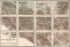
General Karte von Bosnien, der Hercegovina, von Serbien und Montenegro...
Mapping the Balkans in Revolt. Likely the best map of the region to appear in the 19th century.
- Digital Map Information
- Suitable for large format printing
- File Size: 467.78 MB
- File Type: ZIP / TIFF
- ICC color profile embedded
- Delivered instantly via download link
Mapping the Balkans in Revolt. Likely the best map of the region to appear in the 19th century.
This monumental, scarce, 12-sheet map of the Balkans was produced by Austria-Hungary's Imperial-Royal Military Geographical Institute. Published in early to mid-1876, this meticulously detailed military map captures the Balkans during the Great Eastern Crisis (1875 - 1878), which culminated in the Monarchy's absorption of Bosnia and Herzegovina pursuant to the 1878 Treaty of Berlin. When issued, it was the most detailed published general map of this geographically and politically multifaceted region.A Closer Look
This massive map, printed to 12 sheets in color lithography, covers all of Bosnia and Herzegovina, Serbia, Montenegro, and Kosovo; parts of North Macedonia and Albania appear at the south of the map, while parts of Croatia appear in the north and west. The Adriatic coast is mapped from Zara (Zadar) in Croatia to Gorana in Montenegro. In the northeast portion of the map, the Danube can be traced from Vukovar, Croatia, to Severin in Romania. Much of the southeastern part of the map was, at the time, part of Ottoman Bulgaria; an orange border separates Serbia from 'Türk: Serbien,' a territory which included the cities of Niš (now part of Serbia) and Skopje, now capital of the Republic of Macedonia. The map is supremely detailed, with an extensive legend explaining the different sizes of cities and towns, fortifications, roads, and varying terrain. It includes a brief glossary of abbreviations and translations of foreign terms used on the map.A Map Produced Amid Crisis
As the Ottoman Empire declined in power in the second half of the 19th century, the European great powers grew convinced that the Empire would lose its European territories, most likely to the hungrily expansionist Russian Empire. In 1875, Herzegovina's Christian Serb population revolted against the Ottoman Empire; that revolt spread into Bosnia and Serbia. In 1876, Christian revolts broke out in Bulgaria; Serbia and Montenegro declared war on the Ottoman Empire in June of 1876. While there is no indication of the month in which this map was produced, this example is marked 'Provisional Edition', indicating an early iteration of the work. Since a further 1876 edition was produced, this suggests that the map may have been produced even prior to the Serbian war with the Empire, yet another turmoil which would result in the intervention of the great powers via the 1878 Treaty of Berlin. Austria-Hungary, historically quick to expand at the expense of the Ottoman Empire, via the treaty, absorbed Bosnia-Herzegovina and part of Montenegro: Serbia annexed 'Turkish Serbia' as presented here.Publication History and Census
This map was drafted and printed by the Kaiserlich-Königliches Militär-Geographisches Institut, or MGI, the organ of the Austrian Empire responsible for producing maps for the military. The MGI was at the cutting edge of swift and methodical map printing, and so it is possible that the work was done quite swiftly. We are aware of three editions: the present 'Provisional Edition,' a further edition of 1876, and a third printed in 1882. There are roughly 12 examples of the complete map in institutional collections, at least some of which are pastiches of separate sheets from the three editions. Some examples (notably that of the Bibliothèque Nationale de France) are joined with their margins trimmed, eliminating the edition information. Separate sheets appear, but the complete map is rare.Cartographer
Kaiserlich-Königliches Militär-Geographisches Institut (Imperial Royal Military Geographical institute. (active 1839 - 1921) was a military institution of the Austrian Empire, responsible for producing maps for the military; the Institut was in charge of the whole process, from initial survey to reproduction and publication. It had its roots in the military topographical corps of the Cisalpine Republic, established in Milan in 1800. The corps was absorbed by the formation of the Austrian Kingdom of Lombardy-Venetia in 1814, and continued operations: gradually, the organization was transferred to Vienna, a process completed in 1839. Its directors would govern a large (and sadly anonymous) corps of geographers and engineers, producing maps of grand size and granular detail. The Institut won international renown, receiving the Grand Medal at the London Great Industrial Exhibition in 1851 for outstanding achievements in the field of military maps. This excellence was not only in surveying, but also in map printing; the Institut applied and refined technological developments in lithography, copperplate engraving, and electroplating in the reproduction of maps. While the Institut was primarily focused on the production of maps for the military, maps approved for distribution were sold via the Vienna art dealer Artaria. Further Details...
Condition
Excellent. Lithographed map printed to 12 sheets, each dissected in quarters and laid on linen for folding, as issued. Marbled paper covers.
References
OCLC 780578883