
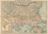
1898 Agayan / Ikbal Kutuphanesi Armenian Map of the Balkans, Ottoman Europe

This item has been sold.
Քարտէս Պալքանէան Պետութեանց / [Map of the Balkan States].
The Balkans on the Brink.
- Digital Map Information
- Suitable for large format printing
- File Size: 56.99 MB
- File Type: ZIP / TIFF
- ICC color profile embedded
- Delivered instantly via download link
The Balkans on the Brink.
This is an extremely rare c. 1898 Armenian-language map of the Balkans prepared by Stepan Agayan and published by the Iqbal Bookshop in Constantinople (Istanbul). It depicts the region at the turn of the 20th century, following the Russo-Turkish War of 1877 - 1878 but before the Balkan Wars that helped set the stage for World War I (1914 - 1918).A Closer Look
Coverage focuses on Bulgaria (Պոէլկարիա) and the rump portion of the Ottoman Empire in Europe ('European Turkey' Եվրոպական Թուրքիա), along with portions of Romania (Րումինիա), Macedonia (Մակեդոնիա), and Serbia (Սերպիա). An inset at left covers Montenegro (labelled as 'Serbs' ՍԵՐԼԵՐ) while another at bottom-right covers Greece (Յոէնաստան) in the vicinity of Thessaly. Cities, towns, administrative boundaries, waterways, mountains, railways, and roads are recorded throughout. A thick blue line running through Sofia (Սոֆիա) and across Bulgaria to Constantinople (Կ. Պօլիս) represents the railway through Rumelia that carried the famous 'Orient Express'.Historical Context
The period between the Russo-Turkish War of 1877 - 1878 and the Balkan Wars of 1912 - 1913 was one of intense political transformation and rising nationalism across the Balkans. The 1878 Treaty of Berlin reshaped the region's political map: Serbia, Montenegro, and Romania gained full independence; Bulgaria emerged as an autonomous principality under nominal Ottoman suzerainty; and Austria-Hungary occupied Bosnia-Herzegovina, though it nominally remained an Ottoman vilayet. These changes both weakened Ottoman authority and stimulated competing national projects among South Slavic, Greek, Romanian, and Albanian populations. Each newly strengthened state sought to expand its borders in accordance with its own historical claims and ethnographic visions, generating a complex web of rivalries. Meanwhile, the European Great Powers, especially Russia and Austria-Hungary, deepened their involvement, viewing Balkan nationalism as both a tool and a threat within the broader imperial balance. With the Ottoman Empire continuing to face internal troubles, outside empires and the emergent nation-states conspired against each other in complex and temporary alliances, resulting in an uprising in Macedonia in 1903, Austria-Hungary's annexation of Bosnia and Herzegovina, and other crises, leading eventually to the formation of the Balkan League in 1912, with the intention of driving the Ottomans from the region entirely, a move which instigated the First Balkan War.Why an Armenian Map of the Balkans?
On the face of it, this map is somewhat paradoxical as Armenia is on the other side of Turkey from the Balkans. However, under both Rome/Byzantium and the Ottomans, there was a centuries-long history of Armenians migrating to the region, and some members of the nobility of these lands (including several Byzantine Emperors) may have had partial Armenian heritage. More immediately, Constantinople/Istanbul was an important center of Armenian culture and emerging national identity (which the Ottomans had themselves encouraged earlier in the 19th century), with the publishing industry playing a central role.This map was published at a critical moment, when Armenian identity was becoming increasingly distinct and even opposed to the Ottoman Empire as ethno-religious attacks on Armenians increased throughout the empire. Aside from the geographical proximity and geopolitical importance of the Balkans, Ottoman Armenians would also have wanted to produce geographical knowledge in their own language as part of a more general project of vernacular knowledge production (see for comparison our Armenia-dadian-1849, from the earliest atlas published in Armenian).
Still, the fact that the same map was also produced in Ottoman Turkish, may have been printed by Jewish printers (see 'Publication History' below), and was issued by a Turkish publisher demonstrates that the cosmopolitanism of the Ottoman Empire, and particularly its intellectual scene based in Istanbul, was still flourishing at this time despite considerable challenges.
Publication History and Census
This map was published by the Iqbal Bookshop (اقبال كتبخانه; İkbal Kütüphanesi; Հրատարակութիւն Իգպալ Գրատան) in Istanbul, noted in the inset map of Montenegro at left. It is undated, but from context, it was likely published at the very end of the 19th century. The name 'S. Agayan' appears at the far bottom-right, within the inset map of Thessaly. Little is known about Agayan aside from his given name being Stepan (Ստեփան Ագայան); he was a frequent contributor of illustrations, including colorful cover illustrations, for the late Ottoman periodical Picture Book (رسملى كتاب; Resimli kitap), which was published in the late 19th and early 20th century. Information for a printer named Poton Kupay (Պօթօն Կուպայ), based in Constantinople, appears at the bottom-right; we have been unable to identify this printer, but he could have been a descendant of an 18th-century family of Jewish printers based in Smyrna (Izmir). In any event, the name Poton Kupay is evidently not Armenian, and the sizable contingent of Jewish printshops in late Ottoman Istanbul played an important role in producing Armenian-language printed works at this time.We have been unable to identify any other examples of this map in institutional collections or on the market. The University of California, Berkeley does hold an Ottoman Turkish edition of a map closely matching this one in description and dimensions (perhaps with an added inset map of the Gulf of Arta) that also names Agayan, as was published by İkbal Kütüphanesi (dated by them to 1898).
Cartographer
Ikbal Kutuphanesi (اقبال كتبخانه; fl. c. 1898 - 1935) was a bookshop and publisher based in Istanbul founded by Huseyin Bey. The Ikbal Kutuphanesi published works on a wide range of topics, specializing in history, geopolitics, geography, and education in addition to maps and atlases. Their early publications note their location as Bab-i Ali, suggesting a physical, and perhaps political and financial, proximity to the Ottoman state. It is unclear if the Ikbal Kutuphanesi initially had a physical location where it sold books, but by the time of the Turkish Republic, it had a shop in Sirkeci that was popular among the city's reading public. Reflecting both the cosmopolitanism and reforms of the late Ottoman period, the Ikbal Kutuphanesi published works in Ottoman Turkish, reformed Latinized Turkish, and Armenian, as well as dictionaries, language study guides, and bilingual works in German and English. Further Details...
Condition
Average. Some older repairs to damage in upper margins. Light loss, reinstated, right side, center, at fold intersection. Wear along old foldlines. Slight soiling.
References
OCLC 1128186353 (Ottoman Turkish variant).