1892 Körber / Kümmerly Map of Bern, Switzerland
Bern-kummerly-1892$200.00

Title
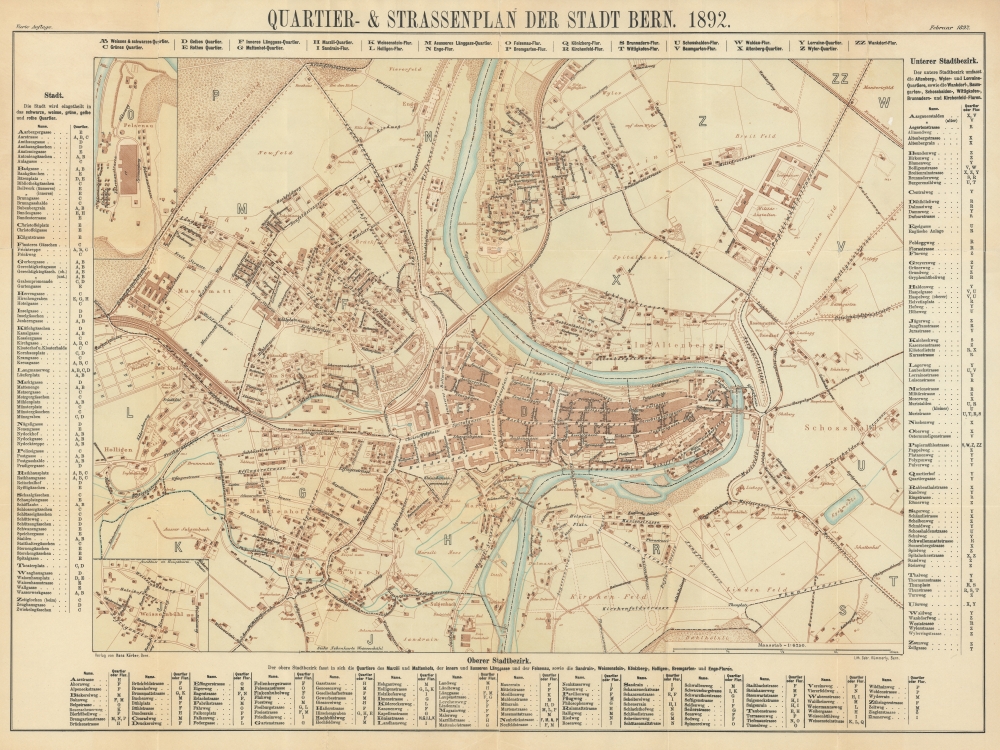
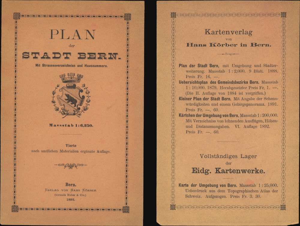
Quartier- und Strassenplan der Stadt Bern. 1892. / Plan der Stade Bern. Mit Strassenverzeichniss und Hausnummern.
1892 (dated) 21 x 28 in (53.34 x 71.12 cm) 1 : 6250
1892 (dated) 21 x 28 in (53.34 x 71.12 cm) 1 : 6250
Description
An attractive 1892 map of Bern, published locally by Hans Körber and Hermann Kümmerly.
A Closer Look
The map is centered on the mediaeval old down, or Weissses Quarter, formed by a curved in the Aare River. It extends to accommodate some of the surrounding suburbs, including the formal military Academy, now the Aussenanlagen Nationales Pferdezentrum. Streets and important buildings are labeled. An inset in the upper left details the legendary Brauerei Felsenau, the legendary brewery founded in 1881. A secondary inset in the lower left details Weissenbühl. The map is surrounded by a street index.Bern
In 1892, Bern, the capital city of Switzerland, exemplified the graceful blend of medieval architecture and budding modernity. The city's iconic Zytglogge, an ancient clock tower, continued to chime over cobbled streets, while the medieval arcades, which lined the Old Town, buzzed with activity. Bern's position as a political and cultural hub was evident in its well-attended theaters, literary salons, and lively cafés. The River Aare, meandering around the city, provided a picturesque backdrop and was a favorite spot for residents seeking leisurely activities. As Europe inched towards the 20th century, Bern, while cherishing its rich history, began to subtly embrace the transformative technological and cultural changes sweeping the continent. Today central Bern is a UNESCO World Heritage Site.Publication History and Census
This map was drawn and published by Hans Körber in Bern, Switzerland. It was engraved and printed in the same city by Hermann Kümmerly. There are editions from about 1882 to 1814. Scarce. We see just two examples of this edition in OCLC, at the Staatsbibliothek zu Berlin and at Zentralbibliothek Zürich.Cartographer
Hermann Kümmerly (September 6, 1857 - April 29, 1905) was a Swiss painter, lithographer, and cartographer. Kümmerly was born in Bern. He apprenticed as a lithographer under his father Gottfried, and also studied as a painter. He worked for a time for the Swiss Confederation's Topographic Bureau, which did not have its own printing company. In conjunction with Rudolf Leuzinger, the Kümmerly printing office gradually specialized in map printing. His maps became renowned for their vivid and accurate presentation of topography and in his naturalistic use of color in maps. He became particularly well known for his large school wall map of Switzerland, which has been hanging in virtually every school in Switzerland from 1903 until today. In 1898, his brother-in-law Otto Julius Frey joined the company as cartographer and co-owner, who now took the name Kümmerly and Frey. In 1931, Walter Kümmerly and Max Frey, the sons of the two predecessors, took over the management and skillfully steered the company through the years of crisis and World War II, despite the prohibition on map printing. In the post-war period, production shifted back to map production and book production with geographic themes. Since 1980, the fourth generation has been represented in the company management with Barbara Elisabeth Peters. More by this mapmaker...
Condition
Good. Verso reinforcement of some older fold-line splits.
References
OCLC 1227263662.