This item has been sold, but you can get on the Waitlist to be notified if another example becomes available, or purchase a digital scan.
1886 Dosseray Map of Brabant Province, Belgium
Brabant-dosseray-1886$150.00

Title
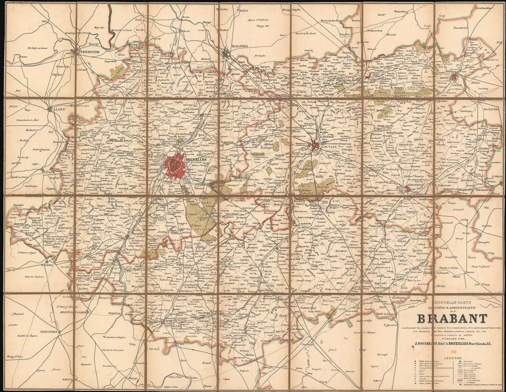
Nouvelle Carte Routière et Administrative du Brabant contenant les noms de toutes les communies, des principaux hameaux, les chemins de fer, station, routes, canaux, etc. etc.
1886 (dated) 27.5 x 36.75 in (69.85 x 93.345 cm) 1 : 100000
1886 (dated) 27.5 x 36.75 in (69.85 x 93.345 cm) 1 : 100000
Description
This is an 1886 Jean Dosseray map of Brabant Province in Belgium. The map was published to capitalize on the growing ease of rail travel and the rise of commercial tourism. Numerous cities and towns are identified throughout the province, with Brussels (the capital of Belgium and the province) and Louvain shaded red. Major roads, railroads, and canals are illustrated as well.
Brabant Province
Established in 1830 after the Belgian Revolution, Brabant Province was the only Belgian province that did not border another country. In the early 1960s, the language border between the Dutch and French-speaking regions was established, along with a bilingual Brussels. The Brussels-Capital Region was created in 1989, and in 1995 Brabant province was divided into Dutch-speaking Flemish Brabant and French-speaking Walloon Brabant.Publication History and Census
This map was created and published by Jean Dosseray in 1886. This is the only known surviving example.Cartographer
Jean Dosseray (1868 - 1904) was a Belgian publisher and editor active in Brussels during the late 19th century. He published science-based maps for schools and tourists. More by this mapmaker...
Condition
Very good. Dissected and mounted on linen. Old linen stable.