This item has been sold, but you can get on the Waitlist to be notified if another example becomes available.
1962 Gerald Eddy Strip Map of the United States West Coast Highway System
California-harolds-1962$125.00

Title
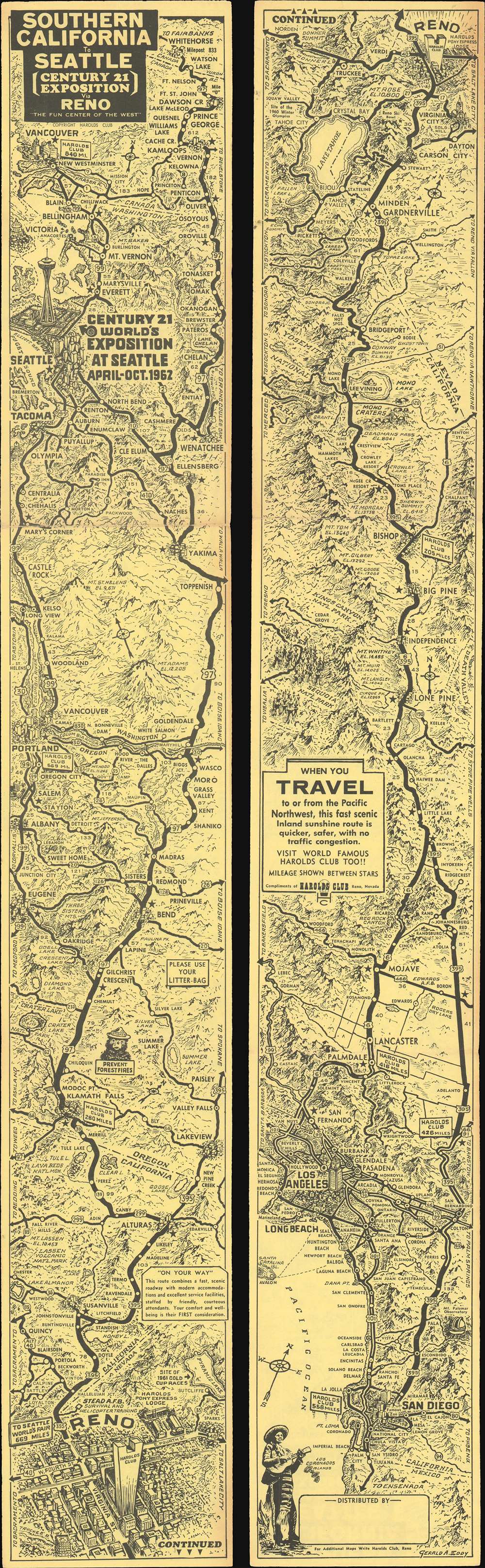
Southern California to Seattle (Century 21 Exposition) via Reno 'The Fun Center of the West'.
1962 (dated) 27 x 4 in (68.58 x 10.16 cm)
1962 (dated) 27 x 4 in (68.58 x 10.16 cm)
Description
Created to take advantage of interest in the Century 21 Exposition, a World's Fair in Seattle, this 1962 Gerald Eddy strip map of the United States west coast highway system promotes a 'quicker, safer' route to the fair. Distributed by Harold's Club in Reno, Nevada, and depicting from San Diego to Seattle, all promoted routes from southern California pass through Reno. A thick black line highlights this route and identifies many of the cities and towns along the way. Other, it is suggested, more crowded and less scenic, roads appear as well, but usually connect to the preferred route through Reno. Since this piece is promoting a vacation to the fair, popular tourist sites, such as Yosemite National Park, Sequoia National Park, and Crater Lake National Park all make an appearance.
The Century 21 Exposition
The Century 21 Exposition was a World's Fair held in Seattle, Washington, between April 21 and October 21, 1962. The fair welcomed nearly ten million visitors, many of whom came to marvel at the Space Needle. Other structures built for the fair, like the Alweg monorail and the Cornish Playhouse, remain part of Seattle's cultural life. Others were simply specially-built and then demolished.Publication History and Census
This map was created by Gerald A. Eddy and published by the Harold' Club of Reno, Nevada, in 1962. This is the only known surviving example.Cartographer
Gerald Allen Eddy (October 12, 1889 - September 9, 1967) was an American artist. Born in Michigan, Eddy's parents either divorced or his father died between 1900 and 1910. In 1910 Eddy was living with his mother, brother, and stepfather in Los Angeles and working as an artist. Eddy was a prolific cartographer and created numerous maps of different areas of the western United States. He was married and had a daughter by 1917, according to his World War I draft card. He was married to his wife Madolyn when he died. More by this mapmaker...
Condition
Very good. Light wear along original fold lines. Map printed on both recto and verso.