This item has been sold, but you can get on the Waitlist to be notified if another example becomes available, or purchase a digital scan.
1875 Imray Nautical Chart Map of Cape Horn, the Strait of Magellan, and Patagonia
CapeHorn-imray-1875$1,375.00


Title
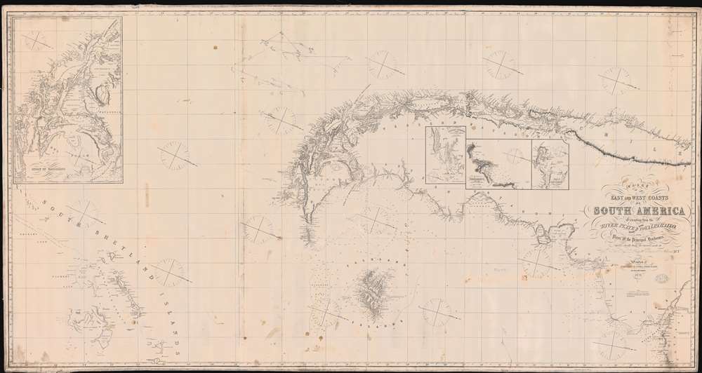
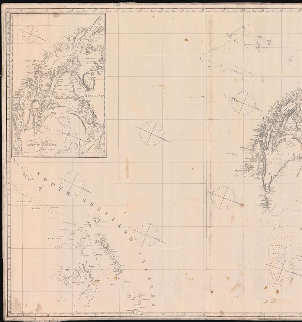
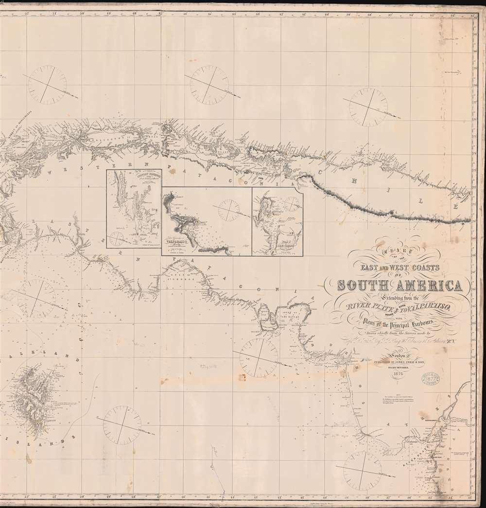
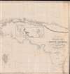
Chart of the East and West Coasts of South America Extending from teh River Platte Round Cape Horn to Valparaiso with Plans of the Principal Harbours.
1875 (dated) 40.5 x 77 in (102.87 x 195.58 cm) 1 : 390400
1875 (dated) 40.5 x 77 in (102.87 x 195.58 cm) 1 : 390400
Description
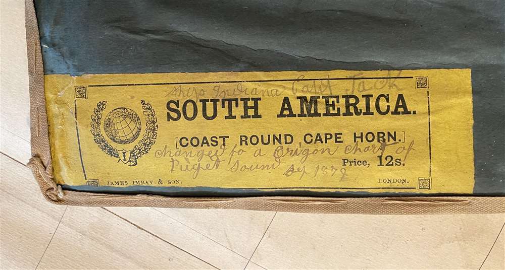
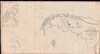
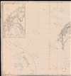
A rare 1874 Imray and Son blueback nautical chart illustrating the southern part of South America, the Straits of Magellan, Cape Horn, Patagonia, and the South Shetland Islands. The map includes pencil annotations recording Captain Robert Jack and the Clipper Indiana particularly harrowing 1879 transit around Cape Horn, where the ship was repeated driven south by the notorious williwaw winds, before eventually exiting the treacherous conjunction of oceans. Jack himself was a known Maine sea captain whose letters have been preserved and offer priceless insights into seaman life in the late 19th century. The map is oriented to the east, and coverage extends from the Rio de La Plata to the South Shetland Islands, and covers Cape Horn on both the Atlantic and Pacific. Detailed insets detail important ports, as well as the Strait of Magellan - with charming place names such as 'Useless Harbor'.
Capt'n Jack and the Indiana
This chart bears a note on the verso associating it with Captain Robert Jack (1812 - 1899) and the clipper ship, Indiana. A native of Bowdoinham, Maine, Jack was described by contemporaries as a vigorous, hearty specimen, the very image of New England manhood, as active at 60, as at 20. He was tenured employee of Sewall and Company, shipbuilders based in Bath, Maine. Jack sailed many Sewall ship, but in this case, he was given the Indiana, and charged with sailing it to San Francisco. The Indiana, was built by Sewall, 1488-ton clipper, launched from Bath on October 31, 1876. This map likely records Indiana's 1879 voyage around Cape Horn for San Francisco. An extensive archive of Jack's letters survives in the Maine Maritime Museum, Bath - some of which describe this very voyage. Moreover, the handwriting on the chart matches Jack's crude script. It was a rough voyage, but the ship arrived in San Francisco intact, and was refitted. The Indiana plied the San-Francisco - Oregon - Seattle route until 1898, when she was sold to the Alaska Packers Association of San Francisco operation with their salmon canneries in Alaska. Jack went on to other voyages, eventually returning to Bowdoinham, where he lived out his days in retirement.Blueback Charts
Blueback nautical charts began appearing in London in the late 18th century. Bluebacks, as they came to be called, were privately published large format nautical charts known for their distinctive blue paper backing. The backing, a commonly available blue manila paper traditionally used by publishers to wrap unbound pamphlets, was adopted as a practical way to reinforce the low-quality paper used by private chart publishers in an effort to cut costs. That being said, not all blueback charts are literally backed with blue paper. The earliest known blueback charts include a 1760 chart issued by Mount and Page, and a 1787 chart issued by Robert Sayer. The tradition took off in the early 19th century, when British publishers like John Hamilton Moore, Robert Blachford, James Imray, William Heather, John William Norie, Charles Wilson, David Steel, R. H. Laurie, and John Hobbs, among others, rose to dominate the chart trade. Bluebacks became so popular that the convention was embraced by chartmakers outside of England, including Americans Edmund March Blunt and George Eldridge, as well as Scandinavian, French, German, Russian, and Spanish chartmakers. Blueback charts remained popular until the late 19th century, when government subsidized organizations like the British Admiralty Hydrographic Office and the United States Coast Survey, began issuing their own superior charts on high quality paper that did not require reinforcement.Publication History and Census
This chart was printed by James Imray and Son of 89 and 102 Minories, London in 1875. The present map bears an 1877 hand stamp, suggesting updates or at least retained accuracy to that date. The hydrography is largely the work of the British Royal Navy in the 1850s, particularly Capt. R. Fritz Roy, L. L. King, W. Robinson, and B. Sulivan. We note recorded examples issued by James Imray himself dated as early as 1851. The earliest surviving example we have noted is 1853 (Atwood House Museum of the Chatham Historical Society). We know of no other examples in this edition.Cartographer
James Imray (May 16, 1803 - November 15, 1870) was a Scottish hydrographer and stationer active in London during the middle to latter part of the 19th century. Imray is best known as a the largest and most prominent producer of blue-back charts, a kind of nautical chart popular from about 1750 to 1920 and named for its distinctive blue paper backing (although not all charts that may be called "blue-backs" actually have a blue backing). Unlike government charts issued by the British Admiralty, U.S. Coast Survey, and other similar organizations, Imray's charts were a private profit based venture and not generally the result of unique survey work. Rather, Imray's charts were judicious and beautiful composites based upon pre-existing charts (some dating to the 17th century) and new information gleaned from governmental as well as commercial pilots and navigators. Imray was born in Spitalfields, England, the eldest son of a Jacobite dyer also named James. Imray did not follow his father profession, instead apprenticing to William Lukyn, a stationer. He established himself as a bookseller and bookbinder at 116 Minories Street, where he shared offices with the nautical chart publisher Robert Blanchford. In 1836 Imray signed on as a full partner in Blanchford's enterprise, christening themselves Blanchford & Imray. At this time the Blanchford firm lagged far behind competing chart publishers Norie and Laruie, nevertheless, with the injection of Imray's marketing savvy the firm began a long rise. James Imray bought out Blanchford's share in 1846, becoming the sole proprietor of the chart house, publishing under the imprint of James Imray. Relocating in 1850 to larger offices at 102 Minories, Imray was well on track to become the most prominent chart publisher in London. In 1854, when Imray's 25 year old son, James Frederick Imray, joined as a full partner, the firm again changed its imprint, this time to James Imray and Son. The elder Imray was a master of marketing and was quick to respond to trade shifts and historic events. Many of his most successful charts were targeted to specific trade routes, for example, he issued charts entitled "Cotton Ports of Georgia" and "Rice Ports of India". Other charts emerged quickly following such events as the 1849 California Gold Rush. Imray's rise also coincided with the development of governmental mapping organizations such as the Admiralty and the U.S. Coast Survey, whose work he appropriated and rebranded in practical format familiar to navigators. Imray's death in 1870 marked a major transition in the firm's output and began its decline. Though Imray's son, James Frederick, excelled at authoring pilot books he had little experience with charts and issued few new publications. Most James Frederick Imray publications issued from 1870 to 1899 were either revisions of earlier maps prepared by his father or copies of British Admiralty charts. Charts from this period are recognizable as being less decorative than the elder Imray's charts following the stylistic conventions established by the Admiralty. The Admiralty itself at the same time began to rise in prominence, issuing its own official charts that were both cheaper and more up to date than those offered by private enterprises. By the end of the century the firm was well in decline and, in 1899 "James Imray and Son" amalgamated with the similarly suffering "Norie and Wilson", which was itself acquired by Laurie in 1904. Today it continues to publish maritime charts as "Imray, Laurie, Norie and Wilson". More by this mapmaker...
Condition
Good. Old pencil marks relating to navigation and minor discolorations indicative of a life at sea. Edge wear.
References
Atwood House Museum of the Chatham Historical Society, x.5500.083.012 (1853 edition).