
Imray, James (James Imray and Son, Blanchford and Imray, Imray Laurie Norie and Wilson)
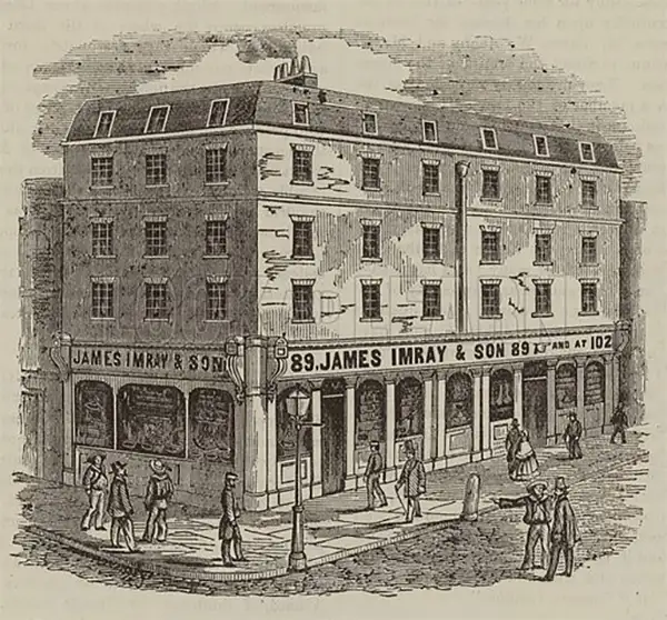
James Imray (May 16, 1803 - November 15, 1870) was a Scottish hydrographer and stationer active in London during the middle to latter part of the 19th century. Imray is best known as the largest and most prominent producer of blue-back charts, a type of nautical chart popular from about 1750 to 1920 and named for its distinctive blue paper backing (although not all charts called "blue-backs" actually have a blue backing). Unlike government charts issued by the British Admiralty, the U.S. Coast Survey, and other similar organizations, Imray's charts were a private, profit-based venture. They were not generally the result of unique survey work. Rather, Imray's charts were judicious and beautiful composites based on pre-existing charts (some dating to the 17th century) and new information gleaned from governmental and commercial pilots and navigators. Imray was born in Spitalfields, England, the eldest son of a Jacobite dyer also named James. Imray did not follow his father's profession; instead, he apprenticed to William Lukyn, a stationer. He established himself as a bookseller and bookbinder at 116 Minories Street, where he shared offices with the nautical chart publisher Robert Blanchford (1775 - c. 1852). In 1836, Imray signed on as a full partner in Blanchford's enterprise, christening themselves Blanchford & Imray. At the time, the Blanchford firm lagged far behind competing chart publishers Norie and Laurie; nevertheless, with the injection of Imray's marketing savvy, the firm began a long rise. James Imray bought out Blanchford's share in 1846, becoming the sole proprietor of the chart house, publishing under the imprint of James Imray. Relocating in 1850 to larger offices at 102 Minories, Imray was well on track to become the most prominent chart publisher in London. In 1854, when Imray's 25-year-old son, James Frederick Imray, joined as a full partner, the firm again changed its imprint, this time to James Imray and Son. The elder Imray was a master of marketing and quick to respond to shifts in trade and historical events. Many of his most successful charts were targeted at specific trade routes; for example, he issued charts titled "Cotton Ports of Georgia" and "Rice Ports of India". Other charts emerged quickly following such events as the 1849 California Gold Rush. Imray's rise also coincided with the development of governmental mapping organizations such as the Admiralty and the U.S. Coast Survey, whose work he appropriated and rebranded in practical format familiar to navigators. Imray's death in 1870 marked a major transition in the firm's output and the beginning of its decline. Though Imray's son, James Frederick, excelled at authoring pilot books, he had little experience with charts and issued few new publications. Most James Frederick Imray publications issued from 1870 to 1899 were either revisions of earlier maps prepared by his father or copies of British Admiralty charts. Charts from this period are recognizable as less decorative than the elder Imray's charts, which follow the stylistic conventions established by the Admiralty. The Admiralty itself at the same time began to rise in prominence, issuing its own official charts that were both cheaper and more up to date than those offered by private enterprises. By the end of the century, the firm was in decline, and in 1899, "James Imray and Son" amalgamated with the similarly suffering "Norie and Wilson", which was itself acquired by Laurie in 1904. Today, it continues to publish maritime charts as "Imray, Laurie, Norie and Wilson".
AKA: James Imray and Son, Blanchford and Imray, Imray Laurie Norie and Wilson
'This was probably the best chart of the West Coast available in 1849' -Heckrotte
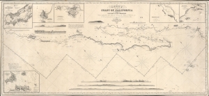
Chart of the Coast of California form San Blas to San Francisco.
$3,900.00
Acquire
- Digital Map Information
- Suitable for large format printing
- DPI: 600
- File Size: 1825.23 MB
- File Type: ZIP / TIFF
- ICC color profile embedded
- Delivered instantly via download link
The 1849 first edition, published for the California Gold Rush, of the James Imray blueback nautical map of the coast of California. This map, by Imray, predates any American charts of the California coast and, when it was issued, was the best obtainable chart for ambitious 49ers en route to the gold regions. (more details)
West-oriented chart of the Middle and North Atlantic Coastline.
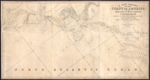
A New Chart of the Coast of America from Halifax in Nova-Scotia to the Chesapeak including Boston, New York, Philadelphia, Baltimore and Washington.
$3,000.00
Acquire
- Digital Map Information
- Suitable for large format printing
- File Size: 87.36 MB
- File Type: ZIP / TIFF
- ICC color profile embedded
- Delivered instantly via download link
This is James Imray's 1852 blueblack nautical map of the Middle-Atlantic and North Atlantic coast of North America, from the Bay of Fundy to the Chesapeake Bay. (more details)
Rare working blueback nautical chart of Cuba!
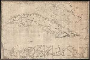
[Cuba]
$4,500.00
Acquire
- Digital Map Information
- Suitable for large format printing
- File Size: 26.33 MB
- File Type: ZIP / TIFF
- ICC color profile embedded
- Delivered instantly via download link
This stunning blueback nautical chart or map of Cuba, issued by James Imray in 1854, has all of the hallmarks of a working shipboard chart and a life at sea. Centered on Cuba, the map covers from Key West (Florida) to Grand Cayman, and from Cape Antonio (Cuba) to the Inagua Islands (Bahamas), coving all of Cuba, and parts of the southern Bahama Islands. Along the bottom of the map there are eight detail sub-maps, including, from left: Havana Harbor, Bahia Honda, Port Mariel, Port Guantanamo (Guantanamo Bay), Santiago de Cuba, Matanzas, Juaga or Zagua, and the Entrance of Puerto de la Nuevias. Some marks in pencil in the Old Bahama Channel or Santaren Channel (Bahamas) indicate navigation use. Soundings, particularly on the south coast of Cuba and throughout the Great Bahama Bank are in fathoms. (more details)
Only known example of this edition.
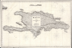
Haïti.
$900.00
Acquire
- Digital Map Information
- Suitable for large format printing
- File Size: 71.61 MB
- File Type: ZIP / TIFF
- ICC color profile embedded
- Delivered instantly via download link
This is a rare 1864 James Imray and Son blueback nautical chart or maritime map of Hispaniola or Santo Domingo, here identified as 'Haïti'. The chart is large and finely engraved with ample coastal detail, some inland topography, and depth soundings throughout. Pencil marks trace a Spanish voyage, likely out of Cadiz, along the island's northern coast. (more details)
Do You Know the Way to Cam Ranh Bay?
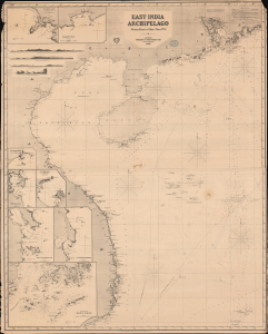
East India Archipelago. [Western Route to China. Chart No. 5].
$1,200.00
Acquire
- Digital Map Information
- Suitable for large format printing
- File Size: 2284.83 MB
- File Type: ZIP / TIFF
- ICC color profile embedded
- Delivered instantly via download link
A large and highly detailed 1869 James Imray and Son blueback chart or nautical map of the South China Sea (or, for the Vietnamese, the East Sea) region between Hong Kong, Hainan, and Vietnam. It provides a tremendous amount of information for the navigator, including a large inset of the waters off Hong Kong, seven other insets, and coast profiles. (more details)
China Trade.
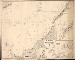
East India Archipelago [Western Route to China. Chart No. 4].
$1,200.00
Acquire
- Digital Map Information
- Suitable for large format printing
- File Size: 87.29 MB
- File Type: ZIP / TIFF
- ICC color profile embedded
- Delivered instantly via download link
This is James Imray's impressive 1869 nautical map covering parts of the South China Sea, including northwestern Borneo (Brunei, Sarawak, Sabah), Palawan (Philippines), and southeastern Vietnam. This chart, and the others in the 'Western Route to China' series, supplemented the Horsburgh cartography of the prior generation. They represent the definitive hydrographic mapping of the Far East at the height of the China Trade. (more details)
Height of the China Trade.
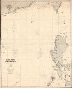
East India Archipelago (Western Route to China Chart no. 6).
$1,950.00
Acquire
- Digital Map Information
- Suitable for large format printing
- File Size: 62.63 MB
- File Type: ZIP / TIFF
- ICC color profile embedded
- Delivered instantly via download link
This is James Imray's impressive 1870 nautical map covering southeastern China in the vicinity of Hong Kong and Guangdong Province, southern Taiwan, and the northern Philippines (Luzon and Mindanao). This chart, and the others in the 'Western Route to China' series, supplemented the Horsburgh cartography of the prior generation. They represent the definitive hydrographic mapping of the Far East at the height of the China Trade. (more details)
A Marvelous Late 19th Century Chart of the Gulf of Thailand.
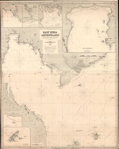
East India Archipelago. [Western Route to China. Chart No. 3].
$1,200.00
Acquire
- Digital Map Information
- Suitable for large format printing
- File Size: 214.98 MB
- File Type: ZIP / TIFF
- ICC color profile embedded
- Delivered instantly via download link
A large-format, intricately detailed blueback nautical map of the Gulf of Siam and nearby waters produced in 1870 by James Imray and Son, part of their 'East India Archipelago - Western Route to China' series. It was used for actual navigation and there are pencil marks and manuscript updates associated with maritime use. (more details)
Plotting the Rio de la Plata.
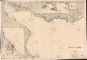
River Plate.
$975.00
Acquire
- Digital Map Information
- Suitable for large format printing
- Full resolution TIFF file
- ICC color profile embedded
- Delivered instantly via download link
This large, richly detailed, and rare work is James Imray's 1872 working, blueback nautical chart of the Río de la Plata in South America. It was surveyed during, and printed shortly after, the War of the Triple Alliance (1864 - 1870), fought by Brazil, Uruguay, and Argentina against Paraguay, largely over control of this waterway. It is the premier nautical mapping of the Río de la Plata to appear in the second half of the 19th century. (more details)
Navigating the Plata.
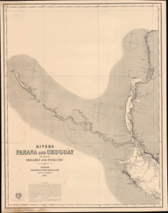
Rivers Paraná and Uruguay as far as Rosario and Paysandu.
$1,200.00
Acquire
- Digital Map Information
- Suitable for large format printing
- File Size: 94.77 MB
- File Type: ZIP / TIFF
- ICC color profile embedded
- Delivered instantly via download link
An 1872 James Imray blueback nautical map of the Rivers Paraná and Uruguay, the latter forming the often-disputed border between Uruguay and Argentina. These two rivers and their tributaries feed into the Rio de la Plata near Buenos Aires and, in the late 19th century, as today, were the region's primary arteries of trade and commerce.. (more details)
Transformative moment in global gastronomy.
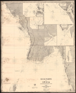
Rice Ports of India compiled from the most recent surveys.
$850.00
Acquire
- Digital Map Information
- Suitable for large format printing
- File Size: 25.84 MB
- File Type: ZIP / TIFF
- ICC color profile embedded
- Delivered instantly via download link
A fascinating 1874 James Imray nautical chart or maritime map of the cost of Myanmar / Burma when that territory was the world's largest rice exporter. Burma's rise as a rice center transformed global gastronomy by democratizing rice consumption. (more details)
Australia and the China Trade.
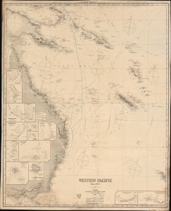
Western Pacific Chart No. 2.
$550.00
Acquire
- Digital Map Information
- Suitable for large format printing
- File Size: 153.08 MB
- File Type: ZIP / TIFF
- ICC color profile embedded
- Delivered instantly via download link
An impressive 1883 James Imray working nautical chart of eastern Australia, Papua New Guinea, and the Solomon Islands. Multiple voyages are charted in manuscript underscoring Australia's role in the China Trade. (more details)
Updating the map of the West Coast.
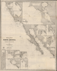
West Coast of North America from San Blas to San Francisco.
$1,900.00
Acquire
- Digital Map Information
- Suitable for large format printing
- File Size: 2178.34 MB
- File Type: ZIP / TIFF
- ICC color profile embedded
- Delivered instantly via download link
An impressive 1887 James Imray blueback nautical chart of the West Coast of America, primarily covering California from roughly San Francisco to Cabo San Lucas. (more details)
Sailing to Tasmania!
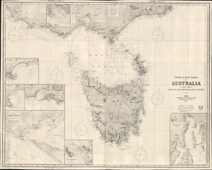
South and East Coasts of Australia [In Five Charts] Chart No. 2, Cape Northumberland to Cape Howe.
$1,500.00
Acquire
- Digital Map Information
- Suitable for large format printing
- File Size: 75.25 MB
- File Type: ZIP / TIFF
- ICC color profile embedded
- Delivered instantly via download link
A striking 1883 James Imray and Son blueback nautical chart or maritime map of Tasmania, Australia. The map captures a transition period as Tasmania emerged from its convict era to embrace mining and agriculture. (more details)
The waters between England and Ireland.
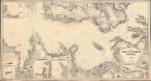
The Irish or St. George's Channel.
$750.00
Acquire
- Digital Map Information
- Suitable for large format printing
- File Size: 176.04 MB
- File Type: ZIP / TIFF
- ICC color profile embedded
- Delivered instantly via download link
This is an 1892 James Imray and Son blueback chart or map of St. George's Channel or the Irish Channel. Measuring over 6 feet long, this gorgeous chart details the sea between England and Ireland, which first received the name St. George's Channel from Martin Frobisher in 1578. (more details)
Islands of Imperial Competition.
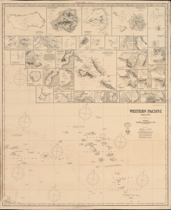
Western Pacific [Chart No. 3].
$500.00
Acquire
- Digital Map Information
- Suitable for large format printing
- File Size: 130.77 MB
- File Type: ZIP / TIFF
- ICC color profile embedded
- Delivered instantly via download link
A remarkable 1896 James Imray working blueback nautical chart of islands and waters in the western Pacific Ocean, including the Marshall, Caroline, Solomon, Mariana, and Gilbert Islands. (more details)