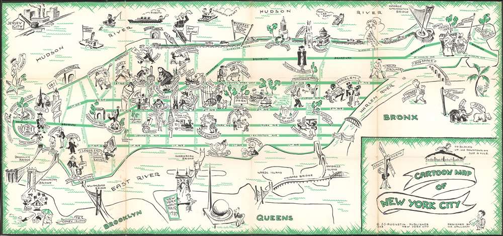
This item below is out of stock, but another example (left) is available. To view the available item, click "Details."
Details
1938 Salloch / Augustin Pictorial Map of New York City
1938 (dated) $400.00
1938 Salloch Pictorial Map of New York City
CartoonMapNYC-shalloch-1938
Title
1938 (dated) 12 x 26 in (30.48 x 66.04 cm) 1 : 32620
Description
The city's bridges are illustrated in profile and labeled, among these are the Brooklyn Bridge, the Manhattan Bridge, the Williamsburg Bridge, and the recently opened Triborough Bridge. A sign at the Queens end of the Queensboro Bridge points the way to the 1939 New York World's Fair, with its trademark Trylon and Perisphere just to the right. Two minor New York City celebrities are also illustrated in the Bronx: Peter the Great the hippopotamus and Alice the Asian elephant, who both lived in the Bronx Zoo. Peter the Great was born at the Central Park Zoo before being transferred to the Bronx and lived to be fifty years old, while Alice came to the zoo via Luna Park at Coney Island and was reportedly 'the most human connected elephant the zoo ever had'.
This map was drawn by Henry Emil Salloch, a German who fled Nazi Germany and arrived in the United States in 1937, and was published by J.J. Augustin in the Cartoon Guide of New York City.
Cartographer
Henry Emil Salloch (December 31, 1908 - August 1985) was a German-American artist and graphic designer. Born Heinz Emil Salloch in Berlin, Germany, Salloch studied art at the Muthesiushochschule, Kiel. In 1929, he returned to Berlin to teach art. After the rise of National Socialism and Adolf Hitler, Salloch refused to join the Nazi Party. In defiance of party edicts, he invited Jewish pupils to a school Christmas Party and refused to use the Nazi newspaper Völkischer Beobachter in his class. This caught the attention of the Gestapo. After being informed by his landlady that the Gestapo had been asking about him, Salloch fled the country and ended up in Cuba before immigrating to the United States in 1937. He spent the late 1930s traveling up the U.S. East Coast from Florida to New York, where he lived in Montauk for a while. The 1940 U.S. Census notes Salloch as living as a bachelor in New York City. Salloch married Erika Salloch, a Jewish refugee and professor of German at Washington College, Chestertown, Maryland. Today, the Erika and Henry Salloch Prize is given by the Department of Modern Languages at Washington College, to the student whose achievement and personal commitment have contributed to the understanding of other cultures. Photo provide courtesy of the Salloch family. More by this mapmaker...

