
1930 Fourmarier Geological Wall Map of the Belgian Congo

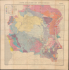
Carte Geologique du Congo Belge.
Resource Extraction in the Belgian Congo.
- Digital Map Information
- Suitable for large format printing
- Full resolution TIFF file
- ICC color profile embedded
- Delivered instantly via download link
Resource Extraction in the Belgian Congo.
This is a large-format 1930 folding geological map of the Belgian Congo, prepared by geologist Paul Fourmarier. The map is a product of Belgian colonial efforts to pillage the Congo's vast natural resources - copper, cobalt, diamonds, and other minerals - through exploitative forced labor.A Closer Look
The map covers from the French colony of Ubangi-Shari (now the Central African Republic) in the north to Benguela (Portuguese Angola) in the south, taking in the entirety of the Belgian Congo and then some. Towns and settlements, waterways, and terrain are indicated throughout. Overlying the map is a color-shading scheme explained in the legend at top-left, indicating different rock types, layers, and formations. As with all geological maps, this information has both purely scientific and economic resonance, as geological information is essential for the efficient extraction of mineral and other resources, which are abundant in central Africa.Historical Context
The Interwar years in the Belgian Congo marked a transition from the chaotic, murderous extraction of the King Leopold Era (the 'Congo Free State,' taken over by the Belgian state in 1908) to a more organized, though still highly coercive, state-managed economy. This 'model colony' period saw the rise of massive mining corporations, such as the Union Minière du Haut-Katanga, which turned the region into a global hub for copper, cobalt, and diamonds. The epicenter of the colonial-era resource rush was the southern province of Katanga, where the powerful corporate cartel, Union Minière du Haut-Katanga (UMHK), held a virtual monopoly over mining operations. As global demand for industrial metals surged through both World Wars and into the Cold War, the Belgian administration aggressively expanded infrastructure, laying thousands of miles of railways to transport raw wealth to Atlantic ports.To fuel this industrial machine, the colonial administration enforced 'prestation' (forced labor) and other coercive measures such as high taxes and breaking up workers from the same tribe or area to prevent resistance. Large coffee and cotton plantations were also established for the export of cash crops. The guiding philosophy of the era was dominer pour server, a Belgian take on the mission civilisatrice. While Belgium invested in some infrastructure (especially railways) and basic healthcare to maintain a healthy labor force, the Congolese were systematically denied access to higher education and political rights. It is no surprise then that this period saw the rise of powerful anti-colonial movements, especially the Kimbanguist movement, a religious and proto-nationalist surge led by Simon Kimbangu, which the Belgians suppressed by imprisoning Kimbangu for 30 years.
Publication History and Census
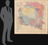
This map was prepared by Paul Fourmarier and printed in 1930 by the Imprimerie lithographique de l'Institut Cartographique Militaire, possibly using base maps by the Service cartographique du Ministère des Colonies. The pastedown in the bottom margin suggests that this example was sold at the Brussels bookshop Librairie Falk Fils. The map is accompanied by a booklet (Notice Explicative) by Fourmarier and printed by the Imprimerie H. Vailllant-Carmanne in Liege that had also been published in the journal Revue Universelle des Mines in June 1930, where the map was also included in a pocket in the back, having been printed on four folding sheets. The present example also appears to be four sheets, but they have been joined, and the combined sheet has then been dissected and laid on linen, resulting in a map measuring 51 in. by 47.25 in.This is the second edition of the map, the first having been published in 1924. Despite being labeled a second edition, the present 1930 map differs considerably from the 1924 map, with a scale of 2,000,000 versus 4,000,000, more detailed inclusion of non-geologic features, and more extensive and detailed geologic information. This edition of the map is cataloged multiple times in the OCLC, but most examples refer to the four-sheet printing that appeared in the Revue Universelle des Mines. Only four examples - held by Brigham Young University, the Natural Environment Research Council Library (U.K.), the Bibliothèque nationale de France, and the ETH-Bibliothek Zürich - match the presentation here, with the four sheets joined and mounted on a single sheet.
Cartographers
Paul Frédéric Joseph Fourmarier (December 25, 1877 - January 20, 1970) was a Belgian geologist specializing in tectonics and stratigraphy. He was born in Brabant and studied at the University of Liege and received a degree in mining engineering in 1899. He then went to work with the government's Mining Corps (Corps des Mines) and established a reputation as a top expert in the field of geology, serving as president of the Geological Society of Belgium in 1908. In 1920, he returned to his alma mater to teach and by 1927 had been named Professor of Geology. Some of Fourmarier's most notable work took place in the Belgian Congo, where he had done research since 1913. While in Katanga, he discovered a mineral, a hydrated oxide of uranyl and lead, that was named after him, as fourmarierite. Fourmarier received multiple awards during his life, including the prestigious Wollaston Medal from the Geological Society of London, and also had an annual prize given since 1937 by the Royal Academy of Sciences, Letters and Fine Arts of Belgium named after him. Further Details...
Institut Cartographique Militaire (1878 - 1947) was Belgium's military mapping agency during its operational lifespan from 1878 to 1947. Succeeding the post-independence Dépôt de la Guerre et de la Topographie, the ICM was institutionalized under the Ministry of War to create highly accurate, official topographic maps of the kingdom and, later, its colonies (especially the Belgian Congo). One of the first tasks of the ICM was to produce a comprehensive set of topographic maps of Belgium using the latest geodetic methods on a consistent scale (1:2000000), which was also later extended to the Congo. It maps were printed by an in-house print shop called the Imprimerie lithographique de l'Institut Cartographique Militaire. The Institut was deeply affected by Belgium's precarious position in European geopolitics and its staff, facilities, and information was requisitioned by the Germans during occupations in both world wars. Following the Second World War, the ICM was phased out, transitioning into the Institut Géographique Militaire in 1947, which eventually evolved into today's civilian Institut Géographique National. Further Details...
Condition
Very good. Dissected and mounted on linen. Accompanied by explanatory text.
References
OCLC 705083816,762182843, 183261966.