This item has been sold, but you can get on the Waitlist to be notified if another example becomes available, or purchase a digital scan.
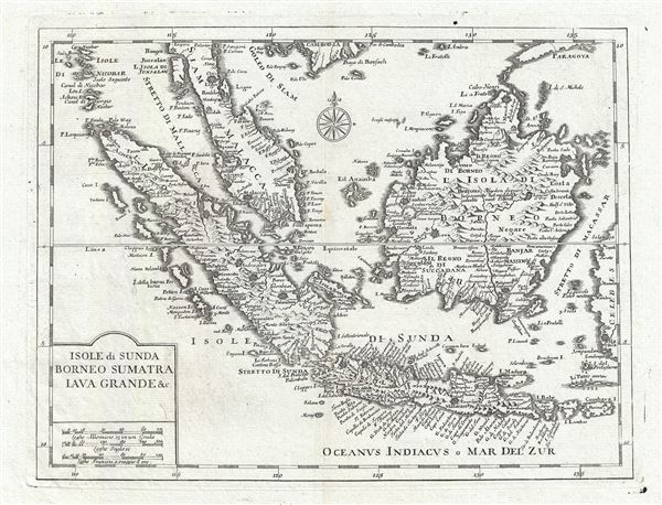
1740 Alibrizzi Map of the East Indies (Malay, Singapore, Borneo)
EastIndies-albrizzi-1740
Title
1740 (undated) 12 x 15 in (30.48 x 38.1 cm) 1 : 9000000
Description
CartographerS
Giambattista Albrizzi (1698 - 1777), a.k.a. Giovanni Battista Albrizzi, was an Italian publisher and journalist active in Venice during the mid-18th century. Albrizzi was the scion of a well-established Venetian publishing dynasty and followed in the footsteps of his father, Girolamo Albrizzi, who founded the family printing business and is known for publishing the work the great Venetian cartography Vincenzo Coronelli. Giambattista Albrizzi is generally considered to be the most prominent 18th century Venetian publisher. Today he is best known for his friendship and collaboration with Giovanni Battista Piazzeta (1683 - 1754), a well know Venetian artist and engraver, whose drawings and engravings appear in many of Albrizzi's publications, including his maps. Giambattista Albrizzi's cartographic work, while not particularly innovative in terms of content, often featured elaborate decorative elements designed by Piazzeta. Through the integration of such decorative elements, Albrizzi hopped to revive the reputation of Venetian publishing, which since the late 17th century, had fallen in regard since the days of Girolamo. His work helped lay the foundations for Italian school decorative cartography in the late 18th and early 19th century, including the work of Antonio Zatta, among others. In addition to Albrizzi's work as a map and book publisher, he also issued a weekly journal, Novelle della Repubblica delle Lettere, a kind of early newspaper that played an important role in Venetian business and intellectual life. More by this mapmaker...
Isaak Tirion (1705 - 1765) was a Dutch publisher in Amsterdam. Born in Utrecht, Tirion quickly rose to prominence by publishing pamphlets, historical works, and most importantly, maps and atlases. He produced several atlases and Dutch town plans. His maps are mainly based on those of Guillaume de l'Isle. Tirion eventually relocated his printing house to the prestigious Kalverstraat. In his long career, he produced eight atlases in multiple editions, some of which were published posthumously until about 1784. Learn More...

