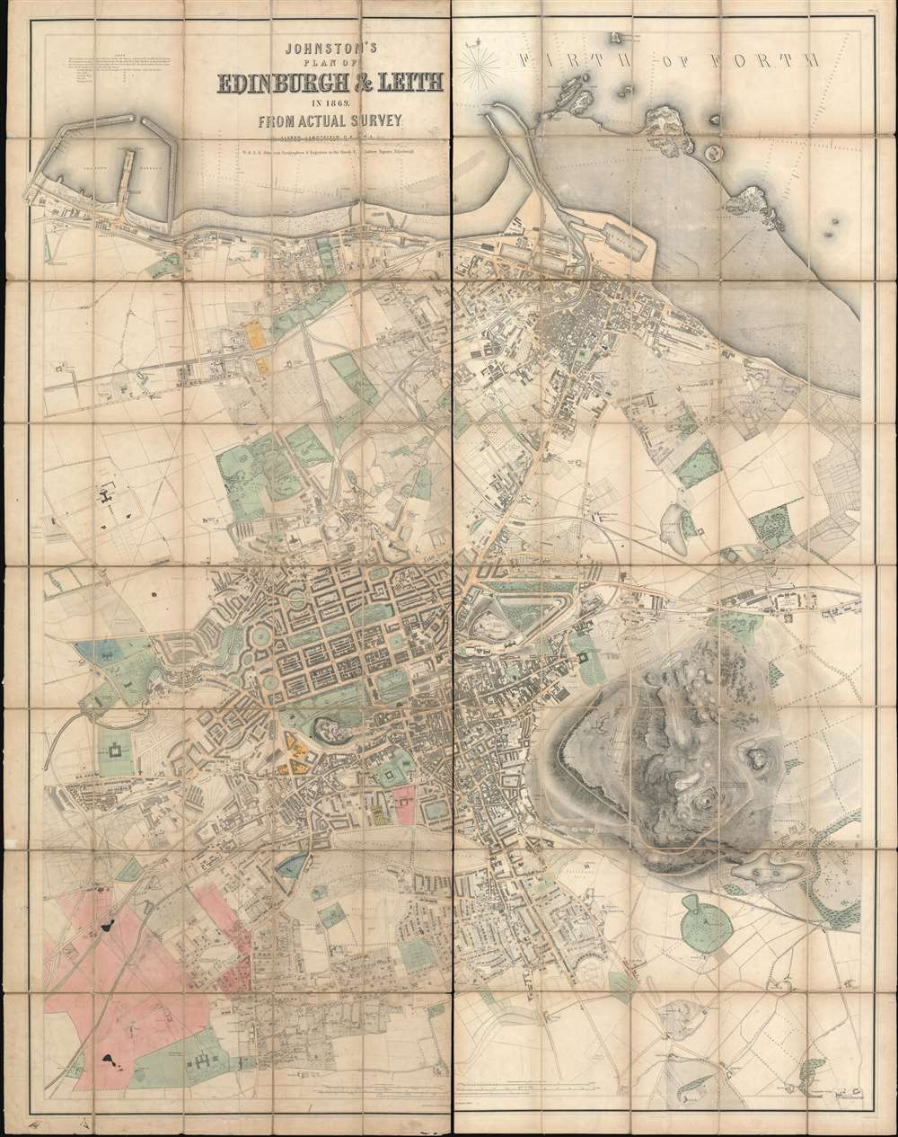
1869 Johnston City Plan or Map of Edinburgh and Leith, Scotland
EdinburghLeith-johnston-1869$2,000.00

Title
Johnston's Plan of Edinburgh and Leith in 1869.
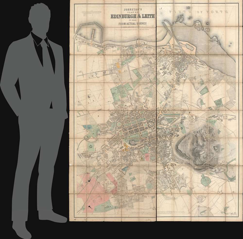
1869 (dated) 68.25 x 53.75 in (173.355 x 136.525 cm) 1 : 4680
1869 (dated) 68.25 x 53.75 in (173.355 x 136.525 cm) 1 : 4680
Description
This 1869 Johnston city plan or map of Edinburgh and Leith, Scotland, presents an impressively detailed overview of the city during an era of rapid industrial expansion. For more than 30 years, this map was the finest available map of Edinburgh, used for urban planning, city administration, trade, infrastructure development, and more. Shipyards, mills, factories, breweries, foundries, and ironworks, many of which are labeled, fuel an economic boom. The city's railways and stations are illustrated in detail. Central Edinburgh's iconic grid, designed by James Craig in 1768, stands in contrast to the maze of streets and lanes that create the rest of the city. As a historical aside, 1869 was also the year the 'Edinburgh Seven,' the first group of female students to enroll in a British university, began attending the University of Edinburgh Medical School, although they were not allowed to take degrees.
Manuscript Notations
Upon close examination, it becomes evident that this example of Johnston's map bears numerous manuscript notations. For example, along the left border, a new railway is sketched in pencil, running from the Heriot Brewery toward the existing rail line. A road is added here. More manuscript notations appear in the lower-left corner, many of which appear to plan out roadways and properties to be established in this area. Unfortunately, precisely what is being planned is unclear. Three different colors, blue, pink, and yellow, are present in manuscript and are used to highlight several areas around Edinburgh, but, alas, we have also been unable to decipher the meaning of this work.Manuscript Notations and The Merchant Maiden Hospital and Gillespie's Hospital
Two Edinburgh landmarks, the Merchant Maiden Hospital and Gillespie's Hospital, are crossed out in manuscript. Both were charitable organizations, but only one was a hospital. Gillespie's Hospital was founded by the James Gillespie (1726 - 1797) and the Merchant's Company of Edinburgh in 1801 as a hospital for aged men and women. The Merchant Maiden Hospital was not a hospital but a home for women who had fallen on hard times. Opened on June 4, 1694, the hospital was co-founded by Mary Erskine (1627 - July 2, 1707) and the Merchant Company of Edinburgh to house and educate the impoverished daughters of Edinburgh's failed merchants. Both Gillespie's Hospital and the Merchant Maiden Hospital were closed and repurposed as schools in 1870, which likely explains why they are crossed out here. The buildings still stood, but the organizations labeled on the map no longer existed. Intriguingly, Watson's Hospital, depicted just above the Merchant Maiden Hospital, was closed in much the same way around the same time and reopened as a boy's school in 1871. However, unlike the other two institutions, it is not crossed out.A Note Concerning Provenance - The Merchant Company of Edinburgh Library
A red binder bearing the stamp of the Merchant Company of Edinburgh accompanies this piece, suggesting that it was once part of their library. Officially known as The Royal Company of Merchants of the City of Edinburgh, the Merchant Company of Edinburgh received a Royal Charter in 1681, but dates to at least 1260. Begun as a merchant guild founded to protect the trading rights of Edinburgh's merchants, the Company also undertakes educational and charitable missions. To become a member, one must be elected by the Master's Court and either reside or operate a business in Edinburgh or within twenty miles of General Register House in Edinburgh.Publication History and Census
This map was created and published by William and Alexander Keith Johnston in 1869 and is accompanied by a red binder. Johnston published editions of his plan of Edinburgh beginning in the 1850s through the 1890s. One example of the present 1869 edition is cataloged in OCLC and is part of the collection at the National Library of Scotland.Cartographer
Alexander Keith Johnston (December 28, 1804 - July 9, 1871) was a Scottish cartographer and map publisher active in the middle portion of the 19th century. Johnson was born at Kirkhill, near Edinburgh, Scotland. He studied at the University of Edinburgh where he apprenticed as an engraver. Around 1826, in partnership with his brother William, he founded a cartographic printing and engraving firm with the imprint "W. and A. K. Johnston." Johnston made a name for himself in educational geography, publishing numerous maps for use in schools. His brother, William Johnston, eventually left the firm to pursue a career in politics, eventually becoming the Lord Provost of Edinburgh. Alexander's son, who would bear the same name, became a geographer and explorer, suffering an untimely death on the Royal Geographical Society's 1879 expedition to Lake Nyasa. More by this mapmaker...
Condition
Good. Even overall toning. Wear and slight damage where originally attached to binder. Map sectionalized in two panels which can be joined (with linen) on request.
References
OCLC 316371105.