
Johnston, Alexander Keith

Alexander Keith Johnston (December 28, 1804 - July 9, 1871) was a Scottish cartographer and map publisher active in the middle portion of the 19th century. Johnson was born at Kirkhill, near Edinburgh, Scotland. He studied at the University of Edinburgh where he apprenticed as an engraver. Around 1826, in partnership with his brother William, he founded a cartographic printing and engraving firm with the imprint "W. and A. K. Johnston." Johnston made a name for himself in educational geography, publishing numerous maps for use in schools. His brother, William Johnston, eventually left the firm to pursue a career in politics, eventually becoming the Lord Provost of Edinburgh. Alexander's son, who would bear the same name, became a geographer and explorer, suffering an untimely death on the Royal Geographical Society's 1879 expedition to Lake Nyasa.
Shifting Borders in North America.
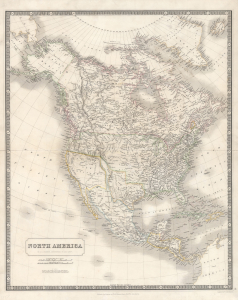
North America.
$750.00
Acquire
- Digital Map Information
- Suitable for large format printing
- DPI: 600
- File Size: 49.57 MB
- File Type: ZIP / TIFF
- ICC color profile embedded
- Delivered instantly via download link
An illuminating 1843 map of North America by Alexander Keith Johnston that was published in the first edition of his important National Atlas. The most noticeable features of the map include an enlarged Republic of Texas, a British-friendly interpretation of the Pacific Northwest, and other geographic oddities in the American West. (more details)
Ephemeral mapping of a brief yet serious German threat to British economic dominance. Also - Texas at its largest!
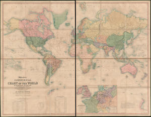
Johnstons' Commercial Chart of the World on Mercators Projection from the latest and Best Authorities Containing the Position of Every Place of Commercial Importance, Shhowing the Princial Currents of hte Ocean with their Direction and Rate of Progress. With an Enlarged Map of Central Europe Showing the Railway Communication between the Different Countries, and Distinguishing the States which compose the German Customs Union.
$4,500.00
Acquire
- Digital Map Information
- Suitable for large format printing
- Full resolution TIFF file
- ICC color profile embedded
- Delivered instantly via download link
An impressive large-scale first edition example of A. K. Johnston's 1849 map of the world. The map features a wealth of fascinating and relevant content, including an ephemeral pre-Compromise of 1850 map of Texas, hints at the threat to British commercial dominance posed by the German Zollverein, and a remarkably comprehensive mapping of caravan routes through the Sahara. (more details)
'...worthy of a place in any nobleman's library' - Australian Mail
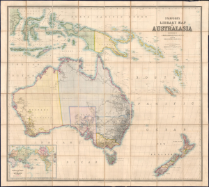
Stanford's Library Map of Australasia.
$8,500.00
Acquire
- Digital Map Information
- Suitable for large format printing
- File Size: 129.08 MB
- File Type: ZIP / TIFF
- ICC color profile embedded
- Delivered instantly via download link
The astounding 1859 first edition of A. Kieth Johnston and Edward Stanford's large-format Library Map of Australasia, comprising Australia, New Zealand, and New Guinea. This is arguably the largest and most detailed general map of Australia to appear in the 19th century, issued a month before the official establishment of Queensland in June 1859. (more details)
Details the Industrial Revolution's effect on Edinburgh and Leith through labeling factories, breweries, mills, works, etc.
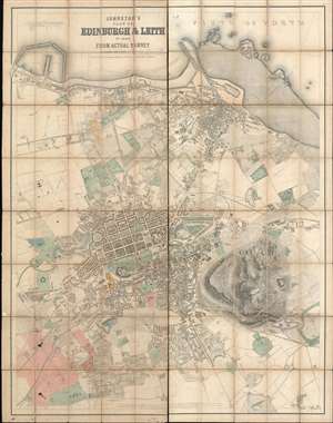
Johnston's Plan of Edinburgh and Leith in 1869.
$2,000.00
Acquire
- Digital Map Information
- Suitable for large format printing
- File Size: 244.13 MB
- File Type: ZIP / TIFF
- ICC color profile embedded
- Delivered instantly via download link
This 1869 Johnston city plan or map of Edinburgh and Leith, Scotland, presents an impressively detailed overview of the city during an era of rapid industrial expansion. For more than 30 years, this map was the finest available map of Edinburgh, used for urban planning, city administration, trade, infrastructure development, and more. Shipyards, mills, factories, breweries, foundries, and ironworks, many of which are labeled, fuel an economic boom. The city's railways and stations are illustrated in detail. Central Edinburgh's iconic grid, designed by James Craig in 1768, stands in contrast to the maze of streets and lanes that create the rest of the city. As a historical aside, 1869 was also the year the 'Edinburgh Seven,' the first group of female students to enroll in a British university, began attending the University of Edinburgh Medical School, although they were not allowed to take degrees. (more details)
A 'Great Game' reconnaissance expedition from Beijing across the Gobi.
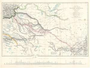
Map to illustrate A Journey Through Western Mongolia.
$800.00
Acquire
- Digital Map Information
- Suitable for large format printing
- File Size: 20.33 MB
- File Type: ZIP / TIFF
- ICC color profile embedded
- Delivered instantly via download link
This is an 1873 Ney Elias map of western Mongolia. Although not specifically described as such, this map and the Elias expedition were most likely British reconnaissance related to 'The Great Game'. This map was drawn by Elias after his 1872 expedition through the region. A thin red line follows his progress from Beijing (Peking), China, across the Gobi Desert to Bisk in Russia, where he arrived on January 4th, 1873. Elias marks each day's progress along his route and labels Uliassutai, the largest settlement he encountered. The pink shading around Elias's route highlights the limits of the surveys conducted by Elias during the expedition. Karakorum, which Elias refers to as the 'ancient Tartar capital', is marked in two places, suggesting ambugity over its actual location. The map traces the Great Wall along the bottom border, with the wall and the rivers leading from Lake Alak, Lake Tsui-yan, and Lake Sobi breaking the map's bottom border. Numerous lakes of varying sizes appear throughout. (more details)
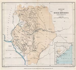
Sketch Map of the Bustar Dependency.
$150.00
Acquire
- Digital Map Information
- Suitable for large format printing
- File Size: 1.82 MB
- File Type: ZIP / TIFF
- ICC color profile embedded
- Delivered instantly via download link
This is a fine example of the 1879 Stanford Map of the Bustar Dependency (Bastar State) in central India. Centered on the Indravati River, the map covers from Chanda District in Hyderabad to the Jeypur estate (Jeypore) in Orissa. Inset map of the region is ... (more details)
An early trek across southeastern Africa from Cape Town to Lake Malawi.
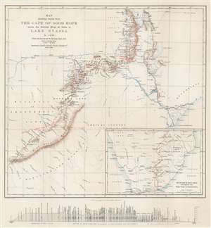
Map showing Route from the Cape of Good Hope across the Zambesi River at Tette to Lake Nyassa in 1884. From the Survey by W. Mantagu Kerr.
$350.00
Acquire
- Digital Map Information
- Suitable for large format printing
- File Size: 12.17 MB
- File Type: ZIP / TIFF
- ICC color profile embedded
- Delivered instantly via download link
This is an 1886 Henry Sharbau map of modern-day Zimbabwe, Mozambique, and Malawai tracing Walter Montagu Kerr's (1852 - 1888) exploration of the region. A thin red line follows Kerr's peregrinations, with towns and native villages labeled along the route. Major settlements including Gubuluwayo, Tette, Mpemba, Blantyre, and Quillimane near the mouths of the Zambezi River. The Zambezi is prominently illustrated, along with numerous smaller rivers. Marshes, mountain ranges, and other physical features are also noted, although very little detail is present in areas distant from Kerr's path. Red lettering marks tsetse fly territory - a serious danger to early explorers. An inset map in the lower right follows Kerr's route from Cape Town to Gubuluwayo. A profile of the 'section of route from Port Elizabeth to Lake Nyassa and Quillimane' is included below the bottom border. (more details)
Scarce 1893 map of the Russian Frontier in Central Asia
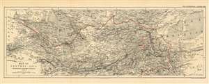
Map of Central Asia Showing the Route of the Earl of Dunmore 1892-3.
$450.00
Acquire
- Digital Map Information
- Suitable for large format printing
- File Size: 19.05 MB
- File Type: ZIP / TIFF
- ICC color profile embedded
- Delivered instantly via download link
This is an 1893 map by William and Alexander Keith Johnston of Central Asia, published by the Royal Geographic Society, to trace the route taken by the Earl of Dunmore in his travels through Kashmir, the Xinjiang province of China, Tajikistan, Kyrgyzstan, Uzbekistan, and through Turkmenistan to the Caspian Sea. The region - largely a Chinese frontier - was the site of significant Russian efforts to exert influence at the time, and it is in that context that the Earl of Dunmore’s journey took place. Following the track, for example, one sees what appears to be a curious detour into the Pamir mountains between Yarkand and Kashgar; here, Dunmore’s expedition was following a Chinese force sent to counter Russian incursions Aktash region. The region was also the site of conflict between Russian and Afghan forces - indeed, the journey took place only a few years before the border between Russia and Afghanistan was set with the signing of the Pamir Boundary Commission protocols in 1895. Dunmore's return route from Samarkand was undertaken on the Russian Trans-Caspian Railway; constructed in order to facilitate Russian troop movements along the frontier, the British considered this railway to be a particular threat to their interests in Asia. (more details)
Settling the Borders of British Nigeria.
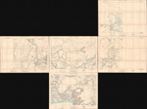
Lake Chad / Nikki / Central Nigeria. / Yola / Cross River.
$1,500.00
Acquire
- Digital Map Information
- Suitable for large format printing
- Full resolution TIFF file
- ICC color profile embedded
- Delivered instantly via download link
A concurrent set of five folding sheets, together forming a map covering central and eastern Nigeria, produced by the Intelligence Division of the British War Office in 1902 (with one map being dated 1905). The maps cover this region as it was roiled by opposition to British encroachments and was being negotiated over between the British and Germans, who controlled the neighboring colony of Kamerun. (more details)