This item has been sold, but you can get on the Waitlist to be notified if another example becomes available, or purchase a digital scan.
1804 Faden Wall Map of Europe (spectacular old color)
Europe-faden-1804$1,000.00

Title
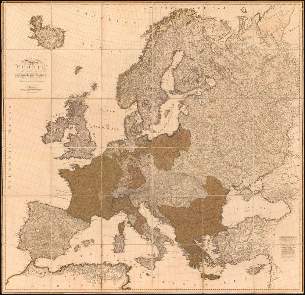
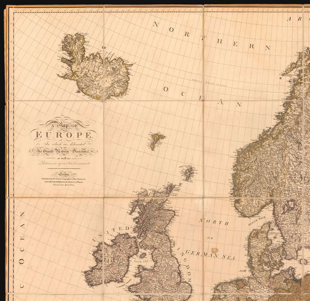
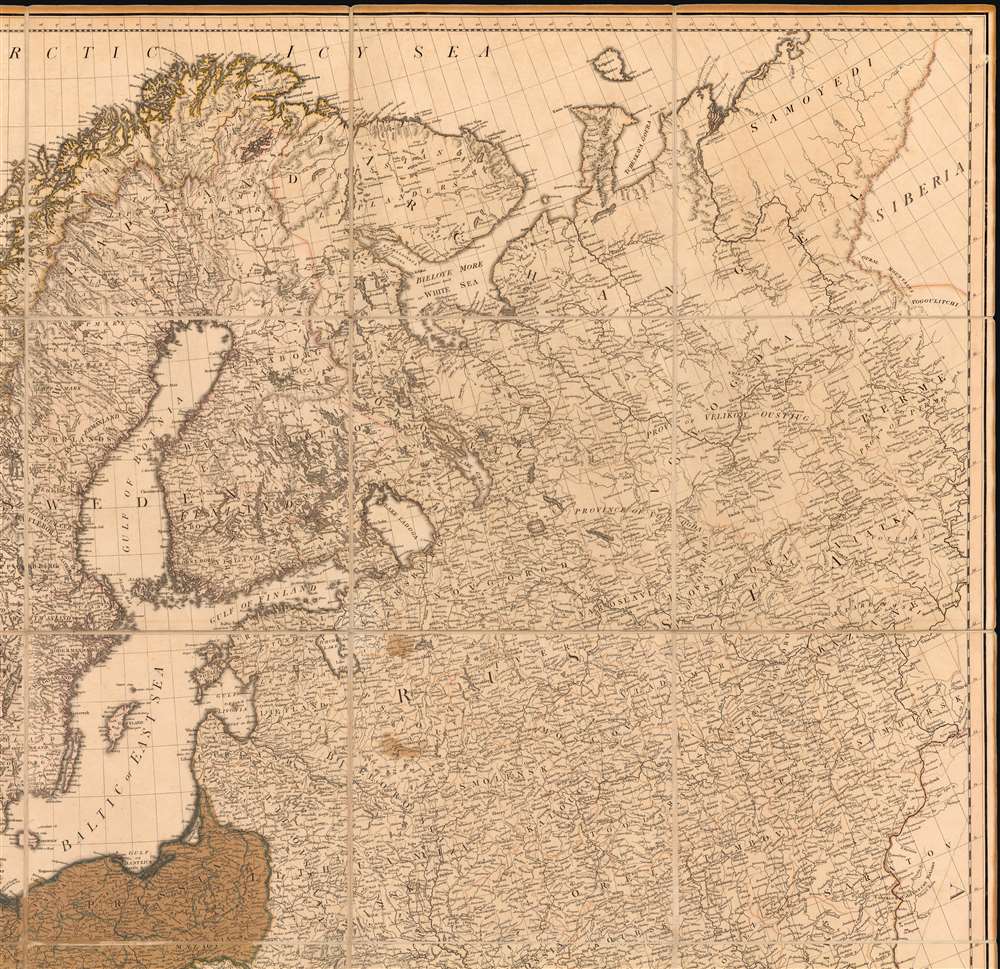
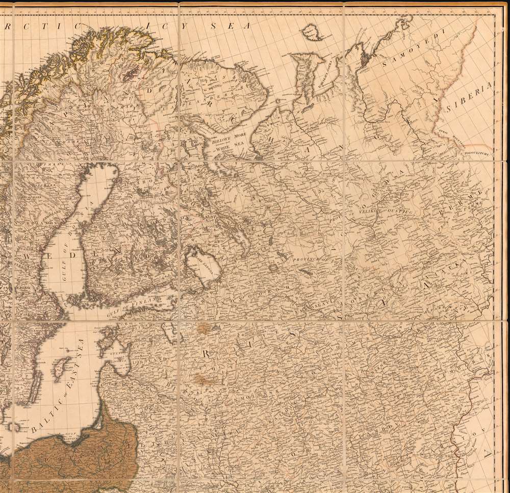
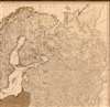
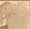
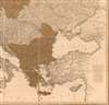
A Map of Europe In which are delineated its Grand Modern Divisions, as well as Partitions into inferior States Governments and C.
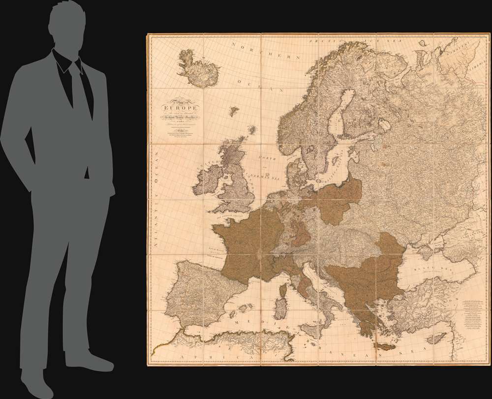
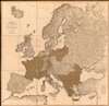
1804 (dated) 61 x 62 in (154.94 x 157.48 cm) 1 : 2851200
1804 (dated) 61 x 62 in (154.94 x 157.48 cm) 1 : 2851200
Description
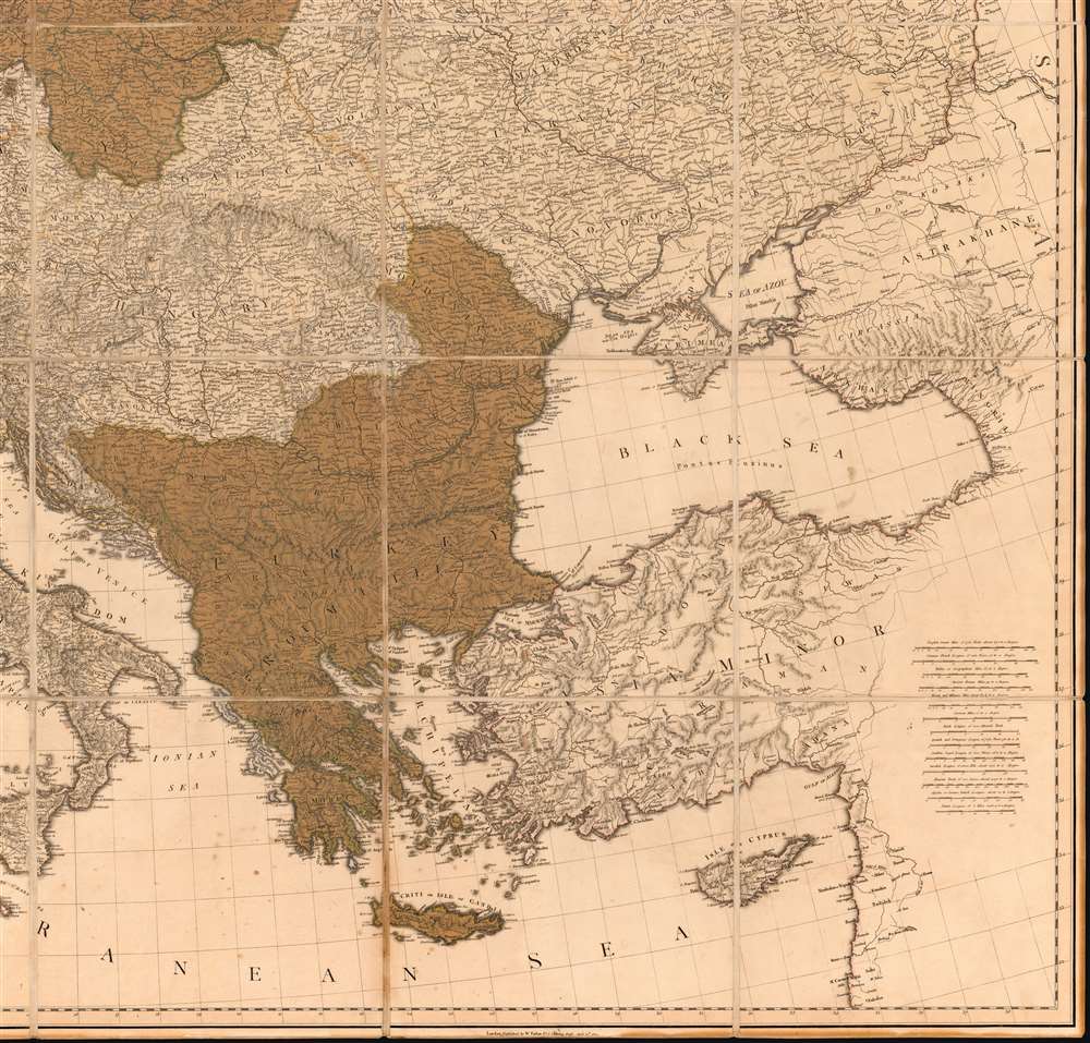
A rare tremendously proportioned 1804 William Faden wall map of Europe issued in the year Napoleon Bonaparte crowed himself Emperor of France - upending generations of dynastic tradition and transforming the continent's political and social landscape. This expansive map covers all of Europe, extending from Iceland to Cyprus and from Spain to the Ural Mountains. Features full old color throughout.
Napoleonic Wars (1803 - 1815)
This map was issued at a pivotal point in European history, just one month before Napoleon Bonaparte declared himself emperor of France (May 18, 1804). The map follows the War of the Second Coalition (1798 - 1802) and the Peace of Amiens, but predates the Napoleonic Wars. The War of the Second Coalition was intended to limit French expansion in Europe, but Napoleon instead used the short peace that followed to stabilize the French economy, intimidate much of continental Europe into becoming French vassal states, and seize parts of Italy. Britain ended the Amiens truce in May 1803, when it once again declared war on France. The British were terrified by Napoleon's political re-structuring of Western Europe, particularly in Switzerland, Germany, Italy, and the Netherlands. While Faden perhaps did not anticipate Napoleon declaring himself emperor, he saw which way the wind was blowing and recognized that a new large-scale map of Europe was becoming both a financial opportunity and a strategic necessity. As Faden's new map hit the presses, all of Europe broke down into conflict - much of which ended with French victory. This magnificent map would have only a short and limited run, for just weeks after it was issued, everything changed, thus accounting for its rarity. The Napoleonic Wars would wage for another 11 before Napoleon was firmly and finally 'met his Waterloo'Publication History and Census
This map was published by William Faden on April 12, 1804. The map is rare with the OCLC noting only 3 examples in institutional collections. Additional holdings include the British Library and at least 2 in private hands.Cartographer
William Faden (July 11, 1749 - March 21, 1836) was a Scottish cartographer and map publisher of the late 18th century. Faden was born in London. His father, William MacFaden, was a well-known London printer and publisher of The Literary Magazine. During the Jacobite Rebellion (1745 - 1746), MacFaden changed his family name to Faden, to avoid anti-Scottish sentiment. Faden apprenticed under the engraver James Wigley (1700 - 1782), attaining his freedom in 1771 - in the same year that Thomas Jefferys Sr. died. While Thomas Jefferys Sr. was an important and masterful mapmaker, he was a terrible businessman, and his son, Jefferys Jr., had little interest in building on his father's legacy. MacFaden, perhaps recognizing an opportunity, purchased his son a partnership in the Jefferys firm, which subsequently traded as 'Faden and Jefferys'. Jefferys Jr. also inherited Jefferys Sr.'s title, 'Geographer to the King and to the Prince of Wales'. With little interest in cartography or map publishing, Jefferys Jr. increasingly took a back seat to Faden, and by 1776, he had withdrawn from day-to-day management, although he retained his financial stake. The American Revolutionary War (1775 - 1783) proved to be a boom for the young 'Geographer to the King', who leveraged existing materials and unpublished manuscript maps to which he had access via his official appointment to publish a wealth of important maps, both for official use and the curious public - this period of prosperity laid the financial underpinning for Faden, who by 1783, at the end of the war, acquired full ownership of the firm and removed the Jefferys imprint. In 1801, he engraved and published the first maps for the British Ordnance Survey. By 1822, Faden published over 350 maps, atlases, and military plans. He retired in 1823, selling his plates to James Wyld Sr. Faden died in 1836. More by this mapmaker...
Condition
Very good. On old stable linen. Old color.
References
OCLC 5564484.