
1851 Depot-General de la Marine Nautical Chart or Map of Florida and the Bahamas

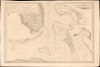
Carte des Canaux de la Providence et de Bahama. D'après la Carte en deux feuilles de E. Blunt de 1847.
Main Trade Route of the Caribbean.
- Digital Map Information
- Suitable for large format printing
- Full resolution TIFF file
- ICC color profile embedded
- Delivered instantly via download link
Main Trade Route of the Caribbean.
This is a large-format 1851 nautical chart or map of southern Florida and the Bahamas, focusing on the Bahama Banks, produced by the French Dépôt de la Marine. Based on a 1847 chart by American hydrographer Edmund Blunt, the chart represents the most detailed hydrographic information on these notoriously tricky waters available at the time. The map marks a point of rising French trade and activity in the Gulf under the Second Empire.A Closer Look
The chart covers Florida from the vicinity of Port St. Lucie south past the Florida Keys (then called the Florida Reef), as far as Cuba and from Gasparilla Sound in the west to the Exuma Cays in the east. It presents a fine mapping of coastal regions and banks with countless depth soundings, hazards, anchorages, lights, bottoms, currents, the positions and routes taken by recent voyages, and navigational notes such as 'très difficile' and 'très dangereux.' Some inland detail is provided, primarily highlands which would be easily identifiable to navigators. Fourteen shore profiles occupy the upper-left and upper-right corners. Four compass roses with magnetic variations are included as well.Early American Forts and Settlements in South Florida
The greatest amount of inland detail is provided in Florida, including terrain, inland waterways, forts, and early trading posts. This chart was produced in the tense period between the Second and Third Seminole Wars. Several of the early sites seen here were ephemeral military outposts or trading posts, such as Fort Dallas, built in 1836 at the mouth of the Miami River, which was frequently abandoned and reoccupied as hostilities fluctuated over the decades, but ultimately formed the basis of the city of Miami. Similarly, Fort Dulaney was established as a coastal supply depot at Punta Rassa, only to be obliterated by a hurricane in 1841, which forced the military to retreat further inland to construct Fort Harvie (the future site of Fort Myers). Fort Harrell, a stockade built in the Western Everglades during the Second Seminole War, was so remote that its remnants were only discovered in 2014.Historical Context
The chart coincides with the Second French Republic (1848 - 1852) and the emerging Second Empire under Louis-Napoléon Bonaparte. While the French had no interest in making claims on this territory, the Florida Current was a key passage for French trade from ports like Pensacola, New Orleans, and Apalachicola (importing cotton, naval stores, timber, and tobacco). It was among the busiest shipping lanes in the Atlantic. This chart is also contemporaneous with rising French influence in Mexico, at this point mostly trade, but ultimately resulting in the ambitious but misguided French Intervention.Publication History and Census
This chart was published by the French Depôt de la Marine in 1851, based on Edmund Blunt's 1847 map of the region, and is the best general chart of the region at the time. It is quite rare, held only in the British Library's collections and appearing only occasionally on the market.Cartographers
Dépôt des Cartes et Plans de la Marine (fl. 1720 - present), often called the Dépôt Général de la Marine, was a French hydrographic mapping organization founded in 1720 under Charles-Hercule of Albert de Luynes (1674 - 1734). Much like the U.S. Coast Survey, the British Admiralty, and the Spanish Deposito Hydrografico, the Dépôt was initiated as a storehouse and distribution center of existing nautical and marine charts. Eventually the Dépôt initiated its own mapping activities in an attempt to improve and expand upon existing material. Some of the more prominent cartographers and hydrographers associated with the of Dépôt Générale des Cartes were, Philippe Buache, Jacques-Nicholas Bellin, Giovanni Rizzi-Zannoni, Rigobert Bonne, and Jean Nicolas Buache. Further Details...
Edmund March Blunt (June 20, 1770 - 1862) was an American navigator, bookseller, chartmaker, and cartographer based in Newburyport, Massachusetts. Blunt was born in Portsmouth, New Hampshire in 1770. In 1796, along with the nominal assistance of prominent navigator Captain Lawrence Furlong, Blunt published The American Coast Pilot, one of the most important published works on American navigation. Although much of the work was plagiarized from British publications, the Coast Pilot was an immediate popular success. In response to the popularity of his work, Blunt published 21 subsequent editions, each with important updates and revisions. The first edition to contain map plates was printed in 1804. Following a fire that destroyed his offices at The Sign of the Bible in 1811, Blunt moved his business to New York and opened a new shop, The Sign of the Quadrant. His sons Edmund Jr. (1799 - 1866) and George William (1802 - 1878), joined the firm in 1824 and eventually took over the family business, renaming the firm 'E. and G. W. Blunt'. They both produced their own nautical books, charts, and instruments, as well as republished their father’s work. In 1830, Edmund accepted a position under Ferdinand Hassler at the United States Office of the Coast Survey. Much of Blunt's original work eventually found its way into U.S. Coast Survey Publications. George closed the firm in 1872 and sold the plates and chart copyrights to the U.S. Coast Survey and the U.S. Navy Hydrographic Office. Due to the quality and detail of Blunt's work, revised editions of his most important charts were republished well into the 1880s. Further Details...
Chassant (fl. c. 1830 - 1860) was a French line and chart engraver active in Paris in the middle part of the 19th century. Chassant was active with the French Dépôt de Marine from the 1830s into the 1860s. He was a master engraver and, some have argued, his dramatic hachuring work to illustrate topography suggests he may have been wasted on nautical charts. Most of his engraving was completed in partnerships with Jacques-Marie Hacq (September 22, 1785 – 18??). Chassant did not sign any of his engravings with a first name or other identifier, so it is difficult to track him down. He may be Alphonse Antoine Louis Chassant (August 1, 1808 - September 7, 1907), who in later life was an art historian and librarian of the city of Évreux. He wrote several books, including works on engraving. We cannot alas verify the connection and it may be pure guesswork. Further Details...
Jacques-Marie Hacq (September 22, 1785 – 18??) was a French letter and line engraver, and historian, active in Paris during the middle part of the 19th century. Hacq was born in Paris and trained under J. P. Besançon, who he succeeded at the Dépôt de la Guerre in 1830. He engraved for the Dépôt de la Guerre as early as 1830 and for the Dépôt des Cartes et Plans de la Marine from, at least, 1840 to 1852. In addition to his work for the French Government, he also completed maps and engravings for Lesage, Lapie, Dufour, Duperrez, Gouvion St. Cyr, and Dumont d'Urville. His historical works include a history of the Napoleonic Wars and a history of Paris under the reign of Louis XIII. During most of his career in Paris he lived at 58 Rue de la Harpe. Further Details...
Condition
Very good. Even toning, slight foxing and offsetting. Edge wear.
References
British Library Maps H.F.SEC.11.(1260.).