This item has been sold, but you can get on the Waitlist to be notified if another example becomes available, or purchase a digital scan.
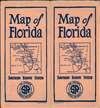
1924 Poole Brothers Map of the Florida Southern Railway System
FloridaSouthernRailway-poolebros-1924$300.00

Title
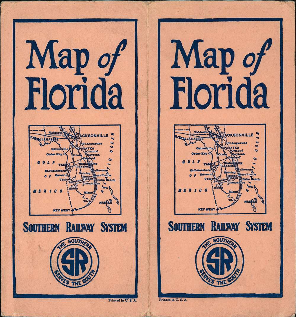
Southern Railway System 'The Way to Florida'. / Map of Florida.
1924 (dated) 28.5 x 17.25 in (72.39 x 43.815 cm) 1 : 1267200
1924 (dated) 28.5 x 17.25 in (72.39 x 43.815 cm) 1 : 1267200
Description
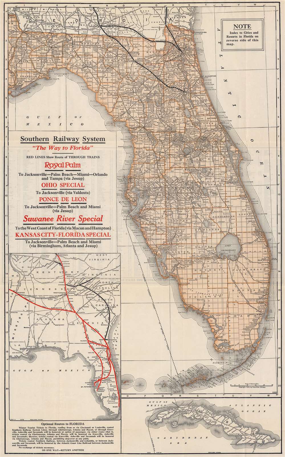
This is a 1924 Poole Brothers railroad map of Florida published by the Southern Railway System. This is one of the few maps to illustrate the ephemeral full operating route of the Florida East Coast Railroad extending through the Keys to Key West. Routes owned by Southern Railway and its subsidiaries in northern Florida are emphasized with thick black lines. Additional competing railroad networks are depicted using thinner lines. The Peninsular and Occidental Steamship Company, which connected Tampa with Key West and Havana, Cuba, is marked by a dotted line running through the Gulf of Mexico. An inset map along the left border highlights the Southern Railway System from Cincinnati and Memphis to Miami, along with other rail lines in the American Southeast. A second inset map of Cuba is situated in the lower right corner that illustrates Cuban railways.
Southern Railway
Southern Railway was formed in 1894 by the merger of three railroads: the Memphis and Charleston Railroad, the Richmond and Danville System, and the East Tennessee, Virginia and Georgia Railroad. Over the course of the 20th century, Southern Railway obtained controlling interests in numerous railroads throughout the south, including the Alabama Great Southern and the Georgia Southern and Florida. By 1916, Southern operated on an 8,000-mile, thirteen-state railroad system that lasted until 1980, when Southern merged with the Norfolk and Western Railway and formed the Norfolk Southern Corporation.FEC to Key West
The Florida East Coast Railroad extension to Key West, although not the focus of this map, is noted. The FEC Key Wet Extension, possibly the greatest Railroad achievement of the era, was planned from about 1895, but not completed until 1912. It operated for little more than 20 years, heralding a golden age for the Florida Keys and Key West in general. Business magnates, presidents, and dignitaries rode the rails to Miami or Key West before embarking on Flagler’s Peninsular and Occidental Steamship Company to Havana, Cuba, and the Bahamas. Long after Flagler’s death, the Labor Day Hurricane of 1935 destroyed some of the railroad bridges leading to Key West (the remains of which can still be seen) and the FEC, then insolvent, was unable to finance the repairs. The tracks were donated to the state, who used the infrastructure to construct the Overseas Highway (U.S. 1).Publication History and Census
This map was created by Poole Brothers and published by the Southern Railway System in 1924. Both the inset maps are dated September 18, 1924, while the central map of Florida was originally published by Poole Brothers in 1915. Several editions and states of this map exist. Specific editions are uncommon on the market, with one example of the present edition being held at the Touchton Map Library, in Tampa.Cartographer
Poole Brothers (1878 - 1968) were a Chicago based firm active in the late 19th and early 20th century with an initial focus on promotional railroad maps. Poole Brothers was founded by George Amos Poole (March 20, 1843 – September 7, 1918). In 1868, Poole, along with his uncle William H. Rand (1828 - 1915) and Andrew McNally (1836 - 1904), purchased the Chicago Tribune's job printing plant and formed the firm Rand McNally. In 1878, he left Rand McNally to form, with his brother William H. Poole, Poole Brothers, a direct competitor to Rand McNally for the lucrative railroad business. Like many of its competitors, Poole Brothers maintained an office on Chicago's Printer's Row (downtown Loop district). Their earliest known work is an 1880 map of Yellowstone National Park. In 1887, Poole Brothers, Andrew McNally, and several others formed the United Typothetae of America, a master printers association. In 1848, they were cited, along with Rand McNally and George Cram, by the Federal Trade Commission for price fixing. Their earliest known work is an 1880 map of Yellowstone National Park. Afterward they went on to produce a vast range of maps and other print products including tickets, cards, coupons, and restaurant menus. In time Poole Brothers merged with Newman-Randolph, which was then acquired by the American Can Company in the early 1960s. The American Can Company liquidated its printing concerns later in the same decade. More by this mapmaker...
Condition
Very good. A few very minor verso repairs and reinforcements along original folds.
References
Tampa Bay History Center, Touchton Map Library, M1043.