1964 Dolph and Florida State Turnpike Authority Map of Florida
FloridaTurnpike-turnpikeauthority-1964$150.00


Title
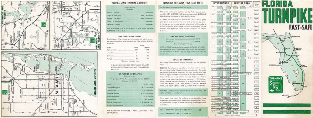
Florida Turnpike. Fast - Safe.
1964 (undated) 23.75 x 8.75 in (60.325 x 22.225 cm)
1964 (undated) 23.75 x 8.75 in (60.325 x 22.225 cm)
Description
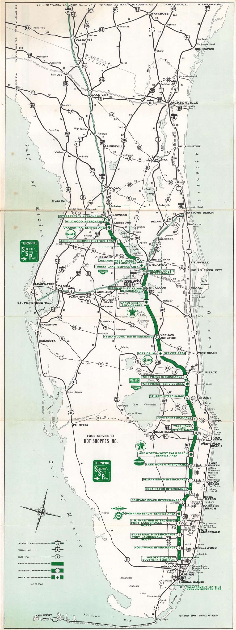
This is a c. 1964 Dolph Map Company and Florida State Turnpike Authority road map of Florida. A thick green line highlights the Florida Turnpike (Sunshine State Parkway) from Wildwood to Miami. White circles bearing green numbers mark the thirty interchanges, with small white numbers note milage. Federal and state highways are illustrated by black lines and are identified numerically. Interstate 4 and Interstate 75 are marked by thick lighter green lines, while the still incomplete Interstate 95 runs along the Atlantic coast.
Verso Content
Smaller maps depicting Wildwood, Orlando, and Miami are printed on the verso. A graphic illustration of the turnpike, presenting the distance between each city as well as the mileage between service areas, appears on the verso as well.Dating the Map
While this map is undated, it is possible to roughly estimate the date based on Cecil Farris Bryant's one term as Governor of Florida from 1961 until 1965. Farris Bryant is identified as the Governor of Florida on the verso.Florida's Turnpike
Florida's Turnpike is a 309-mile toll road. It runs diagonally across the state from an interchange with I-75 in Wildwood to an interchange with I-95 in Miami Gardens. The main Turnpike was constructed between 1957 and 1964, with an extension added in 1974. The turnpike was known as the Sunshine State Parkway from 1957 until April 12, 1968, when the name changed to Florida's Turnpike.Publication History and Census
This map was created by the Dolph Map Company and published c. 1964 by the Florida State Turnpike Authority. We note a single cataloged example, which is part of the collection at the Touchton Map Library at the Tampa Bay Historical Society.Cartographer
Frank B. Dolph (October 3, 1897 - November 26, 1975) was an American businessman and map publisher. Born in Great Neck, Long Island, New York, Dolph served as a Navy storekeeper during World War I. He began selling maps in 1919 after returning from England, likely for the George F. Cram Company, where he ultimately became an administrative aide. He also worked for the Rand McNally Company for some time before he founded his own map publishing firm, Dolph and Stewart, with his friend, sometime in the 1920s. Dolph and Stewart made maps throughout the 1920s and 1930s until they sold the firm in 1945 when Dolph decided to return to Florida. Dolph opened a new map publishing business, the Frank B. Dolph Map Co. in Ft. Lauderdale and published city plans of cities throughout the United States. Many of his maps were distributed by Chambers of Commerce or sold at newsstands. Real estate developers greatly appreciated his maps, those published by both the Dolph and Stewart Company and the Frank B. Dolph Company. Dolph retired as president of his firm around 1965, when he handed the business off to his son, Frank B. Dolph, Jr. Dolph worked with cartographer Theodore M. Politano for decades while operating the Frank B. Dolph Map Company. More by this mapmaker...
Condition
Very good. Exhibits light wear along original fold lines. Closed margin tears professionally repaired on verso. Verso repair to a fold separation. Text and regional maps of Florida on verso.
References
Tampa Bay History Center, Touchton Map Library 2018.103.003.