This item has been sold, but you can get on the Waitlist to be notified if another example becomes available.
1966 Dolph City Plan or Map of Fort Lauderdale, Florida
FortLauderdale-dolph-1966$125.00

Title
Dolph's Map of Fort Lauderdale Florida and Vicinity. / Map of Oakland Park Florida.
1966 (undated) 22.25 x 17 in (56.515 x 43.18 cm) 1 : 28800
1966 (undated) 22.25 x 17 in (56.515 x 43.18 cm) 1 : 28800
Description
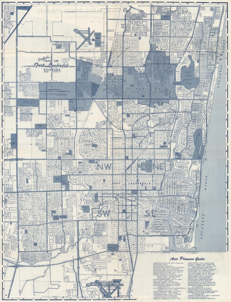
This is a c. 1966 Dolph Map Company city plan or map of Fort Lauderdale, Florida. Numerous locations across the city are identified, including the Lauderhill Mall, which was recognized as the first air conditioned shopping center in the southeastern United States.
A Closer Look
Depicting Fort Lauderdale from eastern Lauderhill to the Atlantic Ocean and from Our Lady Queen of Heaven Cemetery to Fort Lauderdale Hollywood International Airport. The Intracoastal Waterway runs parallel to the coastline, with small inlets for pleasure craft branching off in all directions. Oakland Park is shaded a dark gray, setting it apart from the rest of the map. An 'Area Pleasure Guide' occupies the lower right, listing golf courses, marinas, and other sites.Oakland Park
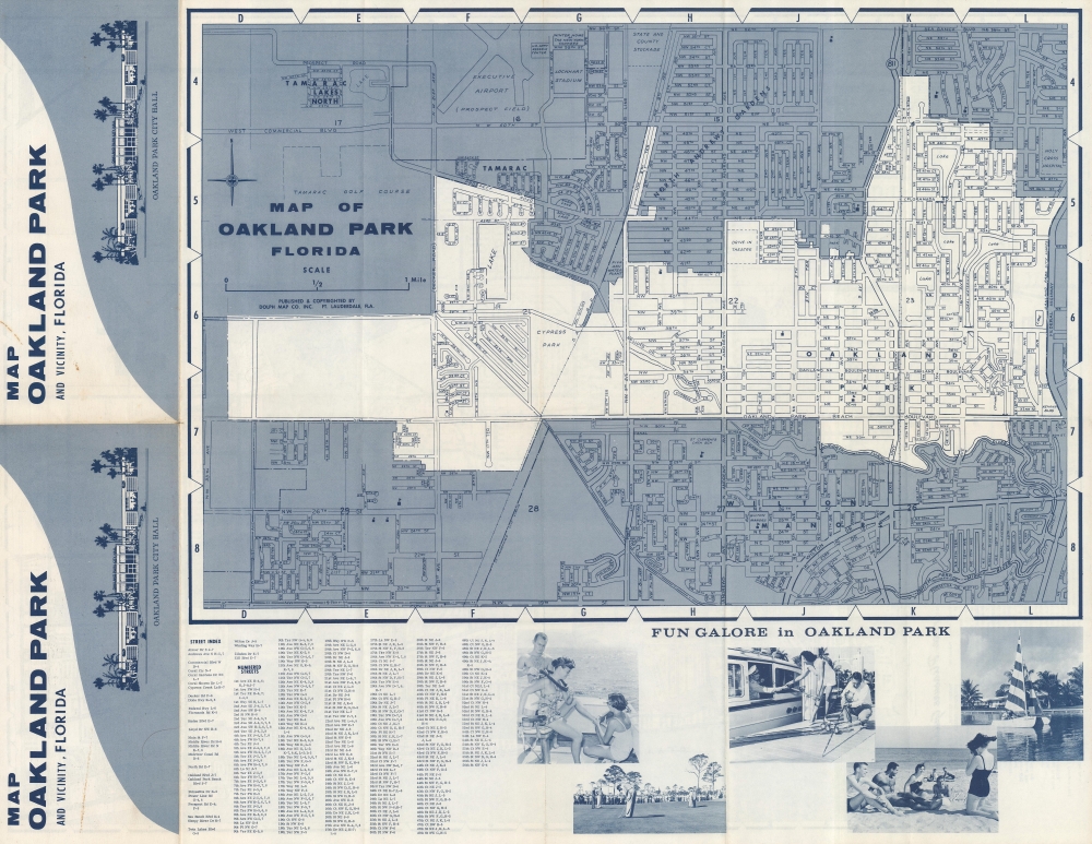
A map of Oakland Park occupies most of the verso. It is given the same level of detail as Fort Lauderdale, although the schools are not identified by name. A street index is included along the bottom border.Dating This Piece
We arrived at our c. 1966 date because of the presence of the Lauderhill Mall Shopping Center, which opened in 1966.Publication History and Census
This map was created and published by the Dolph Map Company c. 1966. This is the only known cataloged example of the present map.Cartographer
Frank B. Dolph (October 3, 1897 - November 26, 1975) was an American businessman and map publisher. Born in Great Neck, Long Island, New York, Dolph served as a Navy storekeeper during World War I. He began selling maps in 1919 after returning from England, likely for the George F. Cram Company, where he ultimately became an administrative aide. He also worked for the Rand McNally Company for some time before he founded his own map publishing firm, Dolph and Stewart, with his friend, sometime in the 1920s. Dolph and Stewart made maps throughout the 1920s and 1930s until they sold the firm in 1945 when Dolph decided to return to Florida. Dolph opened a new map publishing business, the Frank B. Dolph Map Co. in Ft. Lauderdale and published city plans of cities throughout the United States. Many of his maps were distributed by Chambers of Commerce or sold at newsstands. Real estate developers greatly appreciated his maps, those published by both the Dolph and Stewart Company and the Frank B. Dolph Company. Dolph retired as president of his firm around 1965, when he handed the business off to his son, Frank B. Dolph, Jr. Dolph worked with cartographer Theodore M. Politano for decades while operating the Frank B. Dolph Map Company. More by this mapmaker...
Condition
Very good. Light wear along original fold lines. Map of Oakland Park, Florida on verso.