
1842 Bauerkeller Raised Relief Map of France

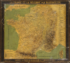
La France et la Belgique par Bauerkeller.
Among the Earliest Commercially Produced Relief Maps
- Digital Map Information
- Suitable for large format printing
- Full resolution TIFF file
- ICC color profile embedded
- Delivered instantly via download link
Among the Earliest Commercially Produced Relief Maps
This is an exceptionally rare c. 1844 raised relief map of France and Belgium, produced by the revolutionary German-born Parisian mapmaker Georg Michael Bauerkeller. Like Bauerkeller's other early works, this was one of the earliest commercially-available relief maps, produced in small numbers in a meticulous patented process.A Closer Look
The map covers France, Belgium, and portions of Britian, Spain, Switzerland, Luxembourg, and German territories. Raised relief demonstrate the elevation of the Alps and Pyrenees, among other highlands, with individual mountains labelled and the tallest listed at right with their elevation in meters. Four major basins are also marked with Roman numerals, as explained at bottom-left. Regions, départements, cities, and towns are also labelled throughout. Waterways are shaded blue, highlighting the interconnection between mountains, valleys, and rivers. Shipping lanes across the English Channel are marked with dashed lines. Corsica appears in an inset at bottom-right. Both horizontal and vertical scales are provided.This work is the result of Bauerkeller's exceptionally innovative techniques and recognition of the potential of a market for relief maps, which previously were only produced on an individual basis. Bauerkeller's patented process, which he called 'geomontographie,' involved a combination of lithographic printing in multiple colors (itself very new and unusual) and embossed papier-mâché (with which Bauerkeller was experienced, unlike most other cartographers). The whole was then typically varnished, as here, for protection. Some of his works were dissected and laid on linen for folding, despite their raised elements. The fact that Bauerkeller employed dozens of workers to produce a relatively small run of maps is testament to the amount of work entailed in the 'geomontographie' process.
Publication History and Census
This relief map was prepared by Georg Michael Bauerkeller (Bauerkeller et Cie) in the early 1840s, one of a group of raised relief maps that were the first such commercially produced maps. There are two editions of this map, a larger (24.5 x 26. 5 in.) c. 1842 edition that is noted as 'embossed in color' (gaufrée en couleur) at bottom, and the present c. 1844 edition that is 'printed in color' (imprimée en couleur… procédé geomontographique). Aside from size and scale, there are some stylistic differences such as the colors employed and the placement of the information about mountains. Either edition is very scarce, only held by the Bibliothèque nationale de France, and extremely rare to the market.Cartographer
Georg Michael Bauerkeller (January 4, 1805 - March 1, 1886) was a German-born mapmaker active in Paris in the mid-19th century, who was one of the most innovative European mapmakers of the century and the best known maker of relief maps of his era. Born in Wertheim, Germany, Bauerkeller was involved in the cartographic profession in Frankfurt from 1831 and 1833. He then returned to his native Wertheim and established a lithographic book and map printing business was his half-brother Georg Leonhart Bauerkeller (1809 - 1848). In 1835, Georg Michael opened a branch of the business in Karlsruhe (in partnership with Friedrich Gutsch, 1838-1897) while his half-brother remained in Wertheim. In 1837, Georg Michael and his family (m. Anna Elizabetha Hoock, 1801-1874) moved to Paris, where he would remain for the rest of his life, and opened a business producing embossed paper (business cards, lampshades) and printed works. Initially, the company's lithographer certificate was awarded to Walter Berger, an employee, as the German-born Bauerkeller was ineligible. Georg Michael Bauerkeller from an early point experimented with new and unusual techniques, including typometric printing (utilizing raised or relief movable type for features, such as placenames, that would be too small to easily engrave on a highly-detailed map). In 1839, he patented the process for producing 'geomontographic' raised relief maps, the first such maps to be commercially produced, as well as among the earliest to be issued in printed color (rather than hand color). One early application of this technology was for teaching geography to the blind students at the Institut des Jeunes Aveugles in Paris (the earliest such school in European history). Highly celebrated maps of Paris ('Nouveau Plan de Paris en relief'), Versailles ('Plan De Versailles En Relief'), Frankfurt ('Neuester Plan des freyen Stadt Frankfurt am Main und Sachsenhausen') France and Belgium ('La France et la Belgique'), and London ('Bauerkeller’s new embossed plan of London'), among other locations, followed in quick succession. Bauerkeller presented his works at several international expositions and received a second class medal at the Paris Exposition Universelle in 1855. Bauerkeller and Cie was briefly dissolved in 1849, with its materials and patents going to Walter Berger who published some relief maps under his own name. But Bauerkeller and Cie was reborn in 1851 through an agreement between Buaerkeller and his son-in-law Charles Jacques Valentin Hoock and quickly revived production, employing nearly 50 workers that same year. Georg Leonhart Bauerkeller also briefly relocated to Paris but then moved around the German-speaking lands before settling in Darmstadt and opening a printing business (Bauerkeller's Präganstalt Jonghaus und Venator) with Gustav Jonghaus (1807 - 1870) and Reinhard Lugwig Venator (1799 - 1762), who had inherited the Hofbuchdruckerei L. C. Wittich, which had roots dating ot the late 17th century, from his father-in-law. This firm's most celebrated work was Bauerkellers Handatlas, noted for its beautiful use of printed color. Georg Leonhart continued to collaborate with his half-brother in Paris and also produced innovative three-dimensional raised-relief maps of Darmstadt and other German territories. Georg Leonhart emigrated with his family to New York City in May 1848 and died shortly afterwards. From Paris, Georg Michael Bauerkeller continued to produce stunning and groundbreaking embossed relief maps at least until the mid-1860s. He also ventured into other media, such as deflectors for skylights (abat-jours), lampshades, screens, and other household items (presumably embossed with printed patterns). Late in his career (c. 1857), the business' name changed to 'Hoock-Bauerkeller' due to his partnership with Hoock, who had an already-extant company called Hoock Fils et Cie (confusingly, a Société Hoock Fils et Cie maintained an independent existence from Hoock-Bauerkeller until the mid-1910s, making similar products, such as caches-lumières). Though it produced some of Bauerkeller's last maps, Hoock-Bauerkeller primarily focused on household products. The firm continued to file patents in Great Britain into the very late 19th century, evidently outliving Bauerkeller by at least a decade. Some sources claim that one of Georg Michael Bauerkeller's sons was Guillaume Rodolphe Bauerkeller, who became a noted violinist in Manchester, England and joined the Hallé Orchestra. His own son, Rudolph Bauerkeller (1879 - 1922), moved to New York City and was a lead violinist and concertmaster with the New York Symphony (later merged with the New York Philharmonic). Further Details...
Condition
Average. Surface scratches, cracks, soiling, as seen. Otherwise stable.
References
OCLC 812529837.