This item has been sold, but you can get on the Waitlist to be notified if another example becomes available, or purchase a digital scan.
1929 Jillson Geological Map of Kentucky
GeologicKentucky-jillson-1929-2$325.00


Title
Geologic Map of Kentucky.
1929 (dated) 31.5 x 61 in (80.01 x 154.94 cm) 1 : 500000
1929 (dated) 31.5 x 61 in (80.01 x 154.94 cm) 1 : 500000
Description
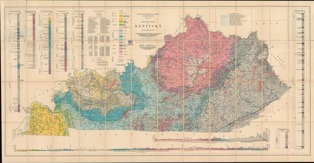
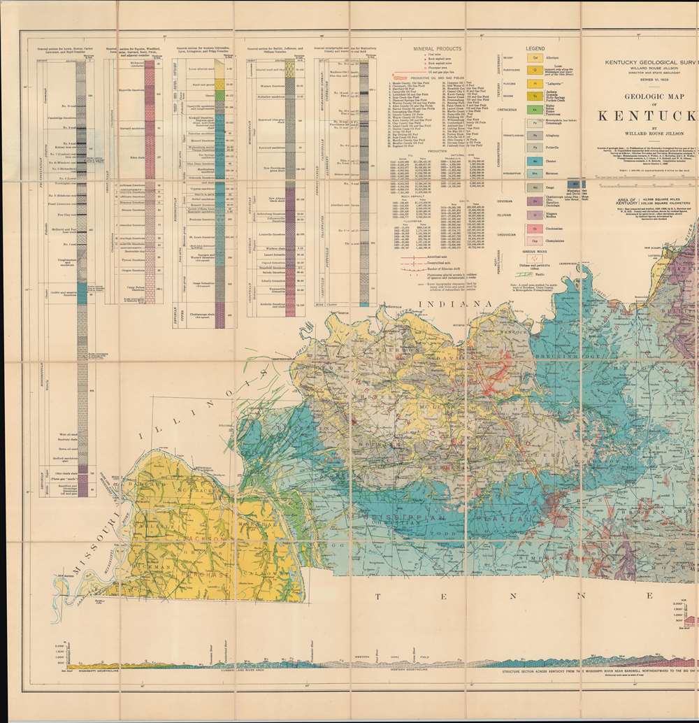
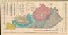
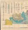
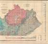
This is a gigantic 1929 Willard Rouse Jillson geological map of Kentucky. The map locates seventeen geological zones with distinct colors and patterns, each defined in the legend in the upper right. Fault lines are also noted and traced in green. As are resources: coal mines, rock asphalt mines, and oil and gas fields. Oil and gas fields are numerically identified and correspond with an index in the upper left. Five different geologic cores are also included in the upper left and right. Two profile sections illustrating layered geological formations are included along the bottom border.
Railroads and Power Lines
Within the state itself, counties are illustrated and labeled. Power transmission lines are illustrated in blue, with eleven patterns differentiating various power companies. Railroads throughout are illustrated and labeled.Publication History and Census
This map was created by Willard Rouse Jillson, published by the Kentucky Geological Survey, and engraved and printed by the U.S. Geological Survey. It is well represented in institutional collections but scarce on the private market.CartographerS
Willard Rouse Jillson (May 28, 1890 - October 4, 1975) was an American geologist, historian, and academic, who was an expert on the history of the state of Kentucky. Jillson authored numerous books on the geology of Kentucky and on Kentucky politicians. He taught at the University of Kentucky in Lexington beginning in 1918 and later taught at Transylvania University from 1947. Jillson also served as director of the Sixth Kentucky Geological Survey and as Kentucky State Geologist. He also held the position of Curator of the State Museum and served as Chairman of the first Kentucky. State Park Commission. He also worked in the private sector developing oil and gas fields in Kentucky. More by this mapmaker...
The United States Geological Survey (1878 - Present), aka the U.S.G.S., is a scientific agency of the United States government, which was founded in 1879. USGS scientists study the landscape of the United States, its natural resources, and the natural hazards that threaten it. The organization has four major science disciplines: biology, geography, geology, and hydrology. It is a bureau of the United States Department of the Interior and is the department's only scientific agency. Learn More...
Condition
Very good. Ex-Library. Dissected and laid on linen. Accompanies original binder.
References
OCLC 57244300.