This item has been sold, but you can get on the Waitlist to be notified if another example becomes available, or purchase a digital scan.
1797 Cassini Terrestrial and Celestial Globe Gores Including Armillary Sphere
GlobeGores-cassini-1797$8,000.00

Title
Globo Terrestre Delineato Sulle Ultime Osservazioni Con I Viaggi e nuove scoperte del Cap. Cook Inglese./ Globo Celeste Calolato per il corrente anno sulle Osservazioni de' Sigg. Flamsteed, e de la Caille. / Circolo per formare La Sfera Aremilare.
1797 (dated) 19.5 x 12.75 in (49.53 x 32.385 cm) 1 : 35000000
1797 (dated) 19.5 x 12.75 in (49.53 x 32.385 cm) 1 : 35000000
Description
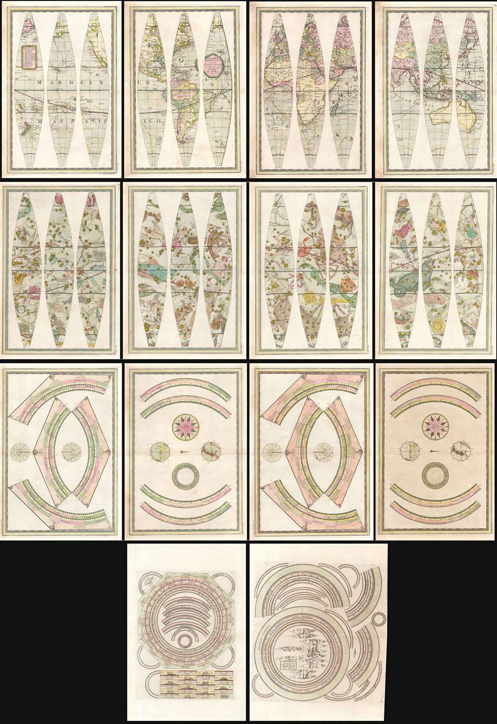
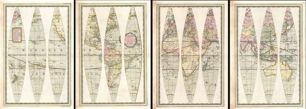
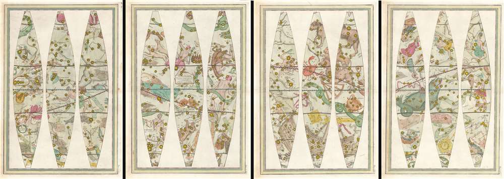
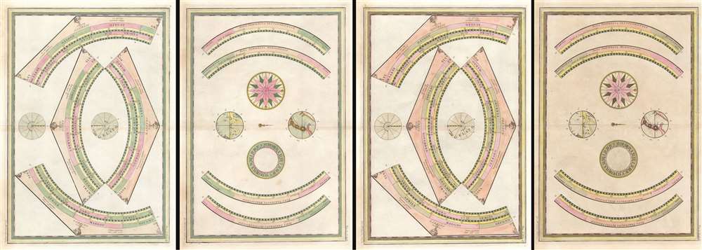
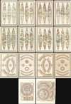
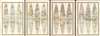
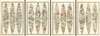
A beautiful, complete set of gores for the construction of Giovanni Maria Cassini's 1792 terrestrial and celestial globe pair, including the calottes and printed matter for the horizon and meridian rings. The gores are paired in four bordered sheets for each globe, plus two sheets containing each globe's calottes and labels for meridians. The set also includes the labels, printed to two sheets dated 1795, for the armillary sphere intended to accompany the globes. All are superbly engraved and beautifully colored, and are evocative artifacts of the world and its place in the universe as understood at the end of the eighteenth century.
The United States is named (Provincie Unite) and shown with its western border along the Mississippi. Westward the territory is named 'Luigiana' and, beyond that, 'Nuovo Messico.' Much of the spurious geography derived from Buache and De l'Isle's mid-eighteenth-century efforts has been expunged, replaced with a coastline derived from Cook's third voyage. The interior of the North American west, lacking new information, is largely left blank. However, the theorized Chinese colony of Fou-Sang appears to the north of Nootka and south of Mount St. Elie.
The world's rivers are illustrated, for purposes of placement rather than strict precision. The number of these falling within the eastern extents of the Russian Empire does suggest state of the art sources informing Cassini's Asian mapping. The return track of final Cook voyage and its mapping of the Kuril Islands presents a modern depiction of Kamchatka and Japan. In Africa, while the source of the Blue Nile is correctly depicted, the White Nile still finds it sources in the legendary Mountains of the Moon.
The Terrestrial Globe
Cassini's globe attractively presents the explored world as it was understood in 1790, with particular focus on the discoveries of James Cook. The tracks of his three voyages are marked, and his discoveries throughout the Pacific Ocean clearly indicated.The United States is named (Provincie Unite) and shown with its western border along the Mississippi. Westward the territory is named 'Luigiana' and, beyond that, 'Nuovo Messico.' Much of the spurious geography derived from Buache and De l'Isle's mid-eighteenth-century efforts has been expunged, replaced with a coastline derived from Cook's third voyage. The interior of the North American west, lacking new information, is largely left blank. However, the theorized Chinese colony of Fou-Sang appears to the north of Nootka and south of Mount St. Elie.
The world's rivers are illustrated, for purposes of placement rather than strict precision. The number of these falling within the eastern extents of the Russian Empire does suggest state of the art sources informing Cassini's Asian mapping. The return track of final Cook voyage and its mapping of the Kuril Islands presents a modern depiction of Kamchatka and Japan. In Africa, while the source of the Blue Nile is correctly depicted, the White Nile still finds it sources in the legendary Mountains of the Moon.
The Celestial Globe
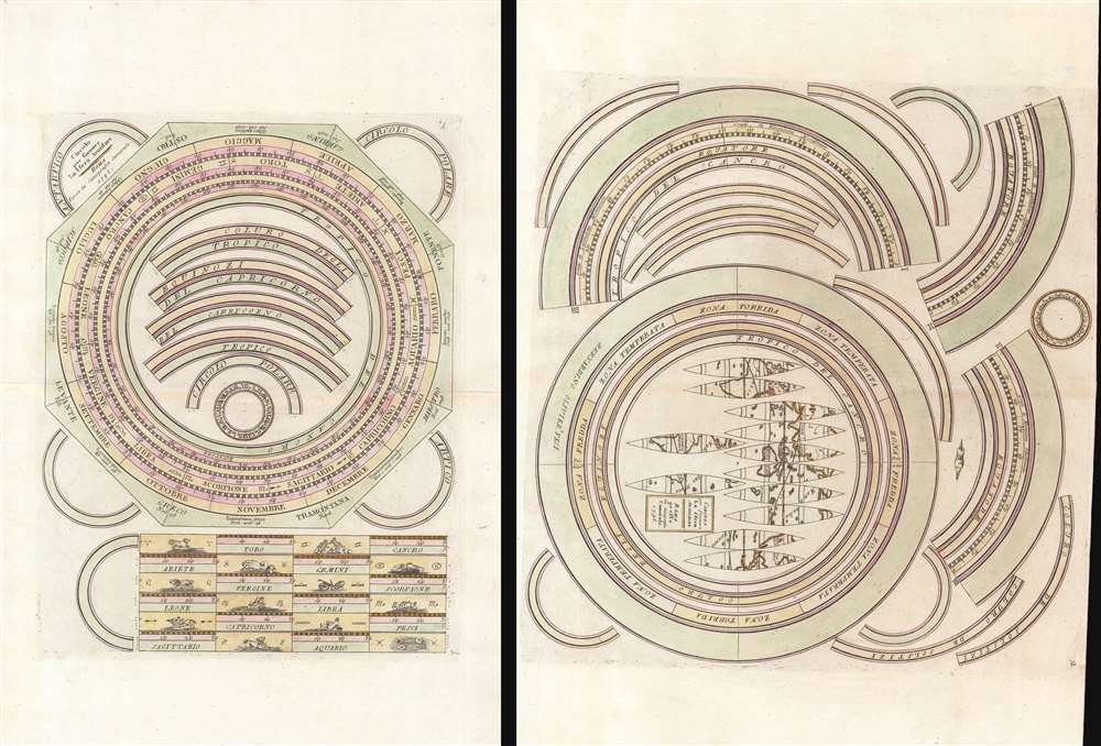
Cassini's globe of the heavens is embellished with figural representations of constellations, to which Cassini has introduced the innovation of shading to give a three-dimensional aspect. The constellations are based upon both Ptolemaic and Renaissance cosmographical systems. While some constellations, such as those of the Zodiac, are recognizable, others such as 'Il Toucan' and 'Il Microscopio,' have fallen out of usage. The individual stars, which are sized according to magnitude, are laid down according to the work of John Flamsteed (1646 - 1719) and Nicolas-Louis de Lacaille (1713 - 1762).The Armillary Sphere
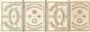
Engraved by Bernardino Olivieri on behalf of Cassini in 1795, these two sheets were included in the second, 1797 volume of Cassini's atlas. An armillary sphere was meant to illustrate the place of the world in the heavens, and as such it formed an important cognitive bridge between the terrestrial and celestial globes. Nested within rings illustrating the celestial spheres would be a miniature globe orbited by the moon. Consequently, the printed matter for the armillary sphere includes a miniature set of globe gores. Cassini's armillary apparently displayed the moon flat, as a practical measure: it does not include its own gores but has a flat paste-down. In any case, gores for so small a sphere would be ludicrously small.Intended for the Construction of Globes
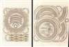
All of these sheets were included in Cassini's Nuovo Atlante Geografico Universale, but even in the table of contents, these are described as being intended to form globes. As early as 1792 and certainly by 1795 Cassini was selling separate pulls of these plates for the purpose of making globes. It is known that Cassini also sold completed globes on wooden stands. It should be noted that the duplication of the sheets containing the calottes for both globes - including the printed matter for the globe stands - was not accidental. While the plates for each were identical, they included two page numbers: 15 and 17, for one, 16 and 18 for the other. Globes and their stands were difficult to produce, and were fragile: the stands themselves tended to suffer wear, protecting the globes. The calottes, covering the poles, tended to suffer damage due to the poles having to house the axles on which a globe would rotate once mounted. The inclusion, in every single print run of the atlas, of duplicates of these specific sheets emphasizes the idea that the gores were intended for the construction of actual globes, and that eventual replacement of the stands would necessitate replacement of the relevant printed matter.Publication History and Census
The sheets pertaining to the two globes appeared in the first volume of the Nuovo Atlante Geografico Universale delineate suelle ultime osservazioni, published in 1792. The two sheets for the armillary sphere were part of the second volume, printed in 1797. A third volume was added in 1801. The work on the terrestrial globe, though dated 1790, may have been completed as early as 1788. The celestial globe, dated 1792, was certainly anticipated by 1791 at which point it was included in the engraved table of contents, dated 1791. The armillary sphere was engraved between 1792 and 1795 by Bernardino Olivieri. The uniformity of this suggests they were all of an edition and colored contemporaneously - thus a dating of either 1797 or 1801. Complete sets of these gores are extremely rare.Cartographer
Giovanni Maria Cassini (1745 - 1824) was a Rome based Italian mathematician, globe maker, geographer, engraver, and cartographer active in the later part of the 18th and early 19th century. He was a disciple of Giovanni Battista Piranesi. He invented new form of projection used for an atlas of the kingdom of Naples issued by Giovanni Antonio Rizzi Zannoni. Cassini is best known as a globe maker and is considered the last of the great 18th century globe makers. His maps are distinctive for their fine engraving, dark strong impressions, and elaborate distinctive cartouche work. Unlike many map and atlas publishers of the period, Cassini did all of his own engraving work - this impregnating each map with his unmistakable style. Though he produced a significant corpus of well-regarded work, little is known of Cassini's personal life. G. M. Cassini is often mistakenly associated with the well-known French cartographic family of the same name, however, they are not related. More by this mapmaker...
Source
Cassini, G. M., Nuovo Atlante Geografico Universale, Volumes 1 and 2, (Rome) 1797.
Condition
Very good. Some marginal stains. Sheet 18 (second celestial calotte sheet) exhibits more toning. Marginal mend at fold of first armillary sheet. Else excellent in bright contemporary color.
References
OCLC 556429612, 556330085, 49700902. Rumsey 14000.033, 14000.038, 14000.087, 14000.088. Dekker, E., Globes at Greenwich, p. 303-4. Baldwin, Robert W., 'P. Giovanni Maria Cassini, C. R. S. (1745-1824 c. ) And His Globes)', Der Globusfreund, December 1995 pp. 201-218. Valerio, Vladimiro 'Giovanni Maria Cassini's Globe Gores (1790-1792)' Globe Studies December 2005 pp. 73-84.