
This item below is out of stock, but another example (left) is available. To view the available item, click "Details."
Details
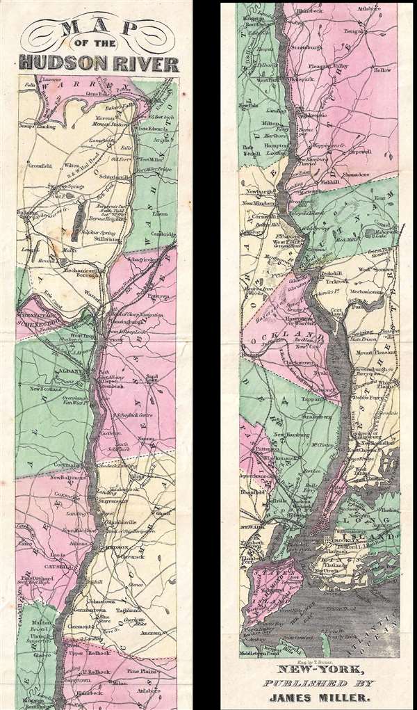
1865 Miller Ribbon Map of the Hudson River, New York
1865 (undated) $300.00
1866 Miller Ribbon Map of the Hudson River, New York
HudsonRiver2-miller-1866$200.00

Title
Map of the Hudson River.
1866 (undated) 25.5 x 3.25 in (64.77 x 8.255 cm) 1 : 530000
1866 (undated) 25.5 x 3.25 in (64.77 x 8.255 cm) 1 : 530000
Description
This is a scarce 1866 ribbon map of the Hudson River, New York by James Miller. The map depicts the course of the Hudson River from Lake Luzerne south as it empties into Upper New York Bay. It also illustrates the numerous towns, cities and counties along its banks, including the New York state capital of Albany, Troy, Hudson, Kingston, Poughkeepsie, Peekskill, White Plains, Yonkers, and New York City. Manhattan, Brooklyn, Staten Island and Long Island are also illustrated. Color coded by county numerous rivers, roads, railways and other topographical features are identified.
This map was engraved by T. Bonar and published by James Miller in his 1866 edition of Miller's new guide to the Hudson River.
This map was engraved by T. Bonar and published by James Miller in his 1866 edition of Miller's new guide to the Hudson River.
Source
Miller, J., Miller's new guide to the Hudson River, 1866.
Condition
Very good. Minor wear along original fold lines. Even overall toning. Light foxing. Blank on verso.