
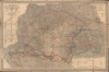
1863 Skrzeszewski Folding Map of the Kingdom of Hungary


This item has been sold.
A magyar szent korona országai: Magyarország, Erdély, Horvát-, Tótország és a katonai végvidék a cs. k. hadi-földirati intézet legújabb felmérései és egyéb hiteles források nyomán.
Hungarian-language map of Hungary on the Eve of the Austro-Hungarian Compromise.
- Digital Map Information
- Suitable for large format printing
- File Size: 68.1 MB
- File Type: ZIP / TIFF
- ICC color profile embedded
- Delivered instantly via download link
Hungarian-language map of Hungary on the Eve of the Austro-Hungarian Compromise.
This is a rare 1863 Hungarian-language folding map of the Kingdom of Hungary prepared by military officer and map publisher Adolf Ritter von Skrzeszewski. It presents the kingdom during the repressive period between the failed Springtime of Nations Revolutions (1848 - 1849) and the 1867 establishment of the Dual Monarchy.A Closer Look
The map displays the Kingdom of Hungary with its constituent counties, military borderlands, and subordinate kingdoms such as Croatia, Slavonia, and the Principality of Transylvania, which are listed at left and top-right. Cities and towns are recorded in detail, along with roads of various qualities, railways (including horse-pulled lines), post offices, fortifications and castles, spas, churches, and a wide range of mines, as listed in the legend at bottom-right. The map's size and scale, along with its handwritten annotations and signs of wear, suggest it was actively used.Historical Context
This map was produced in the tense period after the failed revolution and war of independence in 1848-49 when the Habsburg government cracked down on dissent, liberalism, and separatism (often called Neo-Absolutism) and abolished the bases of Hungarian semi-autonomy. While Hungarian liberals adopted policies of passive resistance, such as refusing to pay taxes or cooperate with the Austrian administration, Vienna also tentatively tried to alleviate pressures, permitting and even encouraging Hungarian-language publications, including this map. The Kingdom of Hungary likewise sought to quell its own internal pressures, for instance, summoning the Transylvanian Diet the same year this map was published to pass reforms granting Romanians equal rights with other nationalities.However, Austria's military ineptitude during the Second Italian War of Independence (1859) and defeat at the hands of the Prussians (1866) put the monarchy on the back foot and Hungarian liberals were able to negotiate the Austo-Hungarian Compromise (1867), which allowed Hungary internal autonomy and liberal reforms while Emperor Franz Joseph maintained control over foreign policy, military affairs, and finances. The unusual arrangement of the Dual Monarchy satisfied Hungarian demands for autonomy and even allowed industrialization and economic development to take off. Still, it did not quell underlying ethnic tensions that ripped the empire apart in the aftermath of World War I (1914 - 1918).
Publication History and Census
This map was prepared by Adolf Ritter von Skrzeszewski, printed by Obenheimer Vincze, and published by Nagel and Wischan in Buda (Budapest). A second edition was issued in 1866 to include new railways in the Kingdom, while a German-language edition ('General-Karte der Lænder der Ungarischen Krone') was also published in 1882 by Bernhard Nagel. In any edition, the map is rare, and this first edition is only noted among the institutional collections of the Universitätsbibliothek Erfurt and Hadtörténeti Intézet és Múzeum.Cartographers
Adolf Ritter von Skrzeszewski (1836 - c. 1895) was an army officer, cartographer, and map archivist based in Vienna. Little is known about the details of his life, but he most likely joined the Austrian Army as a youth and was trained as a cartographic engineer. Afterwards, he worked for a railway office (Abteilung für Bahnerhaltung), and then struck out on his own as cartographer and map publisher, while seemingly maintaining one foot in the Army, eventually reaching the rank of Major. One document also lists him as a map archivist in Vienna, though this might be a misunderstanding or mistranslation of his publishing business. Skrzeszewski published maps between at least 1859 and 1876, and was most in mid-1860s, producing large wall maps as well as more widely distributed works such as atlases and tourist maps in several languages (especially German and Hungarian). His name suggests that he is of Polish extraction, and perhaps of a noble family, though his birthplace and family origins are unknown. Skrzeszewski did donate some of his maps to Polish libraries, suggesting a connection with his ancestral homeland. Further Details...
Bernhard Nagel (fl. c. 1861 - 1883) was a publisher and bookseller based in Buda mostly handling Hungarian and German-language publications. The firm was initially the combined effort of Bernhard Nagel of Buda (Ofen) and Victor Wischán of Székesfehérvár (Stuhlweissenburg). They published a wide variety of works including maps, textbooks, musical scores, technical works, classical literature, and more. Nevertheless, it appears to have been a short-lived partnership, as Victor Wischán disappears from the historical record after 1865. Bernhard Nagel remained active in Buda and published under his own name (Verlag von Bernhard Nagel) until the mid-1880s, seemingly shifting to publishing mostly if not exclusively German-language works, including maps. The 1898 edition of the Biographisches Jahrbuch und deutscher Nekrolog records the death of one Franz Ditmar Nagel (1830 - 1896), presumably Bernhard's son or brother, listed as the 'owner' (Inhaber) of the Verlag von Bernhard Nagel, suggesting that the firm survived into the mid-1890s, even if Bernhard Nagel had died at an earlier date. Further Details...
Condition
Average. Laid down on original linen. Edge wear, old pin holes at corners. Old linen warn but stable, but missing at a few fold intersections. Scattered ink smudges towards right. Light handwritten annotations.
References
OCLC 550932393. Hadtörténeti Intézet és Múzeum B IX a 525/6.