This item has been sold, but you can get on the Waitlist to be notified if another example becomes available, or purchase a digital scan.
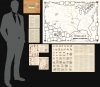
1944 Jefferson Pictorial Map of the United States Indian Tribes w/ Teacher's Kit
IndiansUSA-jefferson-1944-2$475.00


Title
Indians of the U.S.A.
1944 (dated) 22 x 34.25 in (55.88 x 86.995 cm) 1 : 5875200
1944 (dated) 22 x 34.25 in (55.88 x 86.995 cm) 1 : 5875200
Description
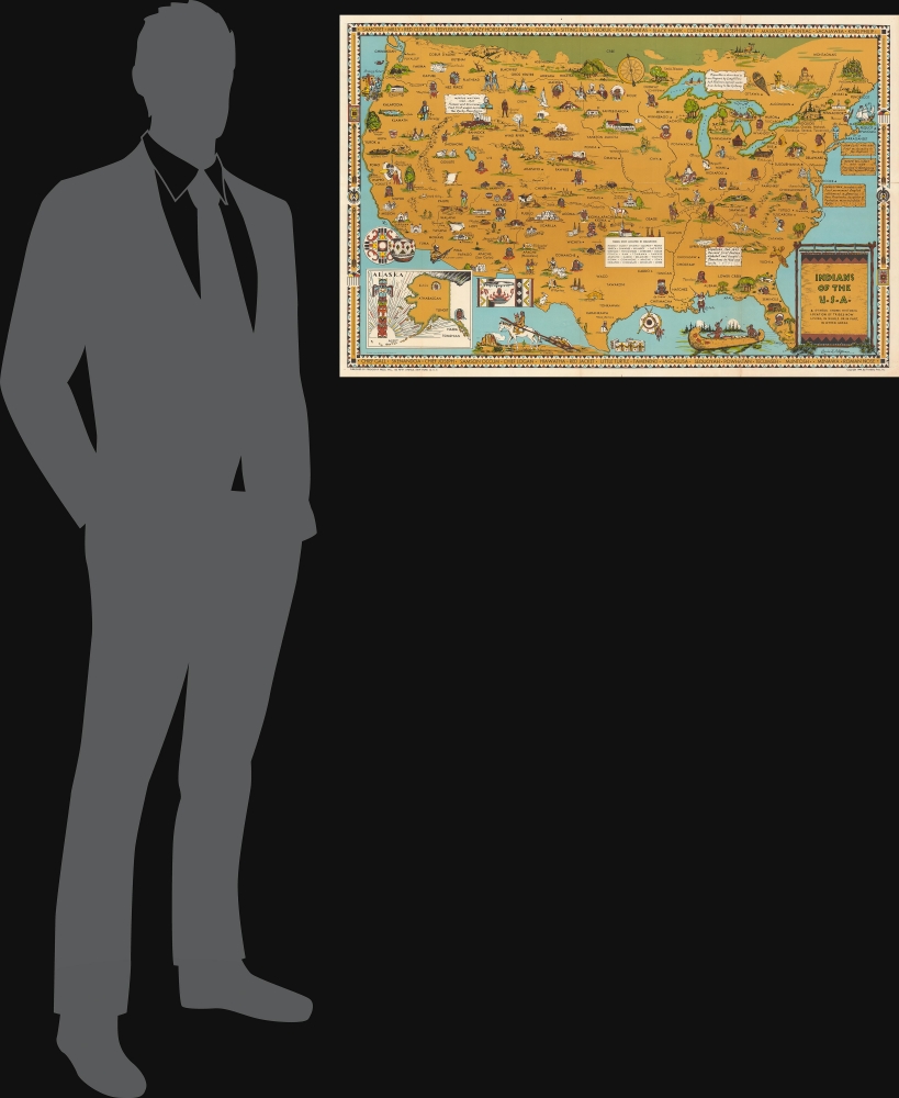
This is a 1944 Louise E. Jefferson pictorial map of the United States illustrating the historic home regions of Native American tribes. In addition to the map, the teacher's kit that accompanied it is also present, including additional maps, student exercises, and sheets of supplementary information.
Sketches of several buildings, including Dartmouth College (founded to provide a Christian education for Native Americans), a longhouse, a wigwam, the Alamo, and pueblos are included. A handful of places are illustrated and labeled as well, such as Sutter's Fort, Bent's Fort, Crater Lake, Boulder Dam, Roosevelt Dam, Mesa Verde, Yellowstone Park, and Devil's Tower. Cities like San Francisco, Washington, D.C., Chicago, and New York are marked and labeled. Explorers and other 'frontier' figures are also referenced, including General Custer, René-Robert Cavelier, Sieur de la Salle, and Daniel Boone. As this map was created during World War II, aspects of wartime life are also inescapably rendered. Airplane Manufacturing, U.S. Army Camps, Construction Work, Factory Worker, and other vignettes serve as a reminder of global events beyond the scope of 'Indians of the U.S.A.' An inset map of Alaska, including references to five Native American tribes, is situated in the lower left. A decorative border encircles the map, and the names of 33 influential Native Americans occupy the top and bottom sections of the border. Native American artistic elements make up the designs on the left and right sides.
In sum, the map and teaching materials present a much more respectful and accurate view of Native American life than was common among school textbooks at the time, where Indians were seen as either inconsequential or intransigent. This view corresponds with the values of Friendship Press, a Christian publisher with socialist sympathies. The press was outspoken in defending the rights of ethnic and religious minorities, including African-Americans and Jewish-Americans, and was also notable for employing members of these groups, including Jefferson, a rare African-American woman cartographer of the era.
A Closer Look
The map depicts the continental United States from the Pacific Ocean to the Atlantic Ocean and from Canada to the Rio Grande River and the Gulf of Mexico. Over 100 Native American tribes are placed in their 'historic locations'. Small triangles denote that some tribes are 'now living, in whole or in part, in other areas'. A text box lists the 'tribes now located in Oklahoma' because they had been forcibly removed from their ancestral lands in the 19th century and relocated to Oklahoma. The now infamous 'Trail of Tears' (illustrated on the map) was just one aspect of this policy. Portraits of numerous Native Americans are scattered throughout, including Chief Joseph, Sacagawea (Sacajawea), Keokuk, Little Turtle, Geronimo, Powhatan, and Osceola.Sketches of several buildings, including Dartmouth College (founded to provide a Christian education for Native Americans), a longhouse, a wigwam, the Alamo, and pueblos are included. A handful of places are illustrated and labeled as well, such as Sutter's Fort, Bent's Fort, Crater Lake, Boulder Dam, Roosevelt Dam, Mesa Verde, Yellowstone Park, and Devil's Tower. Cities like San Francisco, Washington, D.C., Chicago, and New York are marked and labeled. Explorers and other 'frontier' figures are also referenced, including General Custer, René-Robert Cavelier, Sieur de la Salle, and Daniel Boone. As this map was created during World War II, aspects of wartime life are also inescapably rendered. Airplane Manufacturing, U.S. Army Camps, Construction Work, Factory Worker, and other vignettes serve as a reminder of global events beyond the scope of 'Indians of the U.S.A.' An inset map of Alaska, including references to five Native American tribes, is situated in the lower left. A decorative border encircles the map, and the names of 33 influential Native Americans occupy the top and bottom sections of the border. Native American artistic elements make up the designs on the left and right sides.
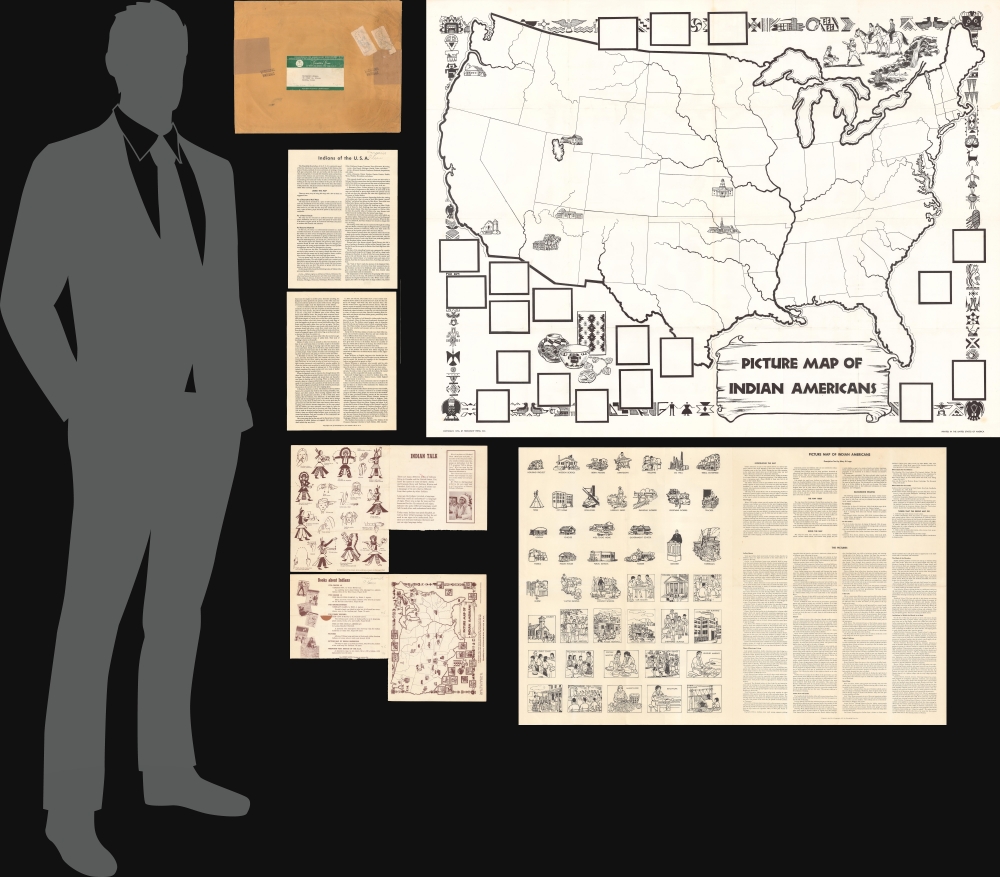
Teacher's Kit
In addition to the main pictorial map, an accompanying teacher's kit includes a picture map with cutouts that students can paste at the appropriate locations, a model picture map with all the cutouts in the correct locations, and several additional sheets of information and illustrations about Native American life.In sum, the map and teaching materials present a much more respectful and accurate view of Native American life than was common among school textbooks at the time, where Indians were seen as either inconsequential or intransigent. This view corresponds with the values of Friendship Press, a Christian publisher with socialist sympathies. The press was outspoken in defending the rights of ethnic and religious minorities, including African-Americans and Jewish-Americans, and was also notable for employing members of these groups, including Jefferson, a rare African-American woman cartographer of the era.
Publication History and Census
This map and supplemental materials were created by Louise E. Jefferson and published by Friendship Press, Inc. in 1944. The map appears on the market from time to time, but the supplementary teachers kit, with its original mailer, are unique.Cartographer
Louise E. Jefferson (1908 - 2002) was an American calligrapher, illustrator, art director, cartographer, and photographer. Notably, she was the likely the first African-American art director at a publishing firm. Born in Washington, D.C. to Paul and Louise Jefferson, she was encouraged toward an artistic profession from a young age. Her father was a calligrapher for the U.S. Treasury and her mother earned a living playing piano and singing aboard cruise ships on the Potomac River. Even though she was encouraged to study music and it ran in her family, Jefferson chose to study graphic arts. She attended Howard University in New York City where she studied fine arts and then the School of Fine Arts at Hunter College where she focused on graphic arts. After her move to Hunter, Jefferson became one of the founding members of the Harlem Artists Guild, where she became familiar with Augusta Savage, Gwendolyn Bennett and Langston Hughes. For a time she roomed with Pauli Murray, who would become a noted lawyer, author, educator, and civil rights and women's movement activist. Jefferson mostly worked as a freelancer during this time in her life, until she was noticed by the Friendship Press, the publishing firm of the National Council of Churches, and hired as a full time staff member. By 1942, Jefferson had become the art director for the firm and controlled every aspect of book production. Even during her time working at Friendship, she accepted freelance work from numerous publishing companies and university presses. Jefferson retired from Friendship Press in 1960, although he retirement was anything but relaxing. At this point, she embarked on an incredibly ambitious project: a book about decorative arts in Africa. Over the course of several years, she traveled to Africa five times, visiting at least fifteen different countries. The book was published in 1973 and contains over 300 illustrations, all of which are her own drawings or photographs. Jefferson described her book as 'a visual sampling of what the spirit and tempo of the African artist's role has been in the past and what it continues to be today.' Louise passed away in 2002 at the age of 93. More by this mapmaker...
Condition
Main Map (color) 1944, 22 x 34.25 - Very good. Some wear on old fold lines. A few minor fold spits, mostly confined to margins, stabilized with archival tissue on verso. Student Map (with blank spots) (Black and White) - 37.75 x 49.5 in Good condition with original folds visible. Picture Sheet - appears to have cards meant to be cut out and pasted on the Student map. 24 x 37 in. Fine condition with original folds visible. Supplementary sheets - one has bottom portions cut off. Printed on both sides.
References
OCLC 13619351.