This item has been sold, but you can get on the Waitlist to be notified if another example becomes available, or purchase a digital scan.
1925 Ohman and Interborough Rapid Transit Map of New York City Subway
IRT-ohmanmapco-1925$137.50

Title
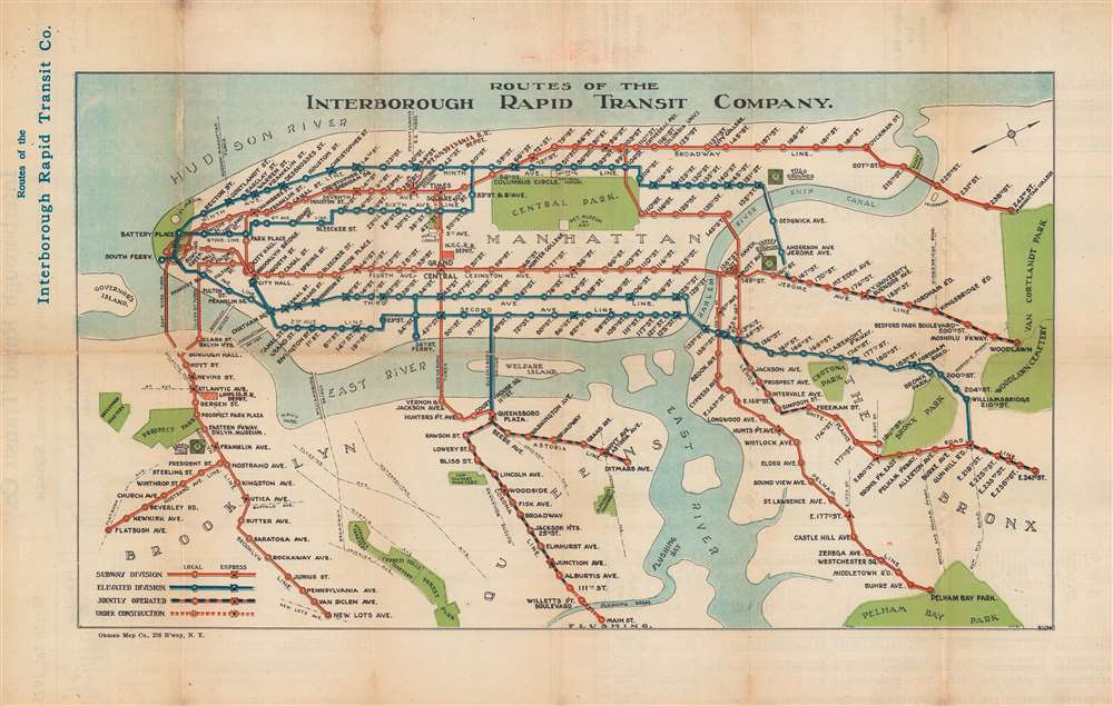
Routes of the Interborough Rapid Transit Company.
1925 (dated) 10.25 x 17.75 in (26.035 x 45.085 cm)
1925 (dated) 10.25 x 17.75 in (26.035 x 45.085 cm)
Description
This is a March 1, 1925, Ohman Map Company and Interborough Rapid Transit Company subway map of the Interborough Rapid Transit Company's routes in New York City. Elevated (blue) and subway (red) lines are differentiated. Express and local stations are identified, and the jointly operated lines in Queens and The Bronx are illustrated as black and red dashed lines. Central Park, the Metropolitan Museum of Art, the Museum of Natural History, Yankee Stadium, Ebbets Field, and Prospect Park rank among the locations identified.
The Interborough Rapid Transit Company
The Interborough Rapid Transit Company (IRT) was a privately owned transit company that operated subway and elevated railways in New York City from 1904 until 1940. The first IRT subway line opened on October 27, 1904, and ran between City Hall and 145th Street at Broadway. The IRT ceased operations on June 12, 1940, when it was acquired by New York City (along with the Brooklyn - Manhattan Transit Corporation) to create the city-owned subway system.Publication History and Census
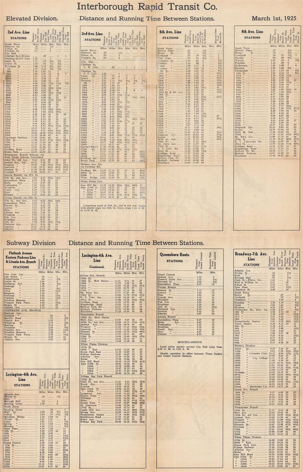
This map was created by the Ohman Map Company for the Interborough Rapid Transit Company in 1925 and published by the IRT on March 1, 1925. A second edition was published on April 6, 1925, with updated schedules printed on the verso, but the map itself still bore the date 3/1/25 in the lower right. We note a single cataloged example of the present edition, located at the New York Transit Museum. Rare.Cartographer
August Reinhold Ohman (May 3, 1859 - April 22, 1934) was a Swedish-American map publisher, engraver, and draftsman. Ohman arrived in the United States in 1893. He married Alice Mary Colton (1868 - 193x), Charles B. Colton's daughter, on January 5, 1897. A year later, in 1898, Ohman began working with G.W. and C.B. Colton, when the firm became known as Colton, Ohman, and Company, which existed until about 1901. After that year, Ohman operated his own firm under his own name August R. Ohman, and advertised his firm as the 'successors to the Coltons'. The Ohman Map Company, as it became known, moved to 258 Broadway around 1914, where it operated until around 1925. George J. Nostrand, who became a major map publisher, operated in the same buiding and possibly even worked for Ohman. Some of Nostrand's work is very similar to Ohman's, particularly his bird's eye view of New York City. More by this mapmaker...
Condition
Very good. Light wear along original fold lines. Verso repair to a fold separation. Subway schedule on verso dated March 1, 1925.
References
New York Transit Museum 2010.29.147.