
This item below is out of stock, but another example (left) is available. To view the available item, click "Details."
Details
1956 Deposito Hidrografico Nautical Chart of San Antonio Port, Ibiza
1956 (dated) $175.00
1846 Alabern and Mabon Map of the Balearic Islands: Majorca, Minorca, and Ibiza
IslesBaleares-alabernmabon-1846$225.00

Title
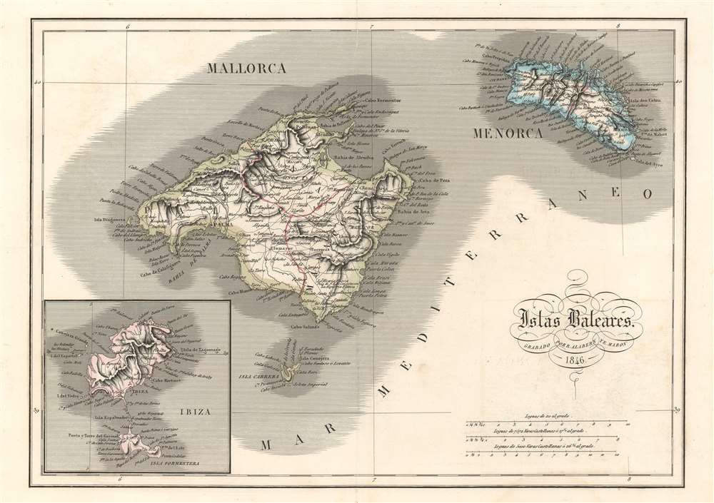
Islas Baleares.
1846 (dated) 12 x 16.75 in (30.48 x 42.545 cm) 1 : 560000
1846 (dated) 12 x 16.75 in (30.48 x 42.545 cm) 1 : 560000
Description
This is an 1846 Ramon Alabern y Casas and E. Mabon map of the Balearic Islands. The map centers on Mallorca, with Menorca to the right. Ibiza, the third island in the trio, is depicted in an inset map in the lower left corner. All three islands are illustrated in detail, with myriad locations throughout all three labeled, including cities, towns, and points along the coasts of each island. Palma, Inca, and Manacor are labeled on Mallorca, and the road network crisscrossing the island is shown in detail. Bays, points, and small islands around the island's coast are identified as well. The Balearic Islands, and Ibiza in particular, are tourist magnets for Europeans. The airport in Palma receives close to thirty million tourists every year.
Census and Publication History
This map was created by Ramon Alabern y Casas and E. Mabon and published in 1846. A charming piece, it is also extremely rare, as we have been unable to trace any other known examples in institutional collections or private hands.Condition
Very good. Foxing along margins. Closed margin tears professionally repaired on verso. Verso repair to centerfold separation. Blank on verso.