This item has been sold, but you can get on the Waitlist to be notified if another example becomes available, or purchase a digital scan.
1909 Ottoman Turkish Mehmet Eşref Map of Istanbul
Istanbul-esref-1909$175.00

Title
(Turkish Plan of Istanbul and its Surrounds)
1909 (undated) 3.75 x 5.25 in (9.525 x 13.335 cm) 1 : 80594
1909 (undated) 3.75 x 5.25 in (9.525 x 13.335 cm) 1 : 80594
Description
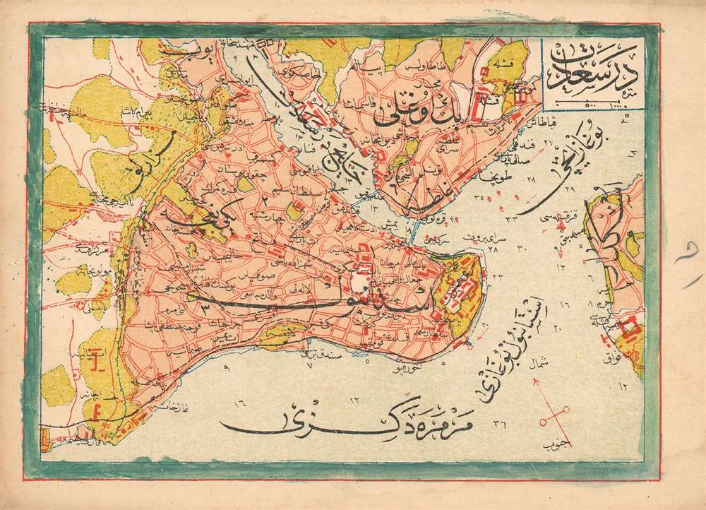
This is a 1909 Turkish plan of Istanbul, produced by the Turkish educator and publisher Mehmet Eşref. All titles and descriptive text are in Ottoman Turkish. Areas within the city and its suburbs are made distinct with color. Depth soundings are noted in the waterways, and the famous 'Maiden's Tower,' or Kiz Kulesi, is marked just off the shore from Üsküdar. Chromolithograph.
Publication History and Census
Turkish atlas maps are rare on the market. This one was published in Eşref’s Umum-i vilayat-ı Şahaneyi havi küçük atlas/( اطالس كوچك حاوى يى شهان ى والياة عموم), of which OCLC lists only a single copy at the Bogazici University Library in Istanbul.Cartographer
Mehmet Esref (1846 or 1847-1912) was a Turkish educator and publisher active in the first part of the 20th century. He published several historical and educational atlases, all of which are rare on the market and contain many of the first Turkish maps of the regions they depict. More by this mapmaker...
Source
Eşref, Mehmet.Umum-i vilayat-ı Şahaneyi havi küçük atlas/ اطالس كوچك حاوى يى شهان ى والياة عموم
Condition
Very good. Wash color added to border in an old hand. Margins complete.
References
ÖZEGE 25533. OCLC 949501827.