
1587 Heinrich Bünting's Biblical Travelogue, With Unique Figural Maps

This item has been sold.
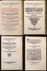
Itinerarium Sacrae Scripturae Das ist/ Ein Reisebuch, Uber die gantze heilige Schrifft in zwey Bücher getheilet. Das Erste Theil begreifft alle Reisen der lieben Patriachen/ Richter/ Könige/ Propheten ... Das Ander/ gehet auff das Newe Testament ... Zuuor gemehret mit einem büchlein DE MONETIS ET MENSVRIS... Insonderheit aber mit einer feinen nützlichen erklerung des Buchs Josua/ Durch M. Henricum Bünting/ Pfarherr der Kirchen zu Grunaw im Lande zu Brunshweig. Mit einer Vorrede des Herrn D. Martini Chemnitij.
Most Desirable Edition of Bünting's Biblical Geography.
- Digital Map Information
- Suitable for large format printing
- Full resolution TIFF file
- ICC color profile embedded
- Delivered instantly via download link
Most Desirable Edition of Bünting's Biblical Geography.
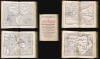
This is a superb example of Heinrich Bünting's 1587 Itinerarium Sacrae Scripturae, the first complete work of biblical geography. This 1587 edition is the first to contain its full complement of figured maps of the continents. Africa, Europa Regina, and Asia-as-a-Pegasus first appear in this edition. Along with the famous cloverleaf world map, Die ganze Welt in einem Kleberblat, it is largely these figural maps for which this work is today most admired. Thus, this is the most desirable form in which this influential and long-lived book appears.A Closer Look
his beautifully-bound folio actually contains four works, but the two volumes of Bünting's Itinerarium represent the lion's share of the book. Despite Bünting's never having traveled outside Germany, his Itinerarium reads as a travelogue. Bünting thus frames scriptural events in the context of a modern world-view, thus supporting the reader's comprehension of scriptural revelation.The inclusion of Bünting's treatise on Biblical currency and measures, and his explication of the Book of Joshua, can be viewed in the same light. De monetis et mensuris sacrae scripturae, for example, was intended to help readers understand Biblical currencies and measure terminology.
The Maps
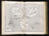
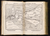
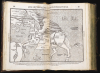
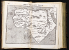
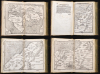
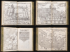
The lasting fame of the work lies in its complement of remarkable maps, though these are not present in all editions. Most famous among these is Die ganze Welt in einem Kleberblat, a figural map of the world in the form of a cloverleaf: This edition includes, for the first time, Bünting's map of Africa, and his figural maps of Europe and Asia. These, along with the cloverleaf world, were novel and would cement Bünting in the imagination of map collectors forever after. The remaining maps, which appeared in all early editions of the Itinerarium, corresponded to those that could typically be found in period Bibles: a world map (more literal than the cloverleaf), a map of Canaan, a map of the Holy Land showing the twelve tribes of Israel, a map of the Exodus, a plan of Jerusalem, and an illustration of the Temple of Solomon. The second volume contained two further maps: one illustrating the Holy Land during the era of the New Testament, and one showing the travels of the Apostle Paul.The Cloverleaf map, and the three new maps of the continents, deserve specific recognition:
Clover Leaf Map
This striking map is unique amongst printed maps of the 16th and 17th century, and is among the most sought-after world maps. It presented the world as a trefoil, with Asia, Africa, and Europe each assigned a leaf, and with Jerusalem and the Red Sea situated at center. America appears, but as an afterthought, consigned to the lower left corner. England and Scandinavia, similarly, appear as northern islands separate from the cloverleaf. The waves of the surrounding ocean are broken here and there by monsters, and a ship plies the sea near American shores.The map's title gives insight to one motivation for producing so singular an image: Die gantze Welt in ein Kleeberblat, welches ist der Stadt Hannover, Meines lieben Vaterlandes Wapen [The Whole World in a Cloverleaf, Which is the Arms of my Dear Fatherland, Hanover]. Civic boosterism aside, as the opening image of a biblical geography, this map exhibits other symbolic elements. The central positioning of Jerusalem reflects its centrality to the Bible story; the tripartite presentation of the world invoked the mysteries of the Holy Trinity. But also, the three parts of the ancient world were the parts of the world relevant to Biblical geography, as the stories of the Bible neither took place in America nor England, nor Scandinavia. The more literal world map following the cloverleaf also focused on the three continents of the Old World, with America sitting in the corner.
Europa Regina
Also newly added to Itinerarium in this edition was a map of the continent of Europe as a woman. Bünting employed the map as a mnemonic to better learn and memorize Europe's geography: the crowned head represents Spain and Portugal; France is the chest (although Germany is the heart). The River Rhine forms a necklace, from which is suspended a great jewel: Bohemia. Italy forms the right arm, with Sicily representing an imperial orb. The left arm is Denmark. Along the lower border of the queen's skirt are Greece, the Peloponnesus, and the Baltic lands up to Muscovy.Bünting here was repurposing an earlier image; the first printed anthropomorphic map of Europe in this form was produced in 1537 by Johannes Putsch (1516 - 1542). His intention was that the image should be an allegory in support of European unity under Charles V's Holy Roman Empire. Europa, Putsch argued, was Charles' queen: to be protected and preserved, rather than to be riven with war.
Asia in the Form of Pegasus
This map of Asia in the form of the mythological winged horse is one of the most famous cartographic curiosities. The horse's head is Asia Minor; its front legs form the Arabian Peninsula. Persia resembles a horse blanket. The hind legs represent the Indian and Malay, while the spreading wings cover the northern steppe of Scythia and Tartaria. The work references Greek myth in a Christian religious context. The classical Pegasus was captured and tamed by the Greek hero Bellerophon, who then rode the winged horse into victorious battle against the three-headed, fire-breathing Chimera. Bünting's Latin text below the map explains the allegory: Bellerophon's defeat of the Chimera is an analog for Jesus defeating Satan. Bellerophon's taming of Pegasus itself is presented as a metaphor for 'Jesus Christ, that great Bellerophon, the slayer of all evil' having 'opened the fountain of learning in Asia'.Africa: The Third Part of the World
Bünting did not map Africa in allegory, as he did with Asia, Europe, and the World maps. It is nevertheless a unique representation of the continent, tapering to a narrow point in the south. The pattern of rivers and major place names is modeled after the 1540 map of Sebastian Münster, but these were necessarily distorted to fit the unusual outline of the continent as presented here. Cities marked on the map include Alexandria, Memphis, Cairo, and the Kingdom of the legendary Prester John, whose fabled Christian kingdom has captured European imaginations for centuries.Publication History and Census
Bünting's Itinerarium has a long and convoluted history in print. It was first published by Jakob Lucius the elder at Helmstadt in Lower Saxony in 1581, followed by editions there in 1582, 1583, and 1585. Meanwhile, in Magdeburg, Athanasius Kircher produced a new edition of the book; the Kircher editions of 1584 and 1585 followed the structure of the Helmstadt editions and exhibited the same complement of nine maps. The cloverleaf map's woodblock was replaced at this juncture, but it is unclear whether the same can be said of the other maps, as there is no adequate cartobibliography. A Leipzig edition, also 1585, followed the same structure.In 1587, Kircher produced the present edition: its first volume was printed by the printer Zacharias Krafft in Wittenberg, while the second volume and the two additional texts were printed by Paul Donat in Magdeburg. Van der Heijden notes a further 1587 Magdeburg edition, but the only example we have seen of a putative 1587 Magdeburg Itinerarium proved to be identical to the Wittenberg edition (Volume 1 printed in Wittenberg, the latter volumes in Magdeburg, bound together) so there may never have been a separate Magdeburg edition that year at all. The 1587 Wittenberg (8th edition, according to van der Heijden) is the first to contain all 12 maps, including the three continental maps appearing here. With or without maps, the work was be reprinted in six languages and more than 50 editions as late as 1754; in this multiplicity of editions, the book is well represented in institutional collections. This 1587 Wittenberg edition, however, is scarce: we see the book listed in only 11 institutions worldwide; few of these retain the full complement of maps, an affliction not unusual for this work.
Cartographer
Heinrich Bünting (1545 – 1606) was a Protestant pastor and theologian. He was born in Hanover, and studied theology at the University of Wittenberg. He earned his Master's degree in 1569. He remained in Wittenberg as a pastor there, before being appointed to that same position at Alt Calenberg, in the service of the Dukes of Saxony. The estate was dissolved when the marriage of the Duchess Sidona and Duke Eric the Younger foundered, and Bünting became pastor in Gronau in 1575. In Gronau, he wrote his two major works - the 1581 Itinerarium Sacrae Scripturae, and the 1584 Brunswick and Lüneburg Chronicle. He produced a smaller work on Biblical coins and measures in 1582. He would briefly serve as superintendent in Goslar, but he would be dismissed as a result of theological differences. Stung, he returned to his hometown and changed to the less controversial profession of a beer brewer, until his death in 1606. The work for which he is best known, Itinerarium Sacrae Scripturae, was the first complete summary of biblical geography. It remained in print in more than sixty editions, long after his death. Earlier editions contain some of the most distinctive and sought after maps, most notably his map of the world in the shape of a cloverleaf, and an allegorical map of Asia in the form of a Pegasus. Further Details...
Condition
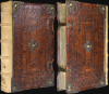
Excellent overall. Folio, original ruled calf with brass clasps, bosses and corner guards. Rebacked in vellum. 10 double-leaf maps, 2 single leaf maps. Vol. 1, (TP printed in red and black) 8ff, 298pp (272), 6ff; Vol 2. 3ff, 116pp, 5ff; Monetis et Mensuris, 3ff, 33 pp; Uber das Buch Josua, 56pp. Numerous pagination errors (as usual). Marginal mend to Clover map not impacting image; slight separation of centerfold visible in the 'Africa' foil. Slight cracking in centerfold of Africa sheet. Contents otherwise complete and in remarkable, untrimmed condition for this kind. (Approximate size listed for map images).
References
OCLC 249641176. Rumsey 15301 (1589). Van der Heijden, H., 'Heinrich Büntings Itinerarium Sacrae Scripturae, 1581: Ein Kapitel der biblischen Geographie', Cartographica Helvetia, 23 (2001). Shirley, R., The Mapping of the World #142, 143. Tooley, R. V., 'Geographical Oddities or Curious, Ingenious, and Imaginary Maps and Miscellaneous Plates Published in Atlases', Map Collectors' Circle, No. 1 #2, 3, 88. Laor, E., Maps of the Holy Land: Cartobibliography of Printed Maps, 1475 - 1900, #140 - 143. Zacharakis, C., A Catalogue of Printed Maps of Greece 1477-1800, 501.