This item has been sold, but you can get on the Waitlist to be notified if another example becomes available.
1971 U.S. Geological Survey Map of Key West, Florida
KeyWestFlorida-usgs-1971$225.00

Title
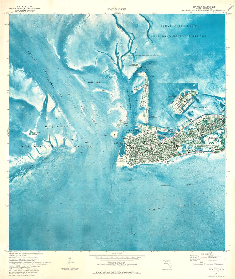
Key West Quadrangle.
1971 (dated) 26.75 x 22.5 in (67.945 x 57.15 cm) 1 : 24000
1971 (dated) 26.75 x 22.5 in (67.945 x 57.15 cm) 1 : 24000
Description
This is a 1971 U.S. Geological Survey topographic orthophotomap map of Key West, Florida. It depicts the region from Key West National Wildlife Refuge to Stock Island and from Great White Heron National Wildlife Refuge to the Intracoastal Waterway and Hawk Channel. Benefiting from the use of aerial photography, Key West appears in detail, with roads illustrated in black and highways, designated here as having four lanes, highlighted in red. Per the map, 'only landmark buildings are indicated in urban area', which includes the Key West International Airport, the courthouse, several post offices, and numerous U.S. military reservations. Coastal navigation lights are also noted and are abundant. Small nuances of its coastline are evident along with those on Dredger Key, Fleming Key, and Wisteria Island. Off Key West, the topography of the ocean floor is depicted in striking blue detail. Channels are labeled, as are shoals and the intracoastal waterway.
What is an Orthophotomap?
An orthophotomap is an image made by compiling orthophotos. An orthophoto, also referred to as an orthophotograph or an orthoimage, is an aerial photograph or satellite image that has been geometrically corrected to have a uniform scale. Orthophotos have been corrected for topographic relief, camera tilt, and lens distortion, making it possible to use orthophotos to measure true distances, unlike true aerial photographs. Orthophotomosaics are made by combining orthophotos, making it appear that every part of the image was taken from vertically above, much like Google Earth. An orthophotomap is an orthophotomosaic that also has additional characteristics, such as a title, scale bar, some form of an arrow designating north, and other cartographic content.Publication History and Census
This map was created by the U.S. Geological Survey from 'aerial photograph taken April 4, 1970' and published in 1971. An example of this map is part of the Perry-Castañeda Map Collection at the University of Texas at Austin. Another example is part of the Historical File of the Topographic Division of the U.S. Geological Survey.Cartographer
The United States Geological Survey (1878 - Present), aka the U.S.G.S., is a scientific agency of the United States government, which was founded in 1879. USGS scientists study the landscape of the United States, its natural resources, and the natural hazards that threaten it. The organization has four major science disciplines: biology, geography, geology, and hydrology. It is a bureau of the United States Department of the Interior and is the department's only scientific agency. More by this mapmaker...
Condition
Very good. Exhibits light toning and soiling. Blank on verso.